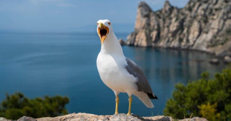
Seagull
Street-smart birds of sea and city

Street-smart birds of sea and city
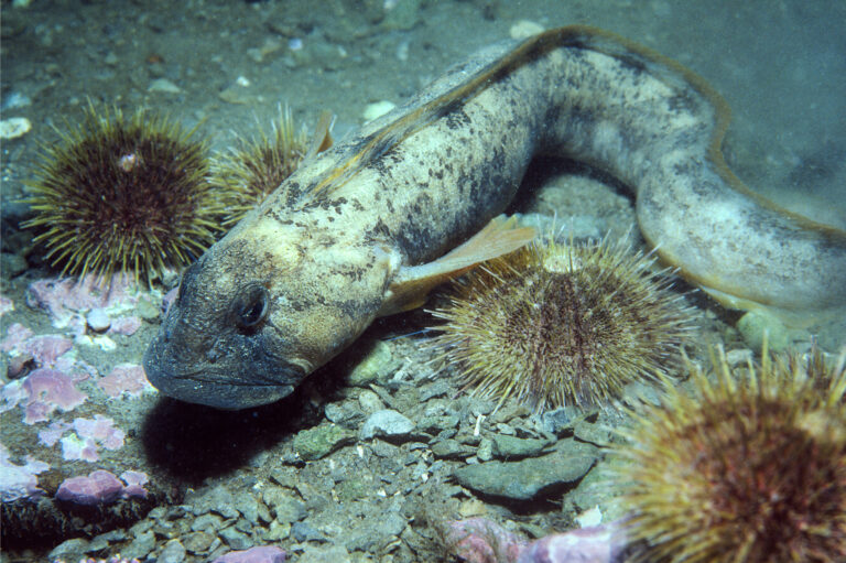
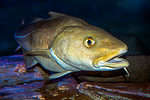
Cold-water bottom dweller with antifreeze
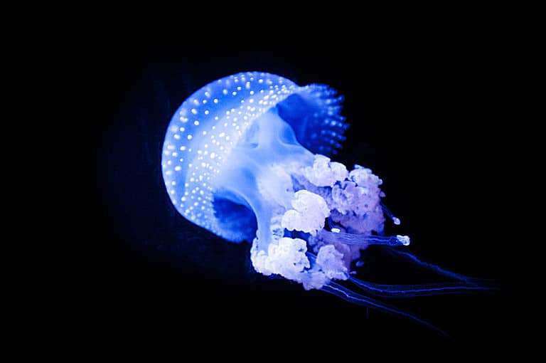
Sting-powered drifters of the sea
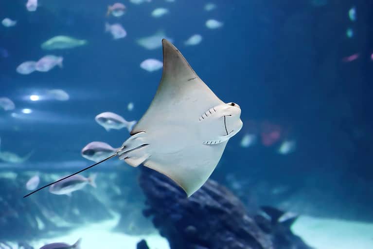
Stingrays: discs, senses, and surprises
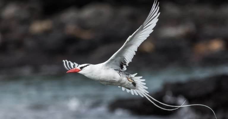
Streamers of the tropical seas
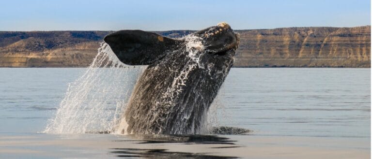
Baleen giants: ocean's living filters
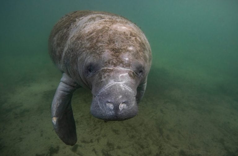
Gentle giants of warm waters
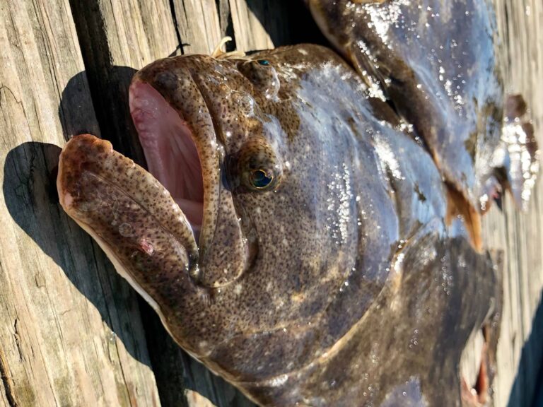
The fluke: seafloor stealth, summer bite.
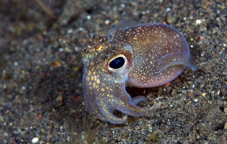
Ten-limbed sprinters of the sea
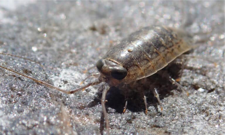
Rock runners of the tide line
The Atlantic Ocean is Earth's second-largest ocean basin, a continuous body of saltwater extending from the Arctic to the Southern Ocean and lying between the Americas to the west and Europe-Africa to the east.
The Atlantic Ocean forms a long, north-south marine corridor linking polar seas, temperate coasts, and tropical basins. It is structured by the Mid-Atlantic Ridge-a major seafloor-spreading center-flanked by broad continental shelves in places and vast abyssal plains in others, creating an array of environments from productive nearshore waters to the deep pelagic and benthic realms.
Its circulation is dominated by interconnected current systems that redistribute heat, nutrients, and organisms across basins. Warm, swift currents such as the Gulf Stream and North Atlantic Drift moderate climates in the North Atlantic, while eastern boundary currents like the Benguela and Canary systems promote coastal upwelling that fuels some of the world's richest fisheries. Together with deep overturning circulation, these processes make the Atlantic a key regulator of global climate and a hotspot of marine biodiversity and human maritime activity.
Etymology: The name "Atlantic" comes from a Greek expression meaning "Sea of Atlas," referring to the Titan Atlas of Greek mythology. In antiquity it denoted waters beyond the Strait of Gibraltar near the Atlas Mountains, and later the name was applied to the entire ocean.
Gulf Stream and major currents, Mid-Atlantic Ridge, transatlantic trade/routes, rich fisheries and deep-sea basins
The Atlantic Ocean is Earth's second-largest ocean, lying between the Americas to the west and Europe and Africa to the east. It stretches from the Arctic Ocean in the north to the Southern Ocean in the south, spanning tropical, temperate, and polar marine environments and including major marginal seas such as the Caribbean Sea, Gulf of Mexico, North Sea, and Baltic Sea.
Milwaukee Deep (Puerto Rico Trench), north of Puerto Rico
Atlantic coast via Labrador, Newfoundland and the Gulf of St. Lawrence approaches
Atlantic seaboard and Gulf of Mexico coastline
Gulf of Mexico coastline (Atlantic basin)
Archipelago on the Atlantic side of the Caribbean region
Borders the Atlantic basin via the Straits/Caribbean connections
Hispaniola island nation bordering the Atlantic basin
Eastern Hispaniola, facing the Atlantic
Caribbean Sea (Atlantic basin)
At the southern entrance of the Caribbean, adjacent to the Atlantic
Eastern Caribbean island directly exposed to the Atlantic
Lesser Antilles (Atlantic basin)
Leeward Islands (Atlantic basin)
Windward Islands (Atlantic basin)
Windward Islands (Atlantic basin)
Windward Islands (Atlantic basin)
Southern Lesser Antilles (Atlantic basin)
Caribbean coast (Atlantic basin)
Caribbean coast (Atlantic basin)
Caribbean coast (Atlantic basin)
Caribbean coast (Atlantic basin)
Caribbean coast (Atlantic basin)
Caribbean coast (Atlantic basin)
Caribbean coast (Atlantic basin)
Caribbean and Atlantic frontage
Northern South American Atlantic coast
Northern South American Atlantic coast
Atlantic coastline (metropolitan) and Atlantic territories (e.g., French Guiana, Caribbean islands)
Extensive eastern South American Atlantic coastline
South Atlantic coastline near the River Plate estuary
South Atlantic coastline (including Patagonia)
North Atlantic island on the Mid-Atlantic Ridge
North Atlantic coastline
Atlantic coast and marginal seas (including the North Sea approaches)
North Atlantic/Norwegian Sea approaches (Atlantic system)
Atlantic realm via Greenland and Faroe Islands; also North Sea/Baltic gateways
Iberian Atlantic coast and Atlantic archipelagos (Azores, Madeira)
Atlantic coast (including Bay of Biscay and southwest Spain)
North Sea coast (Atlantic basin)
North Sea coast (Atlantic basin)
North Sea coast (Atlantic basin)
Baltic Sea coastline (connected to the Atlantic via Danish straits and North Sea)
Baltic Sea coastline (Atlantic-connected)
Baltic Sea coastline (Atlantic-connected)
Baltic Sea coastline (Atlantic-connected)
Baltic Sea coastline (Atlantic-connected)
Baltic Sea coastline (Atlantic-connected)
Baltic coastline (Atlantic-connected) and North Atlantic-Arctic gateways region
Northwest African Atlantic coast
West African Atlantic coast
West African Atlantic coast
West African Atlantic coast at the Gambia River mouth
West African Atlantic coast
West African Atlantic coast
West African Atlantic coast
West African Atlantic coast
Gulf of Guinea (Atlantic) coast
Gulf of Guinea (Atlantic) coast
Gulf of Guinea (Atlantic) coast
Gulf of Guinea (Atlantic) coast
Gulf of Guinea (Atlantic) coast
Gulf of Guinea (Atlantic) coast
Gulf of Guinea (Atlantic) coast and offshore islands
West Central African Atlantic coast
West Central African Atlantic coast
Short Atlantic coastline near the Congo River mouth
Southeast Atlantic coastline (including Cabinda exclave)
Southeast Atlantic coastline
Atlantic coastline (western South Africa) transitioning toward the Southern Ocean
Atlantic archipelago off West Africa
Island state in the Gulf of Guinea (Atlantic)
Bounded by North and South America on the western side; by Europe and Africa on the eastern side; by the Arctic Ocean to the north (via passages including the Greenland, Norwegian, and Labrador seas/approaches); and by the Southern Ocean to the south (commonly near ~60°S). It connects to the Mediterranean Sea via the Strait of Gibraltar and to the Caribbean/Gulf of Mexico through the island arcs and straits of the West Indies and Florida Straits.
Surface avg: ~16-18°C (basin-wide rough mean; warmer in tropics/subtropics, cooler toward subpolar and polar regions)
Deep avg: ~2-4°C in most deep Atlantic; colder toward high-latitude sources, with some slightly warmer deep waters in subtropical depths depending on water-mass mixture
Typical open-ocean ~34-37 PSU. Highest salinities (~36-37+ PSU) in subtropical North Atlantic (strong evaporation) and near Mediterranean outflow influence; lower salinities (~33-35 PSU) in subpolar regions, near major river plumes (Amazon/Orinoco, Congo), and at high latitudes due to precipitation/ice melt. Strong meridional salinity gradient helps drive density structure and overturning circulation.
Strong seasonality in mid-high latitudes (largest surface swings in the North Atlantic: ~5-15°C or more locally), weaker seasonality in the tropics (~1-3°C). Winter cooling and wind mixing deepen mixed layers; summer heating strengthens stratification.
Key systems include the North Atlantic subtropical gyre (Gulf Stream → North Atlantic Current → Canary Current → North Equatorial Current), the South Atlantic subtropical gyre (Brazil Current → South Atlantic Current → Benguela Current → South Equatorial Current), the Equatorial current system (North/South Equatorial Currents and Equatorial Countercurrent), the Labrador Current and East Greenland Current in the northwest/high latitudes, the Antarctic Circumpolar Current influencing the far South Atlantic, and deep/overturning flows tied to the Atlantic Meridional Overturning Circulation (AMOC) with North Atlantic Deep Water export and Antarctic Bottom Water influence.
Semidiurnal tides dominate much of the Atlantic (two highs/lows per day), with strong regional amplification on broad shelves and embayments. Notable high tidal ranges occur in the Bay of Fundy and parts of the northwest European shelf (English Channel/Bristol Channel). Mixed (semidiurnal/diurnal) regimes occur in some tropical/subtropical areas. Internal tides are generated at shelf breaks and over rough topography (e.g., mid-ocean ridges) and can enhance mixing.
Surface and thermocline waters include warm, saline Subtropical Underwater/Mode Waters formed by winter convection in subtropical gyres; central waters differ between North and South Atlantic. Intermediate waters include Antarctic Intermediate Water (AAIW; relatively fresh, ~700-1200 m) spreading northward and Mediterranean Outflow Water (MOW; warm, salty) spreading into the eastern North Atlantic at intermediate depths. Deep waters are dominated by North Atlantic Deep Water (NADW; cold, relatively saline) formed in the Labrador, Irminger, and Nordic Seas; the abyssal Atlantic also contains Antarctic Bottom Water (AABW; very cold, dense) entering from the south and filling the deepest basins. Overall, strong north-south contrasts reflect active overturning and water-mass transformation.
Typically a shallow mixed layer (tens of meters in summer in many regions) over a pronounced thermocline/pycnocline in the subtropics and tropics; seasonal thermoclines form in mid-latitudes (strong in summer, eroded in winter). High-latitude regions can be weakly stratified in winter due to deep mixing and convection, but can become fresher and more stratified seasonally with ice melt and precipitation. Subtropical gyres exhibit persistent stratification and a deep chlorophyll maximum near the nutricline; boundary currents and eddies locally disrupt layering.
Major nutrient upwelling zones include the Canary Current Upwelling System (NW Africa) and Benguela Current Upwelling System (SW Africa), both highly productive and wind-driven. Equatorial Atlantic upwelling occurs along the equator due to divergence driven by trade winds. Additional seasonal/coastal upwelling occurs off Iberia, the western Sahara/Mauritania region, parts of Brazil (localized), and along shelf-break fronts where internal tides and topography enhance vertical mixing. Upwelling intensity varies with wind stress, stratification, and climate modes (e.g., Atlantic Niño influencing equatorial upwelling).
Notable features include strong mesoscale eddy activity and rings shed by the Gulf Stream and Agulhas leakage into the South Atlantic, shaping heat/salt transport. The Sargasso Sea exhibits exceptionally clear, oligotrophic waters and floating Sargassum habitats. The North Atlantic hosts deep winter convection and water-mass formation that help power the AMOC; variability in AMOC strength affects basin-wide climate. Large low-salinity river plumes (Amazon/Orinoco) create strong coastal stratification and biogeochemical gradients. Oxygen minimum zones are generally weaker than in the Pacific but occur at intermediate depths in the tropical Atlantic. In some upwelling regions (notably Benguela), hypoxia/anoxia events and harmful algal blooms can occur on shelves due to high productivity and restricted ventilation.
The Atlantic Ocean spans tropical to polar latitudes, so its marine climate ranges from warm, humid trade-wind tropics to cold, stormy subpolar seas. Basin-scale circulation strongly shapes conditions: the warm Gulf Stream/North Atlantic Current transports heat and moisture toward Europe, moderating winters and supporting frequent mid-latitude cyclones, while the cold Labrador and Canary Currents cool western and eastern subtropical margins. In the South Atlantic, the warm Brazil Current contrasts with the cold Benguela Current along southwest Africa, promoting coastal upwelling, cooler sea-surface temperatures, and high biological productivity. Typical open-ocean conditions include persistent wind belts (trades and westerlies), seasonal shifts of the Intertropical Convergence Zone (ITCZ), and strong vertical stratification in the subtropics versus enhanced mixing in higher latitudes.
Seasonality is strongest in mid- and high-latitudes and weakest near the equator. In the North Atlantic, sea-surface temperatures and upper-ocean stratification peak in boreal summer (roughly Jun-Sep), while winter (Dec-Mar) brings stronger winds, deeper mixed layers, and frequent cold-air outbreaks over warm currents that enhance heat loss and wave activity. The tropics follow the seasonal north-south migration of the ITCZ: wetter, more convective periods occur when the ITCZ is overhead (typically boreal summer north of the equator and boreal winter south of it). In the South Atlantic, seasons are reversed; austral winter (Jun-Aug) favors stronger westerlies and storm tracks at higher southern latitudes, while austral summer (Dec-Feb) increases surface warming and stratification. Eastern-boundary upwelling zones (Canary and Benguela systems) often intensify seasonally with stronger alongshore winds, producing cooler coastal waters and frequent marine fog.
Tropical cyclones in the Atlantic occur mainly in the North Atlantic (hurricanes), with a primary season from June through November and a peak in August-October. Genesis is most common in the Main Development Region (roughly 10-20°N) over warm waters, often seeded by African easterly waves; tracks frequently move westward then recurve into the open North Atlantic. The South Atlantic rarely produces tropical cyclones because of generally cooler waters, higher wind shear, and less favorable atmospheric conditions, though occasional subtropical/tropical-like systems can occur. Outside the tropics, powerful extratropical cyclones are common in both hemispheres, especially in winter along storm tracks of the westerlies; the North Atlantic is notable for frequent deep lows influenced by strong temperature contrasts near the Gulf Stream and subpolar fronts, producing high winds, large waves, and rapid weather changes over wide areas.
Sea ice is present in the Arctic sector of the Atlantic and adjacent seas (e.g., Greenland, Labrador, Barents margins), expanding in winter and retreating in summer. The Labrador Sea and waters around Greenland can experience seasonal ice and drifting icebergs (notably from Greenland outlet glaciers), with the southern reach varying by year. In the Nordic and Barents seas, sea-ice extent is strongly influenced by warm Atlantic inflow, creating sharp gradients between ice-covered and ice-free waters. The central and tropical Atlantic is ice-free year-round. In the far South Atlantic approaching the Southern Ocean, sea ice is seasonal: it expands northward in austral winter and contracts toward Antarctica in austral summer, with the greatest influence south of roughly 50-60°S depending on year-to-year variability.
The Atlantic Ocean spans from polar to tropical latitudes and is shaped by strong basin-scale circulation (e.g., Gulf Stream/North Atlantic Drift, Canary and Benguela upwelling systems, Labrador Current). This creates sharp gradients in temperature, nutrients, and productivity-from highly productive continental shelves and upwelling margins to oligotrophic subtropical gyres (notably the Sargasso Sea). Habitats range from dynamic coasts and shelf seas to deep basins, seamounts, and the Mid-Atlantic Ridge, supporting major migratory corridors for fish, turtles, seabirds, and marine mammals.
Overall biodiversity is high, with hotspots in the tropical Western Atlantic (Caribbean coral reef systems), productive temperate shelf seas, and deep-sea features (seamounts, canyons, cold-water coral reefs, hydrothermal vents). Species richness generally peaks in tropical regions and declines toward the Arctic and Southern Ocean, while biomass and productivity can be greatest in temperate shelves and eastern-boundary upwelling zones (Canary, Benguela).
Species count: On the order of tens of thousands of described marine species (commonly approximated at ~30,000-40,000 across the Atlantic basin), plus substantial undescribed deep-sea diversity.
The Atlantic neritic zone spans the continental shelves and nearshore waters from the Arctic to the subantarctic, where sunlight, river inputs, and frequent mixing make it highly productive. Broad shelves (e.g., North Sea, Grand Banks, Patagonian Shelf) support intense seasonal plankton blooms and rich fisheries, while narrow shelves (parts of West Africa, eastern South America) can still be productive where winds drive coastal upwelling. Habitats include estuaries, salt marshes, mangroves (tropics), seagrass beds, kelp forests (temperate), and coral reefs (Caribbean/Western Atlantic), all shaped by strong currents and temperature gradients such as the Gulf Stream/North Atlantic Drift and the Brazil, Canary, and Benguela Currents.
The Atlantic pelagic zone covers the open-water column beyond the shelf break, ranging from sunlit epipelagic waters to the twilight mesopelagic and the dark bathypelagic. Productivity is patchy: subtropical gyres (e.g., Sargasso Sea) are generally nutrient-poor but support specialized communities around drifting Sargassum, while equatorial divergence and boundary upwelling systems (Canary and Benguela) inject nutrients that fuel high plankton biomass. The Gulf Stream and associated eddies and fronts concentrate prey and predators, creating migratory corridors for tunas, billfishes, sharks, and marine mammals; deeper layers are dominated by diel vertical migrators (lanternfish, squid, krill) that shuttle carbon and energy between surface and depth.
The Atlantic benthic zone includes all seafloor habitats from intertidal flats and shallow shelves to the abyssal plains and deep trenches. On shelves, benthic communities are structured by sediment type (mud, sand, gravel) and hard substrates, supporting bivalves, polychaetes, crustaceans, and demersal fishes; kelp-reef holdfasts and oyster/coral structures add complexity where present. In the deep ocean, low temperatures and high pressure favor slow-growing organisms (sea cucumbers, brittle stars, sponges) that rely largely on "marine snow" and carcass falls. Unique Atlantic benthic hotspots include the Mid-Atlantic Ridge with hydrothermal vents (chemosynthetic communities of bacteria, tubeworms, mussels, shrimps), cold-water coral reefs (e.g., Lophelia) on continental slopes, and methane seeps that sustain specialized clams and microbial mats.
The Atlantic demersal zone lies just above the seafloor on shelves and slopes, where bottom currents, turbidity, and complex topography create strong gradients in oxygen, temperature, and prey availability. It supports groundfish assemblages (e.g., cod, haddock, hake, flounders/soles), skates and rays, deepwater sharks, and cephalopods, with community composition varying from cold-temperate shelves to tropical slopes. Many demersal species couple benthic and pelagic food pathways-feeding on benthic invertebrates (worms, crabs, bivalves) as well as pelagic migrants (small fishes, squid)-and are strongly influenced by features like shelf breaks, canyons, seamounts, and upwelling margins that funnel nutrients and concentrate prey.
Seasonal and basin-scale migrations are prominent in the Atlantic. Baleen whales (humpback, fin, blue) typically feed in high-latitude summers (North Atlantic, Iceland/Greenland waters; Southern Ocean margins) and move to lower-latitude breeding/calving areas in winter (Caribbean, West Africa, Brazil). Atlantic salmon and American/European eels migrate between rivers and oceanic feeding/spawning grounds (notably the Sargasso Sea for eels). Sea turtles (loggerhead, green, leatherback) track warm currents and jellyfish-rich fronts, often moving poleward in summer and returning to tropical/subtropical rookeries to nest. Many pelagic fishes (bluefin tuna, swordfish) migrate along thermal fronts and spawning grounds (e.g., Gulf of Mexico and Mediterranean for bluefin), while seabirds (shearwaters, gannets, terns) follow seasonal plankton and forage-fish peaks in shelf and frontal regions.
Atlantic food webs are driven by phytoplankton production and shaped by currents, upwelling, and seasonal mixing. In productive shelves and upwelling systems (Benguela, Canary, Labrador/Grand Banks), the classic chain is phytoplankton → zooplankton (copepods/krill) → small pelagic fish (sardine, anchovy, herring, mackerel) → higher predators (tunas, cod/hake, seals, dolphins, seabirds), with strong "wasp-waist" control when forage fish dominate energy transfer. In oligotrophic gyres (e.g., Sargasso), microbial loops are important: dissolved organic matter → bacteria → microzooplankton → larger zooplankton → fishes, with drifting Sargassum providing habitat for juvenile fishes and invertebrates. Benthic-pelagic coupling links sinking detritus and plankton blooms to the seafloor: phytoplankton/particulate organic matter → benthic filter feeders and deposit feeders → demersal fishes and crabs → top predators (sharks, large teleosts, marine mammals). In the deep Atlantic, carcass falls (whale falls) and chemosynthetic systems at vents/seeps form alternative pathways where microbes oxidize sulfide/methane to fuel invertebrate communities, which then support specialized predators and scavengers.
The Atlantic Ocean supports globally important biodiversity and ecosystem services across temperate, tropical, polar, coastal, and deep-sea habitats. Conservation status is mixed: some stocks and regions show recovery due to stronger management and expanding marine protected areas, but many ecosystems remain under significant pressure from overfishing, bycatch, pollution (plastics and nutrient runoff), coastal habitat degradation, shipping impacts, and accelerating climate-driven changes (warming, acidification, deoxygenation, and shifting currents). Deep-sea ecosystems (seamounts, cold-water corals) and coastal nurseries (estuaries, mangroves, seagrass) are particularly vulnerable to cumulative impacts.
Fair to poor (regionally variable; improving in some managed fisheries but declining in many habitats and sensitive species)
Overexploitation and unsustainable harvest in some regions; bycatch impacts on sharks, rays, seabirds, and marine mammals; pressure on forage fish that underpin food webs.
Warming, marine heatwaves, acidification, and deoxygenation altering species distributions and productivity; impacts on coral/shell-formers and shifts in plankton communities; potential changes to major current systems affecting ecosystems and fisheries.
Plastic debris and microplastics, oil and chemical contamination, and chronic coastal nutrient runoff causing eutrophication and hypoxic "dead zones"; wastewater and emerging contaminants in nearshore waters.
Coastal development and dredging degrading estuaries, salt marshes, mangroves, seagrass, and reef habitats; bottom-contact fishing damaging benthic habitats including cold-water corals and sponge grounds.
Shipping noise and vessel strikes affecting whales; disturbance from coastal recreation and tourism; seabed disturbance from trawling and anchoring in sensitive areas.
Expansion of ports, subsea cables/pipelines, and offshore energy infrastructure increases fragmentation, noise, and localized seabed impacts; collision/entanglement risks and cumulative effects in busy corridors.
Species introductions via ballast water and hull fouling (and some aquaculture pathways) altering coastal food webs and competing with native species, especially in estuaries and ports.
Disease outbreaks and health stressors in marine mammals and corals, often amplified by warming waters and pollution exposure.
Depletion of key trophic groups (e.g., forage fish) and extraction pressures that reduce ecosystem resilience and alter predator-prey dynamics.
Seabed mineral exploration/interest in parts of the Atlantic raises risks to deep-sea habitats (sediment plumes, noise, slow recovery), though activity varies by jurisdiction.
Widespread plastic pollution and microplastics; nutrient-driven eutrophication and seasonal hypoxia in several coastal systems; legacy and episodic oil pollution; contaminants from rivers and wastewater (metals, PFAS/other emerging chemicals) most acute near dense coastal populations.
Management outcomes vary: some North Atlantic stocks have rebuilt under stricter controls, but others remain overfished or data-limited; bycatch of vulnerable species (sharks, rays, turtles, seabirds, marine mammals) remains a major issue; illegal, unreported, and unregulated fishing persists in some areas.
Rising sea temperatures and more frequent marine heatwaves; ocean acidification affecting calcifying organisms (corals, shellfish, plankton) and food webs; deoxygenation in some basins and coastal dead zones; shifts in species ranges and timing of productivity with knock-on effects for fisheries and protected species.
Ballast water and hull-fouling introductions in major ports and estuaries; invasive tunicates, crabs, and algae in some coastal regions; spread facilitated by warming waters and high shipping intensity.
A British Overseas Territory in the North Atlantic, known for its coral reefs and position near the western edge of the Sargasso Sea.
A well-known Atlantic island destination and a notable reference point for North Atlantic oceanography and navigation; also associated with nearby Sargasso Sea ecology.
A large isolated underwater mountain in the North Atlantic Ocean, southwest of the Azores, rising from deep ocean floor toward the surface.
A well-known Atlantic seamount that supports distinct marine habitats and is studied for seamount ecology and ocean circulation effects.
A group of prominent seamounts in the Northeast Atlantic that rise steeply from the abyssal plain.
Noted for upwelling-driven productivity, diverse deep-sea communities, and importance in Atlantic seamount biogeography.
The deepest part of the Atlantic Ocean, located north of Puerto Rico and Hispaniola at the boundary of the North American and Caribbean plates.
Atlantic depth record-holder and a major subduction-zone feature; associated with significant seismic and tsunami hazards.
A broad, shallow submarine plateau (shallow offshore bank) on the continental shelf southeast of Newfoundland, where the cold Labrador Current meets the warm Gulf Stream.
Historically among the world's richest fishing grounds; a classic example of current mixing driving high marine productivity and associated fishery management challenges.
The narrow passage connecting the Atlantic Ocean to the Mediterranean Sea between Spain and Morocco.
Controls Mediterranean-Atlantic water exchange and creates strong internal waves and mixing; strategically important maritime chokepoint.
A large bay of the Northeast Atlantic off western France and northern Spain with a wide continental shelf and deep submarine canyons.
Important for cetaceans and fisheries; notable oceanographic region with canyon systems that concentrate biodiversity.
A coastal bay on Namibia's Atlantic coast within the Benguela Current/upwelling region.
Notable Atlantic coastal location in southwest Africa; the Benguela Current drives nutrient-rich upwelling along this coast, underpinning high biological productivity and important fisheries in the region.
Cape Hatteras is a cape (headland) on the Outer Banks of North Carolina. Offshore, the Gulf Stream separates from the U.S. East Coast near Cape Hatteras and interacts with cooler continental-shelf waters, creating a dynamic frontal zone.
The convergence of Gulf Stream and shelf waters produces strong fronts and eddies that enhance mixing and biological productivity, making the area a well-studied hotspot important to regional fisheries and oceanography.
An isolated North Atlantic island group atop a carbonate platform surrounded by deep ocean waters.
Major site for long-term ocean observations (including time-series stations) and a notable mid-ocean reef-associated ecosystem.
A Portuguese archipelago in the North Atlantic located near the Mid-Atlantic Ridge with volcanic islands and surrounding seamounts.
Important for migratory whales and pelagic biodiversity; a key region for studying ridge-related oceanography and marine protected areas.
A volcanic archipelago off northwest Africa with steep island slopes and adjacent deep waters influenced by the Canary Current.
Notable for marine biodiversity, productive waters, and as a gateway region for Atlantic upwelling-influenced ecosystems.
A remote Brazilian archipelago in the equatorial South Atlantic with clear waters and rocky reefs.
Renowned marine protected area and diving destination; important for dolphins, turtles, and reef fish in an otherwise vast pelagic region.
A small, ring-shaped coral atoll off northeastern Brazil, one of the only true atolls in the South Atlantic.
Highly protected ecological reserve; critical breeding/feeding site for seabirds and sea turtles and a rare Atlantic atoll formation.
A broad shelf region with extensive coral and rhodolith habitats, including distinctive mushroom-shaped coral pinnacles (chapeirões).
Largest and most biodiverse coral reef system in the South Atlantic; high endemism and major conservation importance.
Offshore coral reef caps atop salt-dome structures in the northwestern Gulf of Mexico (Atlantic basin).
One of the healthiest coral reef areas in U.S. waters; important reference site for coral resilience and conservation.
The wreck of the RMS Titanic lying on the North Atlantic seafloor southeast of Newfoundland at ~3,800 m depth.
Most famous modern shipwreck; landmark in maritime history and deep-sea exploration, and a notable site for cultural heritage protection.
Civil War-era ironclad wreck off Cape Hatteras, North Carolina, in the Atlantic Ocean.
First U.S. National Marine Sanctuary (designated to protect the wreck); iconic naval technology and underwater archaeology site.
A large marine sinkhole within the Belize Barrier Reef system, with deep blue water and submerged cave features.
World-famous dive site and geological feature; part of a UNESCO-listed reef complex in the western Atlantic.
A vast coral reef system off Belize, forming part of the larger Mesoamerican reef chain in the western Atlantic.
One of the world's largest barrier reefs and a UNESCO World Heritage area; critical biodiversity and coastal protection resource.
A loosely defined area between Bermuda, Florida, and Puerto Rico in the western North Atlantic.
Culturally famous in maritime lore; also a region of complex currents, weather, and heavy shipping traffic.
The Atlantic has been a primary corridor for human movement, commerce, and conflict for millennia. In antiquity, Mediterranean-connected Atlantic coasts supported Phoenician and Carthaginian seafaring (e.g., around Iberia and Northwest Africa) and later Roman trade networks that extended to Atlantic ports. Medieval and early modern eras saw the Atlantic become the core of European exploration and colonization: Iberian voyages (15th-16th centuries) opened trans-Atlantic routes; the Columbian Exchange reshaped global agriculture and ecology; and the Atlantic slave trade (16th-19th centuries) forcibly moved millions of Africans to the Americas, leaving enduring demographic and cultural impacts. The ocean also featured prominently in major conflicts (notably the World Wars, including the Battle of the Atlantic) and in the development of global communications via transatlantic telegraph and fiber-optic cable corridors. Exploration milestones include charting of currents (Gulf Stream), deep-sea sounding and oceanography (e.g., HMS Challenger era), and modern subsea mapping and climate research tied to the Atlantic Meridional Overturning Circulation (AMOC).
Major global shipping lanes span the North Atlantic between North America and Western Europe (container, vehicle carriers, and bulk cargo), the South Atlantic between South America and Southern Africa/Europe, and the Atlantic approaches feeding the Mediterranean (via the Strait of Gibraltar), the Baltic/North Sea, and the Caribbean-Gulf of Mexico complex. Key chokepoints and routing influences include the English Channel, Strait of Gibraltar, Florida Straits, Mona/Windward Passages in the Caribbean, and approaches to the Panama Canal (connecting Atlantic-Pacific trade). Prominent ports and port regions include: Rotterdam-Antwerp-Hamburg range (Europe's largest container and petrochemical hub), Le Havre, Felixstowe/London Gateway, Algeciras/Tangier Med (Gibraltar gateway), Lisbon; on the Americas: New York-New Jersey, Norfolk/Hampton Roads, Savannah, Charleston, Miami/Port Everglades, Houston (via Gulf), Halifax, Montreal (via St. Lawrence), Santos, Rio de Janeiro, Buenos Aires/Montevideo; in Africa: Casablanca, Dakar, Abidjan, Tema, Lagos (Apapa/Tin Can), Pointe-Noire, Luanda, Walvis Bay, Cape Town; and island hubs such as Las Palmas (Canary Islands), Ponta Delgada (Azores), and Kingston (Jamaica) for regional transshipment. Seasonal storms, the Gulf Stream, ice in the far North Atlantic, and piracy risks in parts of the Gulf of Guinea shape routing, insurance, and convoy/security practices.
Commercial fisheries are extensive across the Atlantic's continental shelves and upwelling zones, supported by large-scale trawling, purse seining, longlining, and pelagic freezer fleets. Major commercial grounds include the Grand Banks and Georges Bank (Northwest Atlantic), the North Sea-Norwegian Sea approaches, waters around Iceland and the Faroes, the Iberian-Bay of Biscay shelf, the Canary and Benguela Current systems (Northwest and Southwest Africa upwellings), and the Patagonian shelf/Southwest Atlantic. Industrial harvest is managed through regional fisheries bodies and national EEZ regulations, though challenges persist from IUU fishing, bycatch (including seabirds, turtles, and sharks), and stock variability driven by climate oscillations and changing currents.
Artisanal and small-scale fisheries are critical for livelihoods and food security along West African coasts (from Morocco to Angola), Northeast Brazil, the Caribbean, Central America's Atlantic side, and many Atlantic islands. Common practices include handlining, gillnetting, traps and pots (lobster/crab), beach seining, small longlines, and nearshore gleaning for shellfish. These fisheries are tightly interwoven with local cultures and markets but often face pressure from industrial fleets, coastal development, habitat loss (mangroves, reefs, seagrass), and increasing storm and heat stress. Co-management, marine protected areas, and community-led monitoring are growing in importance.
Diving conditions vary widely: warm, clear tropical waters in the Caribbean and parts of the western subtropical Atlantic (often 20-30+ m visibility) contrast with colder, higher-energy temperate and subpolar Atlantic sites where visibility can be lower and currents, surge, and thermoclines are common. The Gulf Stream and other currents can create drift-dive opportunities and strong flow around passes, seamounts, and headlands. Hazards include rapid weather changes (North Atlantic), large swells on exposed coasts, and seasonal storms/hurricanes (Caribbean/Western Atlantic). Marine life ranges from coral reef communities and pelagics (sharks, rays, turtles) to kelp forests, cold-water corals, and historic wrecks across major shipping and wartime theaters.
Atlantic tourism ranges from urban waterfront travel to island and nature-based experiences. Major segments include: beach and resort tourism (Caribbean, Florida, Northeast Brazil, Canary Islands, Cape Verde, parts of West Africa and South Africa), cruise tourism (Caribbean circuits; transatlantic repositioning cruises; Norwegian fjords/UK-Ireland-Iceland itineraries), whale and dolphin watching (Azores, Iceland, Madeira, Bay of Fundy, New England, Canary Islands, South Africa), coastal heritage tourism (Atlantic port cities tied to trade and migration histories), and adventure/ecotourism (surfing in Portugal and France, kitesurfing in Cape Verde, sea kayaking in Atlantic Canada, and trekking/coastal trails such as parts of the UK and Iberian coasts). Iconic destinations include the Caribbean islands, Bermuda, the Azores, Madeira, Canary Islands, Cape Verde, Iceland's south/west coasts, Atlantic Canada, New England, Florida Keys, Bahia and Rio de Janeiro coasts in Brazil, Uruguay's and Argentina's Atlantic beaches, and South Africa's Cape region. Seasonal hurricanes in the western Atlantic and strong winter storms in the North Atlantic influence travel timing and infrastructure resilience.
The Atlantic hosts significant offshore oil and gas extraction, especially along the North Sea and Norwegian Sea margins (Atlantic-connected), the UK-Norway-Denmark sectors, and the broader Northeast Atlantic. Major Atlantic-facing provinces include the Gulf of Mexico (often treated as Atlantic-adjacent), offshore Brazil (Campos and Santos basins with large pre-salt developments), West Africa's offshore belt (Nigeria, Angola, Congo, Ghana, and others), and parts of Atlantic Canada (e.g., Newfoundland and Labrador offshore fields). Activities include seismic surveys, fixed platforms and FPSOs, subsea wells and pipelines, and growing decommissioning operations in mature basins. Environmental sensitivities include spill risk, impacts on deepwater habitats (including cold-water corals), and conflicts with fisheries and coastal tourism; regulation and monitoring vary by jurisdiction.
The Atlantic remains strategically central for deterrence, sea lines of communication, and undersea infrastructure protection. NATO navies and partner forces regularly patrol the North Atlantic to secure transatlantic shipping routes, monitor submarine activity, and conduct exercises in anti-submarine warfare and carrier strike operations. The GIUK gap (Greenland-Iceland-UK) is a historically significant corridor for tracking submarine movements between the Arctic and the broader Atlantic. The US, Canada, UK, France, Spain, Portugal, and others maintain major naval bases and surveillance networks; France and the UK also operate nuclear deterrent forces tied to Atlantic patrol areas. In the South Atlantic, regional naval forces (e.g., Brazil, South Africa, Argentina, and West African states) focus on EEZ enforcement, counter-narcotics, counter-piracy (notably in the Gulf of Guinea), and protection of offshore energy assets. Increasing attention is placed on safeguarding subsea cables, offshore platforms, and critical maritime chokepoints.
The Atlantic borders a wide spectrum of indigenous and coastal cultures shaped by maritime livelihoods, navigation traditions, and ocean-linked trade. In the North Atlantic, Inuit and other Arctic/subarctic peoples (Greenland, Canada) maintain sea-ice and coastal hunting traditions; Atlantic Canada and New England include Mi'kmaq, Wabanaki, and other indigenous communities with deep ties to coastal waters and fisheries. Along the Caribbean and circum-Caribbean, Afro-Caribbean, Indigenous (including Taíno-descended identities), and mixed coastal communities reflect histories of migration, plantation economies, and seafaring. On South America's Atlantic coast, diverse coastal cultures include Brazilian communities (including Afro-Brazilian and Indigenous coastal peoples), and the Río de la Plata region's maritime traditions in Uruguay and Argentina. In Europe, Atlantic-facing cultures include Iberian, Celtic (Irish, Scottish, Welsh, Breton), and Nordic maritime communities with long fishing and shipbuilding histories. Along Africa's Atlantic, Amazigh (Berber) coastal societies in the northwest, and numerous West and Central African coastal peoples (e.g., Wolof, Fante, Ewe, Yoruba, Igbo, Ijaw, Kongo-related groups among many others) sustain rich fishing, trading, and lagoon/estuary cultures; island societies in Cape Verde, the Canaries, Madeira, and the Azores blend African and European influences. Across the basin, port cities have produced cosmopolitan "Atlantic" cultures via centuries of commerce, diaspora, and shared seafaring labor.
225 species documented in our encyclopedia
Thank you for reading! Have some feedback for us?
We appreciate your help in improving our content.
Our editorial team will review your suggestions and make any necessary updates.
There was an error submitting your feedback. Please try again.