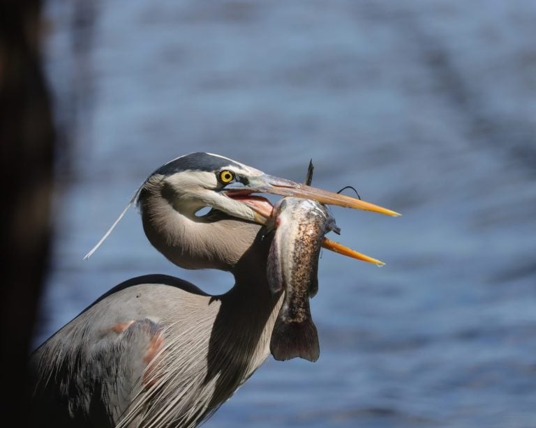
Great Blue Heron
Stand still. Strike fast. Fly blue.

Stand still. Strike fast. Fly blue.
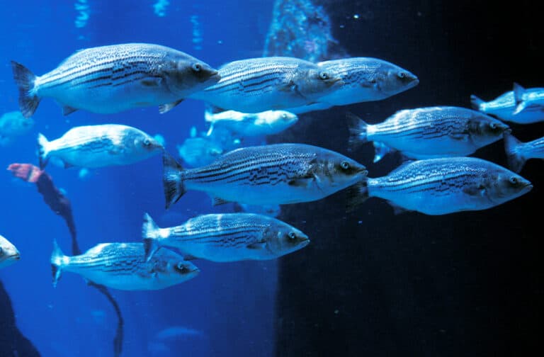
River-born. Ocean-built. Striped bass.
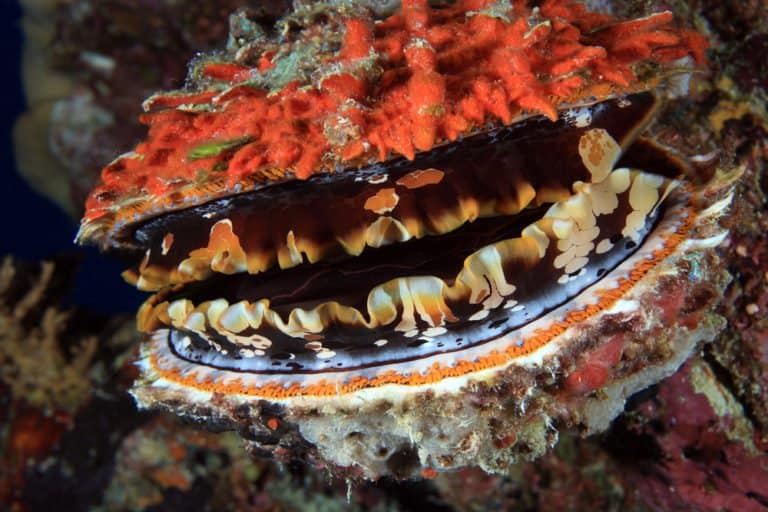
Reef builders that clean the coast
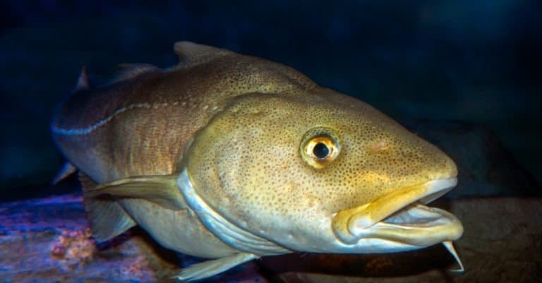
Codfishes: backbone of cold seas
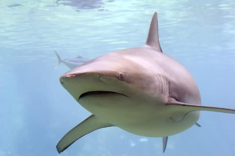
Copper sheen, surf-zone speed.
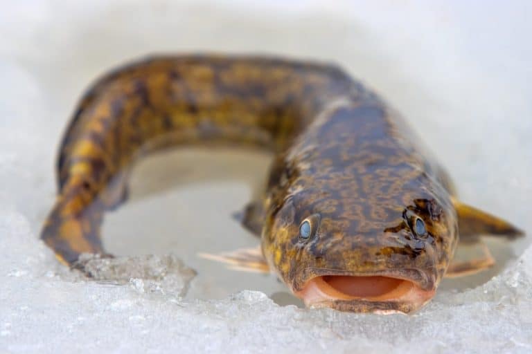
Cold seas, long fins, deep lives
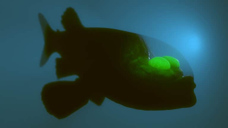
A clear head with eyes that swivel
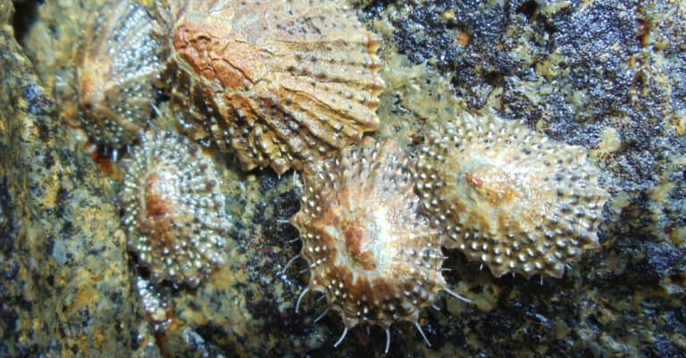
Cling hard, graze smart, ride the tide.

Lure, lunge, and vanish.
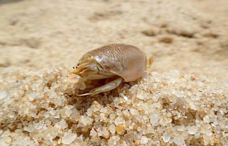
Burrow fast. Filter the surf.
The North Pacific Ocean is the northern subdivision of the Pacific Ocean extending from the equator to the Arctic Ocean, bounded by Asia and North America, and characterized by large-scale wind-driven gyres and major boundary currents that structure its climate and ecosystems.
The North Pacific Ocean spans a vast range of latitudes and environments-from warm tropical waters near the equator to subarctic and seasonally ice-influenced seas toward the Bering Strait. Its circulation is dominated by the North Pacific Subtropical Gyre and Subpolar Gyre, with powerful boundary currents including the warm Kuroshio and the cool California Current. These currents redistribute heat, nutrients, and organisms, shaping regional climates along the coasts of East Asia and western North America.
Biologically, the North Pacific is among the world's most productive ocean regions, especially in temperate and subarctic zones where nutrient supply and seasonal mixing fuel large phytoplankton blooms. This productivity supports extensive food webs-ranging from krill and forage fish to salmon, tunas, seabirds, and marine mammals-and underpins major fisheries and coastal economies across multiple nations. The region is also notable for strong climate variability (e.g., ENSO and the Pacific Decadal Oscillation), which can reorganize temperature, productivity, and species distributions across basin scales.
Etymology: "Pacific" derives from the Latin pacificus ("peaceful"), a name popularized after Ferdinand Magellan described the ocean as calm during his 16th-century crossing; "North Pacific" simply denotes the northern portion of the Pacific Ocean.
Kuroshio & California Currents, major temperate-subarctic fisheries, the Pacific Ring of Fire, typhoons, and the Great Pacific Garbage Patch
The North Pacific Ocean is the northern portion of the Pacific Ocean, extending from the equator northward to the Arctic gateways (via the Bering Sea and Bering Strait). It lies between the east coasts of Asia (Russia's Far East, Japan, the Koreas, China, Taiwan, and the Philippines) and the west coasts of North America (Alaska/United States, Canada, and Mexico), encompassing major temperate-to-subarctic current systems such as the Kuroshio and California Currents.
Challenger Deep, southern end of the Mariana Trench (western North Pacific)
Far Eastern Russia borders the northwest North Pacific via the Kamchatka Peninsula and adjacent seas/island arcs (incl. Kuril region).
Japan's Pacific-facing coasts and island arcs form a major western boundary, adjacent to deep trenches (e.g., Japan Trench).
Borders the western Pacific via the Korean Peninsula's east coast (regionally connected through the Sea of Japan and nearby straits).
Borders the western Pacific region via Korea Strait/adjacent marginal seas and approaches to the open North Pacific.
China's eastern seaboard connects to the western North Pacific through marginal seas and straits leading to the open basin.
Taiwan sits on the North Pacific's western edge, near straits linking seas to the Philippine Sea and open Pacific.
The Philippines form a major island boundary to the western tropical-to-temperate North Pacific (notably the Philippine Sea).
The U.S. borders the North Pacific via Alaska, the West Coast, and ocean islands like Hawaii.
Canada's Pacific coast (British Columbia) borders the eastern North Pacific and its productive shelf seas.
Mexico borders the eastern North Pacific along Baja California and mainland Pacific coast; waters become more tropical southward.
South: the Equator, transitioning into the South Pacific. North: Bering Strait/Bering Sea margin connecting to the Arctic Ocean. West: Asian continental margin and island arcs (Kuril-Kamchatka, Japan, Ryukyu-Taiwan, Philippine arc). East: North American continental margin from Alaska through British Columbia and the U.S. West Coast to Baja California/Mexico. Central: open-ocean basin including the Hawaiian-Emperor seamount chain.
Surface avg: ~ 16-18 °C basin-wide north of the equator (highly variable: ~2-10 °C subarctic; ~10-20 °C mid-latitudes; >20 °C in subtropics/western boundary)
Deep avg: ~ 1.5-3 °C below ~1000 m (North Pacific Deep Water relatively cold and old; little deep-water formation locally)
Typical surface salinity ~32-35 PSU. Subtropical gyre is saltier (~34.5-35+ PSU) under high evaporation; subarctic and coastal/river-influenced regions are fresher (~32-34 PSU) due to precipitation, runoff, and sea-ice melt at high latitudes. Intermediate depths include a pronounced salinity minimum (North Pacific Intermediate Water) around ~500-1000 m.
Strong seasonality north of ~35-40°N: winter cooling and deep mixed layers; summer surface warming and strong stratification. Western boundary region (Kuroshio/Extension) has strong fronts and mesoscale variability; eastern boundary (California Current) is cooler year-round with summer coastal cooling from upwelling.
Western boundary: Kuroshio Current and Kuroshio Extension; subarctic frontal system including Oyashio Current. Eastern boundary: California Current System (equatorward flow, coastal upwelling, countercurrents). Gyre-scale: North Pacific Subtropical Gyre (clockwise) with North Equatorial Current feeding Kuroshio, and North Pacific Current (west-to-east) splitting toward Alaska Current (poleward) and California Current (equatorward). Subarctic Gyre (counterclockwise) with Alaska Current/Alaskan Stream and broad eastward subarctic flow. Includes equatorial current system at the southern boundary and strong mesoscale eddy activity along major fronts.
Mixed tides dominate much of the basin (mixed semidiurnal common), with strong regional variability. Largest ranges occur in marginal seas and embayments around the North Pacific rim (notably the Gulf of Alaska/nearby inlets and parts of the Bering/Okhotsk margins), while the open-ocean North Pacific typically has modest tidal amplitudes. Internal tides are significant along ridges and continental slopes, contributing to mixing.
Surface waters: warm, saline Subtropical Surface Water in the gyre; cooler, fresher Subarctic Surface Water north of the subarctic front. Intermediate: North Pacific Intermediate Water (NPIW) characterized by a salinity minimum and relatively high dissolved oxygen compared with deeper layers, formed via mixing/subduction near the Kuroshio-Oyashio transition and subarctic regions. Deep/abyssal: North Pacific Deep Water and Pacific Abyssal Water are cold, nutrient- and CO2-rich, oxygen-poor relative to the Atlantic, reflecting long residence times and limited local deep-water formation; influenced by inflow of Antarctic-origin deep waters.
Strong stratification in subtropical regions: warm mixed layer over a sharp thermocline/pycnocline (~50-200 m). In subarctic regions, stratification is weaker in winter with deep mixed layers (hundreds of meters) and stronger in summer due to surface warming/freshening. Persistent halocline in high-latitude areas (and near the Bering/Okhotsk margins) can cap deeper mixing, affecting nutrient supply and primary production.
Major nutrient upwelling occurs along the eastern boundary (California Current upwelling zones from Baja California to Oregon/Washington, strongest in spring-summer) and along parts of the western boundary/fronts (Kuroshio-Oyashio transition and eddy-driven upwelling). Subarctic gyre domains exhibit broad wind-driven Ekman divergence and winter mixing that recharges surface nutrients. Additional localized upwelling and mixing occurs around island chains and topographic features (Aleutians, Kurils, seamounts) and in marginal seas (e.g., Okhotsk shelf processes feeding intermediate waters).
Strong basin-scale fronts (subarctic front; Kuroshio Extension) with intense mesoscale eddies that redistribute heat, salt, and nutrients. The North Pacific hosts major climate modes (ENSO teleconnections, Pacific Decadal Oscillation) that shift temperature, storm tracks, and ecosystem productivity. The eastern North Pacific commonly experiences seasonal hypoxia/acidification stress in upwelling areas as CO2- and nutrient-rich waters reach the shelf. A large subtropical convergence zone accumulates floating debris (Great Pacific Garbage Patch). Deep waters are relatively oxygen-poor and nutrient-rich ("old" water), influencing biogeochemistry and fisheries via productivity gradients.
The North Pacific Ocean spans tropical, temperate, and subarctic belts, so its marine climate ranges from warm, humid trade-wind conditions near the equator to cool, stormy mid-latitudes and cold, seasonally ice-influenced waters toward the Bering/Chukchi margins. The basin is strongly shaped by major current systems: the warm Kuroshio and its Extension transport heat poleward along East Asia and across the western/central basin, while the cool California Current and subarctic currents promote coastal cooling and high nutrient supply along western North America. Large-scale atmospheric patterns (Aleutian Low in winter, subtropical highs in summer, ENSO and the Pacific Decadal Oscillation) modulate sea surface temperatures, winds, upwelling, and productivity, supporting temperate-to-subarctic ecosystems and major fisheries.
Winter (roughly Nov-Mar) features stronger westerlies across mid-latitudes, frequent low-pressure systems, higher wave energy, and widespread surface cooling and deep mixed layers-particularly in the Gulf of Alaska and western subarctic. Summer (roughly Jun-Sep) brings a northward shift/strengthening of the subtropical high, weaker mid-latitude storminess, more persistent stratification, and enhanced coastal upwelling along the California Current region (and seasonally in parts of the western boundary/Kuroshio Extension margins). Spring and autumn are transitional periods with rapid changes in wind direction, mixed-layer depth, and nutrient availability; these transitions often align with major blooms and shifts in fish distribution. Interannual variability is pronounced: El Niño events tend to warm and stratify the eastern/central tropical-to-temperate North Pacific and can suppress upwelling, while La Niña often enhances cooling and upwelling-favorable conditions; decadal shifts (PDO) can reorganize basin-scale temperature and ecosystem patterns.
Tropical cyclones form primarily in the western and central North Pacific (typhoons) during the warm season, typically peaking from late summer into early autumn. Many typhoons track westward toward the Philippines, China, Korea, and Japan; some recurve northeastward into the open North Pacific, transitioning into powerful extratropical cyclones that can generate very large swell and severe winds across the mid-latitudes. The eastern North Pacific also produces tropical storms/hurricanes mainly off Mexico and Central America; these usually move west-northwest and less commonly reach far into the mid-latitude North Pacific. In the extratropics, the dominant hazard is the winter storm track: frequent, intense cyclones associated with the Aleutian Low affect the Gulf of Alaska, Aleutians, and the western/central North Pacific, with strongest winds and seas generally from late autumn through early spring.
Sea ice is not present across most of the North Pacific but occurs in the far-northern margins and adjoining seas. Seasonal sea ice forms extensively in the Bering Sea and can extend southward in colder winters; it typically advances in late autumn/early winter and retreats in spring. The Sea of Okhotsk experiences substantial seasonal ice (often among the lowest-latitude major ice seas), driven by cold continental outflow and coastal polynyas; ice generally peaks in mid-to-late winter and clears in spring. The northernmost reaches toward the Bering Strait connect to Arctic sea-ice regimes, with ice presence and duration varying strongly by year and longer-term climate trends.
The North Pacific Ocean spans strong latitudinal and climatic gradients-from equatorial/subtropical waters to subarctic and seasonally ice-influenced seas-creating a mosaic of highly productive shelf, slope, and open-ocean habitats. Its ecology is strongly shaped by major current systems (notably the Kuroshio, Oyashio, North Pacific Current, Alaska Current, and California Current), which drive nutrient transport, frontal zones, and upwelling. These processes fuel large phytoplankton blooms, support extensive food webs (zooplankton → forage fish/squid → seabirds/marine mammals), and underpin globally important fisheries (salmon, pollock, tuna, sardine/anchovy complexes, squid, crab). Interannual to decadal variability (ENSO, PDO) and marine heatwaves can rapidly reorganize communities, shifting species distributions, bloom timing, and predator-prey dynamics.
Overall diversity is high and strongly structured by latitude: subtropical island chains and warm boundary currents support richer reef and pelagic assemblages, while temperate-to-subarctic regions tend to have lower species richness but exceptionally high biomass and productivity. Biodiversity hotspots occur at current confluences and fronts (e.g., Kuroshio-Oyashio transition), along continental margins and canyons, and around seamounts and island arcs. Deep-sea habitats (seamounts, canyons, hydrothermal vents) add substantial, often poorly cataloged diversity, including specialized and locally restricted invertebrate communities.
Species count: Tens of thousands of marine species overall; on the order of ~1,000+ fish species across the basin, thousands of crustaceans and mollusks, and hundreds of seabird and marine mammal populations (counts vary by subregion and survey effort).
The North Pacific neritic zone spans continental shelves and coastal seas from East Asia (Japan, Russia, China) to North America (Alaska to California), including major shelf systems such as the Bering Sea, Gulf of Alaska, Sea of Okhotsk, and the California Current margin. Productivity is high where wind-driven upwelling (especially along the California Current) and tidal/ice-edge mixing (subarctic shelves) inject nutrients into sunlit waters, fueling strong spring-summer phytoplankton blooms. Kelp forests, seagrass beds (more localized), rocky reefs, and estuaries provide nursery habitat for groundfish, salmonids during coastal phases, forage fish (sardine, anchovy, herring), and invertebrates (crab, shrimp, scallops). Coastal conditions are highly seasonal: storms and downwelling dominate many margins in winter, while summer upwelling and stratification can create sharp fronts that concentrate plankton and fish.
The pelagic North Pacific includes vast open-ocean waters structured by basin-scale gyres and boundary currents. The Kuroshio transports warm, nutrient-poor subtropical water northward and forms the highly dynamic Kuroshio Extension, where eddies and fronts enhance mixing and create feeding "hotspots" for tuna, squid, seabirds, and marine mammals. Farther east, the North Pacific Current splits into the Alaska and California Currents, linking subarctic, transition, and subtropical domains. The subarctic pelagic region is typically rich in macronutrients but can be iron-limited, producing episodic blooms; the subtropical gyre is generally oligotrophic with lower plankton biomass but large areal extent. Seasonal stratification, mesoscale eddies, and frontal zones shape where prey aggregates, influencing distributions of highly migratory species (e.g., tunas, sharks) and wide-ranging predators (whales, albatrosses).
The benthic zone ranges from shallow continental shelves to deep abyssal plains and trenches (e.g., Aleutian and Kuril-Kamchatka trench systems). On shelves, benthic communities are tightly coupled to surface production: spring blooms export organic matter that supports clams, polychaetes, amphipods, echinoderms, and cold-water corals/sponges in some areas. In the Bering and Chukchi-linked margins, sea-ice timing strongly influences how much production sinks to the seafloor, sustaining exceptionally rich benthos that supports walruses, gray whales, and demersal fish. In the deep North Pacific, food is scarce and arrives mainly as "marine snow," carcass falls, and sporadic pulses; communities include deposit feeders (holothurians), scavengers, and specialized fauna at chemosynthetic habitats where present (e.g., some seep/vent-influenced areas along active margins). Sediment type, oxygen availability, and slope currents determine benthic habitat mosaics.
The demersal zone includes waters just above the seabed along shelves, slopes, and seamounts, where strong bottom currents, internal waves, and topography concentrate nutrients and prey. It supports major groundfish and invertebrate assemblages-Pacific cod, pollock, sablefish, rockfishes, flatfishes (halibut, sole), skates, and commercially important crabs and shrimps. Many demersal species use depth zonation by life stage, with juveniles on shallower nursery grounds and adults on deeper slopes. Seamounts and canyon systems create localized productivity and refugia, often hosting long-lived structure-formers (sponges, corals) that provide habitat for demersal fishes. Because demersal communities depend on both benthic prey and pelagic inputs (sinking plankton, krill layers), they are sensitive to changes in surface production, oxygen minimum zone expansion (notably in parts of the eastern North Pacific), and bottom disturbance.
Notable migrations are strongly seasonal and linked to temperature, prey blooms, and spawning cycles. Gray whales migrate between Baja California breeding lagoons (winter) and Bering/Chukchi feeding grounds (late spring-summer), often tracking coastal corridors. Humpback whales and some fin and blue whales move from lower-latitude wintering areas to high-latitude feeding grounds in the Gulf of Alaska, Aleutians, and western subarctic in summer, following krill and forage fish. Pacific salmon (chum, sockeye, pink, coho, Chinook) undertake multi-year ocean migrations across the North Pacific and return to natal rivers, with coastal migrations peaking during spring-fall depending on species and region. Seabirds (shearwaters, auklets, albatrosses) shift with fronts and bloom timing, with many concentrating in the transition zone and coastal upwelling regions in summer. Highly migratory fishes (albacore, bluefin tuna) track temperature fronts and prey fields, often moving poleward in warmer months and equatorward or offshore as waters cool.
Key food webs are built on strong plankton production and the coupling between pelagic, coastal, and benthic pathways. (1) Upwelling/temperate chain (eastern boundary): nutrient input → diatoms → copepods/krill → anchovy/sardine/hake → salmon, tuna, seabirds, marine mammals; krill also directly supports baleen whales. (2) Subarctic shelf "benthic-rich" chain (Bering/Okhotsk/Gulf of Alaska shelves): ice-edge/spring bloom → export to seafloor → amphipods/clams/polychaetes → crabs, Pacific cod, flatfish, walrus and gray whale (benthic feeding), linking surface bloom timing to higher predators. (3) Kuroshio-Oyashio transition chain (western boundary/fronts): frontal mixing → plankton blooms → squid and small pelagic fish → tunas, sharks, dolphins, and pelagic seabirds; eddies concentrate prey and enhance predator foraging success. (4) Microbial loop/oligotrophic gyre: picophytoplankton → microzooplankton → higher zooplankton → mesopelagic fishes; energy transfer is longer and less efficient but supports large midwater biomass that feeds squid, tuna, and deep-diving whales. Across the basin, detrital export ("marine snow") and carcass falls connect surface productivity to deep benthic and demersal communities, while top predators (orcas, large sharks) exert top-down effects by regulating prey fish and marine mammal populations.

The North Pacific Ocean remains one of the world's most productive temperate-to-subarctic marine regions, driven by major current systems (e.g., Kuroshio/Oyashio, California Current) that fuel high fisheries yields and biodiversity. However, ecosystem health is increasingly constrained by climate-driven marine heatwaves, shifting species distributions, ocean acidification (notably impacting high-latitude food webs), persistent industrial and plastic pollution, and continued pressure on key stocks and bycatch-sensitive species. Coastal habitats and nearshore nursery areas are also affected by development, altered river inputs, and heavy vessel traffic across Asia and North America.
At-risk: high productivity but increasingly stressed by climate change, fishing pressure, and pollution hotspots.
Warming and more frequent/intense marine heatwaves alter productivity, shift species ranges (northward/deeper), increase harmful algal bloom risk in some areas, and contribute to ecosystem regime shifts; ocean acidification is especially consequential in subarctic waters and upwelling margins.
Ongoing pressure on some commercially important and forage species; stock variability and distribution shifts complicate management. Bycatch and entanglement risks persist for seabirds, sea turtles, sharks, and marine mammals in some fisheries.
Plastic debris and microplastics in gyres and coastal accumulation zones; contaminant burdens (e.g., POPs, mercury) in upper trophic levels; episodic oil/chemical spills and chronic urban/industrial runoff affecting nearshore ecosystems.
Degradation of coastal wetlands, estuaries, kelp forests, eelgrass beds, and coral communities (where present) from coastal development, sedimentation, and warming-driven habitat change, reducing nursery and feeding habitat.
High shipping density and associated underwater noise, ship strikes (notably for large whales), disturbance near breeding/rookeries, and expanding offshore activities in some areas.
Biofouling and ballast-water introductions (and range expansions) that alter nearshore communities; invasive tunicates, algae, and invertebrates are recurrent issues in ports and coastal embayments.
Localized depletion of prey resources (including forage fish) and cumulative extraction pressures that can reduce ecosystem resilience, especially during warm anomalies.
Disease dynamics and parasite loads may increase with warming and altered food webs, with episodic impacts on marine mammals and fish; interactions with nutritional stress can amplify effects.
Coastal hardening, port expansion, and subsea cables/pipelines in some regions increase habitat fragmentation and disturbance; cumulative impacts are significant near major coastal population centers.
Major issues include plastic and microplastic accumulation (including debris transport to the North Pacific Subtropical Gyre), legacy and ongoing contaminants (mercury, POPs) that bioaccumulate in tuna, sharks, and marine mammals, and chronic coastal runoff (nutrients, pathogens, metals) near urban/industrial corridors; oil spill risk persists along shipping lanes and production/transit areas.
Many fisheries are actively managed, but status is mixed: some stocks are well-assessed and regulated while others face uncertainty from climate-driven distribution shifts, variable recruitment, and bycatch challenges. Illegal, unreported, and unregulated (IUU) fishing remains a concern in parts of the basin, and ecosystem-based management is uneven across jurisdictions.
Warming and marine heatwaves disrupt plankton communities, reduce or shift prey availability, and can trigger widespread ecosystem changes; acidification and low-oxygen events are heightened in upwelling systems and high latitudes, affecting calcifiers and early life stages of fish and invertebrates. Net impacts include altered phenology, shifting fisheries, and increased stress on cold-adapted species.
Invasions are concentrated near ports and aquaculture/harbor areas, facilitated by ballast water and hull fouling; range expansions of non-native or warm-water species are increasingly climate-enabled. Impacts include competition with native species, habitat alteration (e.g., invasive algae), and changes to food webs in nearshore ecosystems.
The deepest known oceanic trench on Earth in the western North Pacific, formed by subduction of the Pacific Plate beneath the Mariana Plate.
Home to the Challenger Deep (~11 km), it is a global reference point for extreme-depth exploration, trench ecology, and plate-tectonic processes.
A large embayment off central California adjacent to a major submarine canyon and productive upwelling zone influenced by the California Current.
Renowned for marine biodiversity, oceanographic research (Monterey Bay Aquarium Research Institute), and feeding hotspots for whales, seabirds, and pelagic fish.
A narrow passage between Alaska and Russia linking the North Pacific (Bering Sea) with the Arctic Ocean (Chukchi Sea).
A critical gateway for water, nutrient, and organism exchange between the Pacific and Arctic; strategically important and sensitive to rapid climate-driven change.
A long subduction trench south of Alaska and the Aleutian Islands where the Pacific Plate descends beneath the North American Plate.
Associated with major earthquakes and tsunamis; influences deep-sea habitats and regional productivity through complex bathymetry and currents.
A long chain of extinct volcanic seamounts extending north from the Hawaiian Ridge toward the Aleutians.
A classic hotspot track used to reconstruct plate motion; seamounts host rich deep-sea coral and sponge communities and support fisheries habitat.
A volcanic island archipelago in the central North Pacific formed by hotspot volcanism atop the Pacific Plate.
Iconic for geology and endemism; central to Pacific navigation history; surrounding waters support important pelagic ecosystems and fisheries.
A vast protected area spanning the Northwestern Hawaiian Islands and surrounding waters.
One of the world's largest marine protected areas, safeguarding critical seabird colonies, coral reef habitats, and endangered species such as Hawaiian monk seals.
A deep subduction trench off Russia's Kamchatka Peninsula and Kuril Islands.
A major tectonic boundary with frequent large earthquakes; supports deep trench ecosystems and influences productivity along the Oyashio-influenced margin.
A barrier reef system surrounding much of Palau in the western North Pacific, with lagoons, channels, and reef walls.
A world-class reef complex and renowned diving region with high coral and fish diversity and strong conservation significance in Micronesia.
A coral atoll in the Marshall Islands with a large lagoon and numerous WWII-era shipwrecks.
Famous for nuclear test history and for exceptional wreck diving; the lagoon's shipwrecks are among the most celebrated underwater archaeological sites in the Pacific.
Battleship wreck at Pearl Harbor, Oahu, sunk during the 1941 attack and remaining partially submerged.
A major historical memorial site; also an important case study in long-term wreck corrosion and environmental monitoring (oil leakage management).
A high-energy reef corner and drop-off in Palau known for strong currents and pelagic action.
Widely regarded as one of the world's premier dive sites for shark encounters and large schools of fish driven by current-fed productivity.
The North Pacific has been a major corridor for human movement and exchange for millennia. Austronesian and later Polynesian voyaging traditions expanded across the western and central Pacific, and northern routes connected Northeast Asia, the Aleutians, and the Pacific Northwest via long-standing Indigenous maritime networks. From the 16th-19th centuries, European and Russian exploration mapped coasts and island chains (e.g., Spanish expeditions along California and the Pacific Northwest, Russian expansion across Kamchatka and the Aleutians, and British/French surveying). The Manila Galleon trade (1565-1815) linked the Americas and Asia across the broader North Pacific realm via trans-Pacific routes between the Philippines and New Spain, catalyzing early globalization in silver, spices, textiles, and people. The 19th-early 20th centuries saw intense commercial whaling and sealing across subarctic waters and island arcs, followed by rapid growth in steamship and telegraph-linked commerce. World War II profoundly shaped the region (Aleutian Campaign, island fortifications, and naval/air routes), and the Cold War further militarized parts of the basin, making it a persistent strategic frontier between North America and Asia.
Major trans-Pacific shipping lanes connect East Asia (China, Japan, South Korea) with North American gateways along the U.S. and Canadian West Coast. High-density routes run through the western North Pacific (approaches to the East China Sea and Sea of Japan), across the mid-latitude North Pacific great-circle tracks, and into approaches to the Strait of Juan de Fuca, San Francisco Bay, and Southern California. Key ports and logistics hubs include: Shanghai/Ningbo-Zhoushan and other China coast ports (feeding North Pacific routes via regional transshipment), Busan and Incheon (Korea), Yokohama/Tokyo Bay, Kobe/Osaka and Nagoya (Japan), as well as Los Angeles-Long Beach, Oakland, Seattle-Tacoma, and Vancouver/Prince Rupert in North America. Critical chokepoints and routing constraints influencing North Pacific traffic include the Bering Strait (limited but growing strategic relevance), the Tsugaru and La Perouse/Soya Straits (Japan-Russia), approaches to the Aleutian chain, and coastal traffic separation schemes along the U.S./Canada coasts. Seasonal storm tracks, fog, icing in higher latitudes, and typhoon activity in the western basin shape routing, safety regimes, and schedule reliability.
The North Pacific supports some of the world's largest industrial fisheries, spanning U.S., Canadian, Russian, Japanese, Korean, and Chinese fleets and management regimes. Large-scale operations target pollock in the Bering Sea and Gulf of Alaska; salmon across the subarctic rim; tuna and billfish in temperate waters; and groundfish (cod, hake/whiting, flatfish) along continental shelves. Highly developed processing and cold-chain logistics support export-oriented markets, with major landing/processing centers including Alaska (e.g., Dutch Harbor/Unalaska and Kodiak), the U.S. Pacific Northwest, British Columbia, Russia's Far East, and northern Japan. Management is shaped by national exclusive economic zones (EEZs), regional fisheries management organizations for highly migratory species, bycatch controls, observer programs, and ecosystem-based measures in many jurisdictions, though IUU (illegal, unreported, unregulated) fishing remains a concern in some areas and for certain species.
Artisanal and small-scale fisheries are widespread along the North Pacific rim, often closely tied to Indigenous subsistence and local coastal economies. Examples include salmon, shellfish, and nearshore finfish harvesting by Alaska Native and Pacific Northwest First Nations communities; coastal set-net and small-boat fisheries in Japan; community-based coastal fisheries in Russia's Far East; and small-scale fisheries along California and Baja California targeting rockfish, crab, lobster, squid, and nearshore pelagics. These fisheries commonly rely on seasonal knowledge of currents and upwelling, use smaller vessels and traditional gear (handlines, traps/pots, gillnets, beach seines), and are increasingly affected by marine heatwaves, harmful algal blooms, shifting species ranges, and coastal development.
Diving conditions vary strongly by latitude and current regime. Temperate eastern boundary areas influenced by the California Current often have cool water, variable visibility (frequently reduced by plankton blooms and surf-zone turbulence), and strong surge and currents around headlands and kelp forests. Subarctic zones (Gulf of Alaska, Aleutians, Kamchatka) are colder with challenging weather windows, currents in passes, and generally lower temperatures requiring drysuits; visibility can be excellent in some offshore/rocky areas but is often weather-dependent. Western boundary/current regions associated with the Kuroshio can offer comparatively clearer water and stronger currents near island chains and capes, with seasonal typhoon impacts and rapid sea-state changes. Common features include kelp forests, rocky reefs, volcanic seascapes, cold-water invertebrate communities, and occasional pelagic encounters.
Tourism is concentrated along coastlines and island arcs and often centers on wildlife, scenery, and maritime culture. In North America, major activities include whale watching (California to Alaska), coastal cruising and expedition cruises (Inside Passage, Gulf of Alaska, Aleutians), sea kayaking and sailing (British Columbia, Washington, Alaska), beach and surf tourism (California and parts of the Japanese Pacific coast), and national-park-driven travel (e.g., Olympic Peninsula, Alaska coastal parks). In Asia, popular destinations include Japan's Pacific coast and islands (Hokkaido to Okinawa influences on broader Pacific travel, with temperate North Pacific sites in the north), the Kuril/Kamchatka region for expedition tourism (limited, niche), and coastal urban tourism tied to major port cities. Iconic draws include seasonal salmon runs, seabird colonies, kelp forests, tidepooling, and aurora/ice-edge experiences toward the subarctic. Tourism is sensitive to seasonality, sea state, fog, and storm frequency, and is increasingly shaped by climate-driven shifts in wildlife distributions and coastal hazards.
Hydrocarbon activity in the North Pacific is regionally concentrated and heavily regulated or politically constrained in many areas. Historically significant extraction and offshore development occurred along parts of California's coast (legacy platforms and ongoing decommissioning debates) and in Alaska, where offshore exploration and development have been proposed or intermittently pursued in the Beaufort/Chukchi (Arctic gateway) and considered in parts of the Gulf of Alaska, though policy restrictions, economics, and environmental concerns have limited many offshore projects. On the western side, Russia's Far East has offshore oil and gas development in adjacent North Pacific/Okhotsk-linked regions (notably Sakhalin projects) that influence North Pacific energy shipping and support infrastructure. Overall, the basin's oil-and-gas footprint is shaped by high environmental risk, rough sea states, sensitive fisheries, Indigenous rights, and evolving decarbonization policies.
The North Pacific is a core strategic theater due to its role as the maritime and aerospace bridge between North America and Asia, proximity to the Arctic, and access to key straits and island chains. The U.S. maintains major naval and air presence across the Pacific (with significant force posture connected to the North Pacific via the U.S. West Coast, Alaska, and forward bases in Japan), supporting sea-lane security, deterrence, and rapid response. Japan's Self-Defense Forces play a central role in regional maritime security around the Japanese archipelago and nearby approaches. Russia maintains significant forces in its Far East, including Pacific Fleet elements and bases along the Kamchatka Peninsula and surrounding waters, contributing to a persistent strategic competition and periodic exercises. The region also hosts missile defense and early-warning infrastructure (notably in Alaska), submarine operating areas, and frequent multinational training and patrol operations. Strategic flashpoints and planning considerations include the Kuril Islands/Northern Territories dispute, approaches to the Bering Strait and Aleutians, and the broader U.S.-China and U.S.-Russia strategic environment that affects North Pacific operations and routing.
The North Pacific is bordered by diverse coastal and Indigenous cultures with deep maritime traditions. Along North America, this includes Alaska Native peoples (Yupik, Inupiat, Aleut/Unangan, Alutiiq/Sugpiaq, Tlingit, Haida, and others) and Pacific Northwest First Nations and Tribes (including Coast Salish, Nuu-chah-nulth, Kwakwaka'wakw, Tsimshian, among many), whose cultures center on salmon, marine mammals, kelp/seaweed, and sophisticated seafaring, carving, and governance traditions. Along the Russian Far East are Indigenous groups such as the Chukchi, Koryak, Itelmen, Even, and Nivkh, with livelihoods historically tied to coastal fishing, reindeer herding (inland-coastal linkages), and marine hunting in northern reaches. In Japan, coastal communities from Hokkaido through Honshu include long-established fishing and seaweed-harvesting cultures; the Ainu of Hokkaido represent a distinct Indigenous culture with strong riverine and coastal connections. Across East Asia more broadly, coastal Chinese and Korean maritime communities and port-city cultures have long shaped trade, shipbuilding, cuisine, and diaspora networks. These cultures share dependence on productive currents (Kuroshio, Oyashio, California Current), seasonal runs (especially salmon), and nearshore ecosystems, and many are actively engaged in co-management, marine conservation, and cultural revitalization amid rapid ecological and economic change.
314 species documented in our encyclopedia
Thank you for reading! Have some feedback for us?
We appreciate your help in improving our content.
Our editorial team will review your suggestions and make any necessary updates.
There was an error submitting your feedback. Please try again.