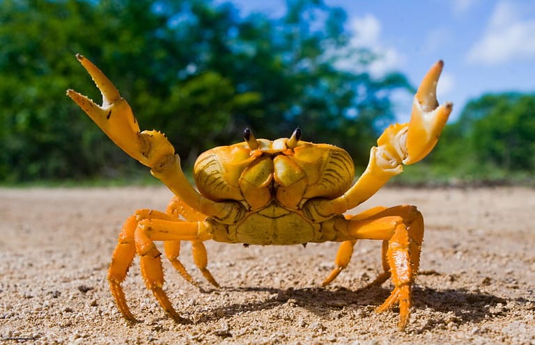
Crab
Sideways masters of every shore
Sideways masters of every shore
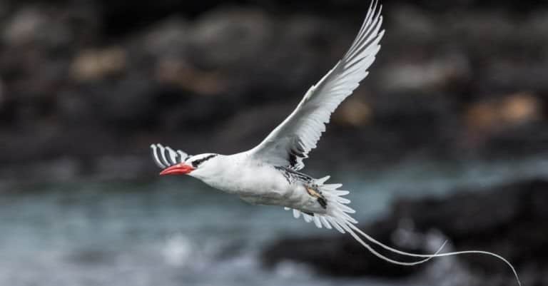
Streamers of the tropical seas
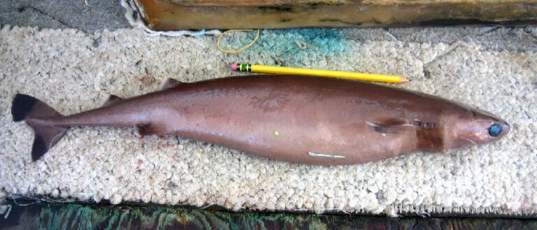
The deep-sea donut-cutter
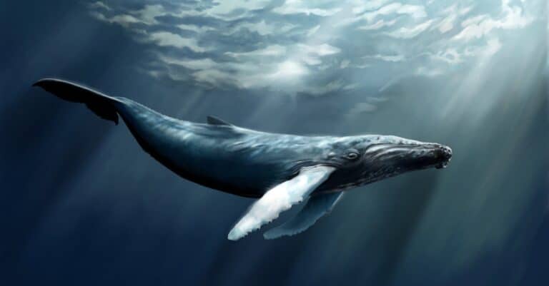
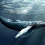
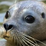
Big flippers. Bigger journeys.
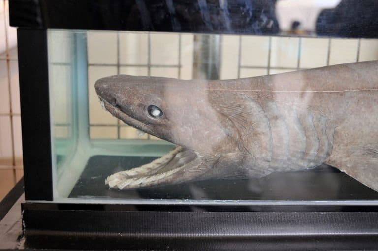
The deep-sea shark that looks like a sea serpent
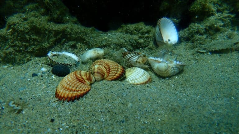
Ribbed hearts of the tidal flats
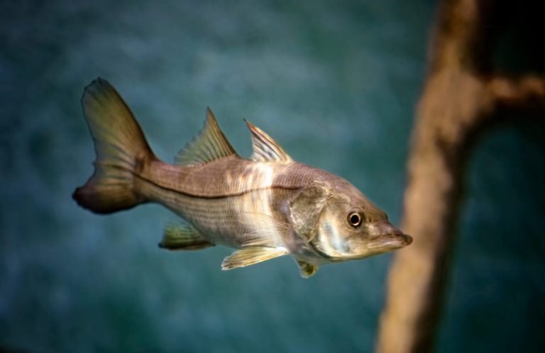
Linesiders of the tides
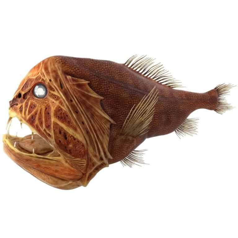
Small fish. Huge fangs. Deep sea.
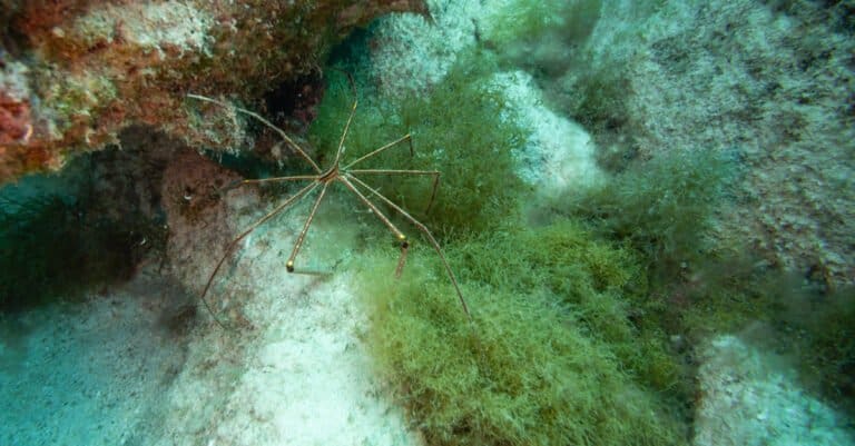
All legs, no land-meet Pycnogonida
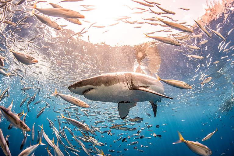
Warm-blooded hunter of the seas
The North Atlantic Ocean is the northern portion of the Atlantic Ocean extending roughly from the equator to the Arctic Ocean, bounded by North America to the west and Europe and northwest Africa to the east, and encompassing key basins and current systems that link tropical, temperate, and subpolar waters.
The North Atlantic is one of Earth's most intensively studied and economically important ocean regions, forming the watery bridge between the Americas and Europe-Africa. Its surface circulation is dominated by the Gulf Stream and its continuation, the North Atlantic Drift, which transport heat and salt northeastward and help moderate climates-most notably across western and northern Europe-while also shaping fog, storm tracks, and seasonal sea-ice patterns at higher latitudes.
Ecologically, the region spans warm subtropical gyres to cold subpolar and Arctic-influenced seas, producing strong gradients in temperature, salinity, and nutrients. These gradients, combined with energetic fronts, shelf seas, and episodic deep winter mixing, support high primary productivity and rich food webs, including major fisheries (e.g., cod, haddock, herring, mackerel) and migratory megafauna such as whales, seabirds, and sea turtles. The North Atlantic also plays a central role in the global carbon cycle and climate system through deep-water formation and the Atlantic Meridional Overturning Circulation, while facing pressures from warming, acidification, deoxygenation, and intense maritime use.
Etymology: 'Atlantic' comes from Greek and is commonly glossed in English as 'Sea of Atlas,' referring to Atlas in Greek mythology (and associated by some traditions with the Atlas Mountains); 'North Atlantic' denotes the northern part of the Atlantic Ocean.
Gulf Stream & North Atlantic Drift, rich fisheries, major transatlantic shipping routes, hurricane development region
The North Atlantic Ocean is the northern sub-region of the Atlantic Ocean, lying primarily between North America to the west and Europe and northwest Africa to the east. It extends from the equatorial Atlantic northward through temperate waters into subpolar regions toward the Arctic gateways near Greenland, Iceland, and Norway, and includes major current systems such as the Gulf Stream and North Atlantic Drift.
Milwaukee Deep, Puerto Rico Trench (~8,376 m)
Atlantic coastline including Labrador and the Maritime provinces; borders the Labrador Sea and Northwest Atlantic shelves
Atlantic seaboard from Maine to Florida; includes major shelf systems and the Gulf Stream region
Atlantic drainage via the Gulf of Mexico (a marginal sea connected to the North Atlantic)
Island nation on the western boundary of the North Atlantic near the Florida Straits and Bahamas platforms
Northern Caribbean island bordering passages connecting the Caribbean Sea to the North Atlantic
UK overseas territory in the western North Atlantic near the Sargasso Sea/gyre region
Greenland's east and south coasts front the North Atlantic and key Arctic-Atlantic exchange corridors
Straddles the Mid-Atlantic Ridge and the subpolar North Atlantic circulation
Norwegian Sea/North Sea coasts connected to the North Atlantic and major warm-water inflows
Borders the North Atlantic (west of Scotland) and the North Sea (a connected marginal sea)
Western European island nation directly facing the open North Atlantic
Bay of Biscay and English Channel coasts connected to the North Atlantic
Cantabrian and Atlantic Iberian coasts; gateway region toward the Strait of Gibraltar
Atlantic-facing Iberian coast; includes the Azores (mid-ocean) and Madeira archipelagos
Northwest African Atlantic coast; includes waters near the Canary Current system
Atlantic coastline along northwest Africa adjacent to upwelling-influenced waters
Atlantic coast influenced by major coastal upwelling and productive fisheries
Atlantic coast at the northeastern tropical Atlantic margin
Short Atlantic frontage at the mouth of the Gambia River
Atlantic coast with extensive estuaries and shelf waters
Atlantic coast on the Gulf of Guinea margin (north of the equator)
Atlantic coast on the eastern tropical North Atlantic
Atlantic coast on the eastern tropical North Atlantic
Atlantic coast on the Gulf of Guinea margin (north of the equator)
Atlantic coast on the Gulf of Guinea margin (north of the equator)
Narrow Atlantic coastline on the Gulf of Guinea margin
Atlantic coastline on the Gulf of Guinea margin
Atlantic coastline along the Bight of Benin/Bight of Bonny (Gulf of Guinea)
Island nation in the eastern North Atlantic off West Africa
Island nation in the Gulf of Guinea near the equatorial boundary of the North Atlantic
Bounded to the west by the eastern coasts of Canada, the United States, and the northern Gulf/Caribbean rim; to the east by the Atlantic coasts of Europe (from Iberia through the British Isles to Scandinavia) and northwest Africa (from Morocco to the Gulf of Guinea north of the equator). It transitions southward into the South Atlantic across the equatorial Atlantic and connects northward to the Arctic Ocean via the Greenland-Iceland-Norway (GIN) seas and Fram Strait/Barents-Norwegian Sea pathways. It connects to the Mediterranean Sea through the Strait of Gibraltar and to the Caribbean Sea and Gulf of Mexico through island passages and the Florida Straits.
Surface avg: ~12-16 °C (basin-wide mean; varies strongly with latitude and proximity to western boundary currents)
Deep avg: ~2-4 °C (typical deep North Atlantic; colder in overflow waters, slightly warmer at mid-depths in subtropics)
Typical open-ocean surface salinity ~34.5-37 PSU. Subtropical gyre commonly ~36-37 PSU due to high evaporation; subpolar regions lower (~34-35 PSU) from precipitation, river input, and ice melt. Deep waters generally ~34.8-35.0 PSU with distinct signatures from NADW and overflow sources.
Strong seasonality north of ~35-40°N: winter cooling and deep mixing; summer surface warming and stratification. Subpolar regions typically ~2-8 °C in winter and ~6-15 °C in summer; temperate western boundary regions can exceed ~20-26 °C in summer.
Major systems include: Gulf Stream (western boundary current) transitioning to the North Atlantic Current/Drift toward Europe; Subtropical Gyre circulation (including the Azores Current and Canary Current eastern boundary flow); Subpolar Gyre (Labrador Current, East Greenland Current, Irminger Current); Norwegian Atlantic Current into the Nordic Seas; and the Atlantic Meridional Overturning Circulation (AMOC) with northward upper-ocean flow and southward deep return (NADW).
Generally semidiurnal (M2-dominated) across much of the basin with strong regional amplification on continental shelves and in resonant basins. Largest ranges occur in the NW Atlantic (e.g., Bay of Fundy/Gulf of Maine) and parts of the European shelf/North Sea; smaller ranges in the deep ocean and many subtropical open-ocean areas. Strong tidal currents and internal tides common along shelf breaks and mid-ocean ridges.
Key water masses include North Atlantic Deep Water (NADW; relatively cold, oxygen-rich, ~2-4 °C, ~34.9-35 PSU) formed from high-latitude convection and overflow; Labrador Sea Water (intermediate, ventilated, high oxygen); Mediterranean Outflow Water (warm, saline intermediate water spreading westward at ~800-1200 m); Subtropical Mode Water/18°C Water in the western subtropical gyre; and dense overflow waters from the Nordic Seas via the Denmark Strait and Faroe Bank Channel feeding the deep limb of AMOC.
Strong vertical stratification in subtropical/tropical regions with a pronounced thermocline and halocline; weaker stratification and deeper winter mixed layers in temperate/subpolar regions. Wintertime convection and mixing are prominent in the Labrador and Irminger Seas, while summer stratification strengthens widely due to surface heating and freshwater inputs. Internal waves and mesoscale eddies contribute to intermittent layering and mixing, especially near fronts (Gulf Stream/North Atlantic Current) and shelf breaks.
Notable nutrient upwelling and high productivity occur along the eastern boundary near NW Africa (Canary Current upwelling system), seasonally along parts of Iberia, and locally along shelf breaks and banks (e.g., Grand Banks, Georges Bank) where tidal mixing and slope processes lift nutrients. Additional nutrient supply arises from winter mixing and convective overturning in subpolar regions, and from eddy-driven upwelling/downwelling along the Gulf Stream and North Atlantic Current fronts.
Frequent strong mesoscale variability (Gulf Stream meanders, warm/cold-core rings) that redistributes heat, salt, and nutrients; intense air-sea coupling and storm forcing with large winter heat loss at high latitudes; episodic deep convection events affecting ventilation and carbon uptake; freshwater anomalies and sea-ice influence in subpolar/Arctic-adjacent areas (e.g., Greenland melt, Arctic outflows) that can modulate stratification and AMOC strength; and prominent frontal zones (subtropical/subpolar front) that structure ecosystems and biogeography.
The North Atlantic Ocean spans tropical to Arctic latitudes, producing strong gradients in sea-surface temperature, salinity, and weather. Climate is dominated by the Atlantic Meridional Overturning Circulation and major currents: the warm Gulf Stream/North Atlantic Drift moderates conditions across the western and especially eastern basin, while the cold Labrador and East Greenland Currents cool the northwest and subpolar regions. Persistent westerlies and frequent frontal systems drive highly variable conditions, with energetic mixing and high productivity in temperate-to-subpolar waters (notably along shelf seas and subpolar fronts).
Winter (Dec-Mar): Strongest westerlies and largest air-sea temperature contrasts; frequent extratropical cyclones, high seas, and deep ocean mixed layers in mid-to-high latitudes; cold conditions and enhanced convection in subpolar regions. Spring (Apr-May): Increasing stratification as surface waters warm; onset of major phytoplankton blooms in temperate/subpolar waters; storminess gradually decreases. Summer (Jun-Aug): Warmest SSTs in tropics/subtropics; more stable stratification and generally lighter winds in many areas, though fog can be common where warm air overlies cold currents (e.g., Grand Banks/Labrador Current). Fall (Sep-Nov): Re-intensifying winds and storms; surface cooling increases mixing; secondary blooms can occur; peak warm-water extent supports tropical cyclone development and northward recurvature.
Tropical cyclones (hurricanes) form mainly from June to November, peaking August-October in the tropical and subtropical North Atlantic (including the Main Development Region off West Africa). Many track westward then recurve poleward and eastward into the open Atlantic; some affect the Caribbean, Gulf of Mexico, U.S./Canada Atlantic coasts, and occasionally western Europe as transitioning/post-tropical systems. Extratropical cyclones occur year-round but are most frequent and intense from late fall through spring along the North Atlantic storm track (U.S. East Coast to Iceland/Norwegian Sea), producing strong winds, large swell, and rapid weather changes.
Sea ice is seasonal and primarily confined to the Arctic/subarctic margins: the Greenland Sea, Fram Strait vicinity, Denmark Strait, and parts of the Labrador Sea and waters around Greenland and Newfoundland. Winter-early spring typically sees maximum extent with drifting pack ice and occasional southward export via the East Greenland Current; summer-early fall brings minimum extent and retreat toward higher latitudes, though icebergs can persist into warmer months in the northwest due to glacial calving and cold currents. Mid-latitude and tropical North Atlantic waters are generally ice-free year-round.
The North Atlantic Ocean spans tropical-to-Arctic latitudes and is strongly structured by major currents (notably the Gulf Stream and North Atlantic Drift) that transport heat, nutrients, and organisms across the basin. Its ecology is characterized by highly productive temperate and subpolar shelves (supporting major fisheries), strong seasonal blooms of phytoplankton, extensive continental-slope and abyssal deep-sea habitats, and distinctive features such as the Sargasso Sea in the subtropical gyre and hydrothermal systems along the Mid-Atlantic Ridge. Productivity and community composition vary sharply with latitude, water-mass boundaries, and mixing/upwelling on shelves and banks.
Species richness is generally moderate compared with tropical oceans but can be very high locally where currents, fronts, and complex seafloor topography concentrate nutrients and life (e.g., continental shelves, banks, canyons, seamounts, and frontal zones). The basin supports diverse plankton communities that drive large seasonal food webs, extensive benthic diversity in deep-sea sediments, and regionally important assemblages of seabirds, marine mammals, and commercially important fishes and invertebrates.
Species count: Estimated ≥25,000 described marine species across the North Atlantic basin (from microbes to megafauna), with many additional deep-sea and microbial taxa likely undescribed; local shelf regions can host thousands of species, while basin-scale totals rise into the tens of thousands.
The North Atlantic neritic zone spans the continental shelves and nearshore waters from the subtropics to the Arctic, including highly productive shelf seas such as the North Sea, Irish Sea, Grand Banks, Georges Bank, Labrador Shelf, and the shelves off Iberia and northwest Africa. Strong tidal mixing, wind-driven upwelling (notably along northwest Africa), and seasonal stratification create recurrent plankton blooms that fuel major fisheries. River inputs and coastal wetlands/estuaries add nutrients and detritus, while temperature gradients shaped by the Gulf Stream and colder Labrador/East Greenland currents produce sharp fronts that aggregate plankton and forage fish. Habitats include kelp forests and rocky reefs in cooler regions, sandy and gravel banks, and shallow seagrass/estuarine systems where salinity and turbidity vary widely.
The North Atlantic pelagic zone covers the open-ocean water column from the surface mixed layer through the mesopelagic "twilight zone" and into the deep ocean. Its ecology is structured by basin-scale circulation (Gulf Stream, North Atlantic Drift, subpolar gyre) and by persistent fronts and eddies that concentrate nutrients and prey. Seasonal light and mixing drive spring blooms across temperate and subpolar waters, while oligotrophic subtropical gyre waters rely more on recycling and episodic eddy-driven nutrient injections. In the mesopelagic, diel vertical migration of zooplankton and lanternfish moves carbon and energy between surface production and deep predators, and deep pelagic communities depend on sinking marine snow, carcasses ("whale falls"), and sporadic particle flux pulses.
The benthic zone of the North Atlantic includes the continental shelf seabed, slopes, abyssal plains, and specialized deep-sea features such as submarine canyons, seamounts, and mid-ocean ridge segments. Shelf and slope bottoms host diverse infaunal and epifaunal communities (polychaetes, bivalves, echinoderms, crustaceans) that process organic matter from surface blooms and coastal detritus; sediment type (mud, sand, gravel), oxygen, and bottom temperature strongly shape community structure. Deeper habitats have slower growth and lower productivity but high specialization, including cold-water coral reefs (e.g., Lophelia pertusa) on slopes and seamounts that create complex three-dimensional habitat for fish and invertebrates. In the abyss, food limitation favors scavengers and deposit feeders, and benthic-pelagic coupling varies with the strength of seasonal particle export from overlying waters.
The demersal zone comprises the near-bottom waters over shelves and slopes where currents, turbidity, and benthic habitat complexity influence predator-prey interactions. It supports many commercially important groundfish and invertebrates (e.g., cod, haddock, saithe, pollock, hake, flatfishes, redfish, skates, deepwater sharks, and benthic crustaceans) that feed on benthic invertebrates, demersal forage fish, and pelagic prey concentrated near fronts and banks. Banks and shelf breaks act as feeding hotspots, while submarine canyons and coral mounds provide refugia and nursery areas. Demersal communities are tightly linked to benthic productivity (infauna/epifauna) and to episodic delivery of pelagic biomass to the bottom (post-bloom fallout, fish kills, discarded carcasses), making them sensitive to changes in stratification, oxygen, and fishing pressure.
Notable migrations in the North Atlantic are strongly seasonal and often follow temperature bands, prey blooms, and current pathways. Baleen whales (e.g., humpback, fin, minke, and North Atlantic right whales) generally migrate from low-latitude wintering/breeding areas to higher-latitude summer feeding grounds (Gulf of Maine, Newfoundland/Labrador, Iceland-Norwegian waters, and the Barents gateway). Atlantic salmon and sea trout migrate between rivers and offshore feeding areas, while eels undertake trans-Atlantic spawning migrations to the Sargasso Sea. Large pelagic fish (bluefin tuna, swordfish, some sharks) track warm currents and prey into temperate latitudes in spring-summer and retreat southward in autumn. Seabirds (auks, shearwaters, gannets, gulls, and terns) shift between breeding colonies on North Atlantic coasts/islands and offshore wintering areas, often concentrating along productive fronts. Many zooplankton and mesopelagic fish also exhibit daily vertical migrations that are a major, basin-wide movement of biomass.
Key North Atlantic food webs are built on (1) phytoplankton-driven production in spring and early summer and (2) detrital pathways that transfer bloom material to the seafloor. In temperate-subpolar waters, diatoms and other phytoplankton are grazed by copepods (e.g., Calanus spp.) and krill, which in turn support forage fish (herring, mackerel, capelin, sand eels) and higher predators (cod and other groundfish, tuna, seabirds, and baleen whales). Shelf systems often feature a strong "forage fish bridge," where energy moves efficiently from plankton to mid-trophic schooling fish and then to marine mammals and birds. Benthic-demersal chains are prominent on shelves: phytodetritus and benthic microalgae support worms, bivalves, and crustaceans, which feed flatfish, cod/haddock, skates, and benthic-feeding mammals; scavengers recycle carcasses and discards. In oligotrophic gyre regions, microbial loops (bacteria-protists) recycle nutrients and route energy to small zooplankton and micronekton, ultimately supporting pelagic predators but with lower transfer efficiency. Deep-sea food webs rely on sinking particles and episodic inputs (marine snow pulses, carrion), sustaining deposit feeders and scavengers that are prey for deep demersal fishes and cephalopods.

The North Atlantic Ocean supports some of the world's most productive temperate-to-subpolar marine ecosystems, shaped by the Gulf Stream and North Atlantic Drift. Conservation status is mixed: several fish stocks have rebuilt under modern management, but many habitats and species remain under significant pressure from climate-driven ocean change, legacy and ongoing overfishing, heavy shipping and industrial use, and chronic pollution (including plastics and chemical contaminants). Biodiversity hotspots on continental shelves, seamounts, and deep-sea coral/sponge grounds are vulnerable to bottom-contact fishing, seabed disturbance, and warming-driven shifts in species distributions.
moderate
Warming, marine heatwaves, changing stratification, and shifts/weakening variability in major current systems alter productivity and species ranges; ocean acidification and deoxygenation threaten calcifiers and deep-sea ecosystems. Rapid shifts are evident in plankton communities and poleward movement of many fish and invertebrates.
While some stocks have recovered, pressures persist from mixed-stock fisheries, bycatch, IUU fishing in some areas, and historically depleted populations (e.g., some groundfish and large pelagics). Bottom trawling impacts benthic habitats and can slow recovery of long-lived deep-sea corals/sponges.
Chronic inputs of plastics/microplastics, persistent organic pollutants and heavy metals, oil and chemical spills, nutrient enrichment and episodic hypoxia in coastal seas, plus underwater noise from shipping and industry. Contaminants bioaccumulate in top predators and affect seabirds and marine mammals.
Degradation of coastal and shelf habitats (saltmarshes, seagrass, kelp forests), damage to seabed features from bottom-contact gear, and disturbance to deep-sea habitats (canyons, seamounts, coral and sponge grounds). Coastal development and shoreline hardening reduce nursery and foraging areas.
High vessel traffic elevates ship strikes (notably for large whales), chronic underwater noise, and disturbance from tourism and offshore industrial activity. Entanglement risk from fishing gear and marine debris remains significant for whales, seals, and turtles.
Expansion of offshore wind, subsea cables, and other marine infrastructure increases localized habitat disturbance and noise; benefits are possible with careful siting, but cumulative impacts and sensitive-area conflicts are key risks.
Warming waters can increase pathogen prevalence and harmful algal blooms, affecting shellfish, fish, and marine mammals; disease interacts with other stressors (nutrition, contaminants).
Non-native species introduced via ballast water, hull fouling, and aquaculture can alter food webs and outcompete natives, especially in coastal and estuarine systems; warming improves establishment success for some invaders.
High shipping density and coastal population centers contribute to marine litter (including microplastics), oil/chemical contamination, and legacy pollutants (PCBs, mercury) in some regions; nutrient runoff drives eutrophication and harmful algal blooms in enclosed/semi-enclosed seas and estuaries; underwater noise is a pervasive, basin-wide stressor.
Overall management capacity is relatively strong in much of the region, with rebuilding of several target stocks; however, some stocks remain overfished or vulnerable, bycatch of non-target species persists, and bottom trawling continues to affect benthic habitats and slows recovery of sensitive deep-sea communities.
Warming and marine heatwaves shift distributions poleward and change timing of blooms; acidification reduces carbonate availability affecting shell-forming organisms and deep-sea corals; expanding low-oxygen zones and altered circulation patterns can reduce habitat suitability and disrupt fisheries productivity.
Coastal invasions are driven by ballast water and hull fouling (and some aquaculture pathways), with notable pressures in ports, estuaries, and warming shelf seas; invasives can modify habitats, compete with native species, and change food-web dynamics.
A mid-ocean island group perched on a volcanic seamount, surrounded by extensive carbonate platforms and coral reefs at the northern limit for Atlantic reef growth.
Notable as one of the world's northernmost coral reef systems, a key waypoint for migratory species, and an important site for studying Gulf Stream influences on reef ecology.
A deep submarine trench north of Puerto Rico and Hispaniola that marks a major subduction-zone boundary between the North American Plate and the Caribbean Plate.
The deepest part of the Atlantic Ocean and an important tectonic and seismic zone influencing regional hazards and deep-ocean habitats.
A major transform fault and fracture-zone valley system cutting across the Mid-Atlantic Ridge, forming deep passages and complex seafloor terrain.
A key biogeographic corridor and mixing zone for deep waters; the area is central to studies of deep-ocean circulation and species dispersal across the Atlantic.
A distinctive open-ocean sea region of the North Atlantic bounded by currents, characterized by floating Sargassum seaweed mats.
A critical nursery and feeding habitat for eels, turtles, and many pelagic species; globally famous for its unique ecosystem defined by ocean currents rather than coastlines.
A deep oceanic trench north of Puerto Rico and Hispaniola, marking a major subduction zone boundary in the North Atlantic region.
It is the deepest part of the Atlantic Ocean and an important tectonic and deep-sea habitat area, influencing regional geology and associated marine research.
A broad, shallow area of the continental shelf southeast of Newfoundland, comprising a series of submarine banks where cold Labrador Current waters meet warmer Gulf Stream-influenced waters.
Historically among the world's richest fishing grounds; noted for high biological productivity and as a focal area for ocean-front dynamics and marine management.
An isolated offshore bank (shallow plateau) east of Newfoundland, separated from the Grand Banks by deeper channels.
A notable, productive fishing and biodiversity area with distinct oceanographic conditions; important in international fisheries governance and stock assessments.
A cold, deep basin between Greenland and Labrador where winter cooling and winds promote deep convection.
One of the principal regions of North Atlantic Deep Water formation, making it central to the Atlantic Meridional Overturning Circulation and global climate regulation.
A narrow passage between southern Spain and northern Morocco connecting the Atlantic Ocean and the Mediterranean Sea.
A globally important choke point for water exchange, nutrient flow, and shipping; strong currents and mixing create distinctive habitats and influence Atlantic chemistry.
A deep marine passage between the Faroe Islands and the Shetland Islands that routes cold overflow waters and warm inflows between the Nordic Seas and the North Atlantic.
A key gateway for dense-water overflows that contribute to deep-ocean circulation; ecologically important for deep-water habitats (including corals) and for commercial fisheries.
A volcanic island chain near the Mid-Atlantic Ridge, with surrounding deep waters, seamounts, and steep island slopes.
Renowned for cetacean diversity and pelagic ecosystems; a hotspot for migration corridors, seamount-associated biodiversity, and oceanographic research.
A large seamount/bank southwest of Portugal with peaks rising to relatively shallow depths compared with the surrounding seafloor.
A well-known seamount system that concentrates marine life and attracts fisheries; also notable for complex geology tied to plate interactions near Iberia.
A deep oceanic trench north of Puerto Rico and Hispaniola on the boundary between the North American and Caribbean plates; it includes the Milwaukee Deep, the deepest point in the Atlantic Ocean.
The deepest part of the Atlantic and a key tectonic feature for studying subduction-zone processes and related earthquake and tsunami hazards in the northeastern Caribbean region.
A deep oceanic trough in the northeast Atlantic, located west of Scotland and Ireland, adjacent to Rockall Bank.
A major deep-water habitat area that supports cold-water corals and sponge communities and is frequently referenced in North Atlantic deep-sea ecology and conservation planning.
A large embayment between Greenland and Baffin Island that connects via Davis Strait toward the Labrador Sea.
A major Arctic-Atlantic transition zone affecting sea-ice export, marine mammal habitats, and the freshwater balance influencing North Atlantic circulation.
A German World War II submarine wreck off the U.S. Mid-Atlantic coast, lying on the continental shelf in recreational diving range.
A famous Atlantic shipwreck dive site and historical landmark; the identification story and accessible wreck ecology make it widely known among divers.
Remains of an ocean liner wrecked off the coast of Fuerteventura in the Canary Islands, in the eastern North Atlantic.
Iconic, photogenic wreck site illustrating Atlantic storm hazards and maritime history; a well-known coastal attraction tied to North Atlantic shipping routes.
A volcanic archipelago off northwest Africa influenced by the Canary Current and coastal upwelling.
A classic upwelling-driven ecosystem supporting productive fisheries and diverse pelagic life; important for studying subtropical-temperate transitions in the Atlantic.
Clear-water dive region on the western edge of the Bahamas platform, with walls, reefs, and strong current-influenced channels.
Famous for high-visibility diving and shark encounters; a well-known example of carbonate platform margins interacting with Gulf Stream dynamics.
The North Atlantic has been a core corridor of human movement and exchange for millennia. Early seafaring and coastal trade linked Atlantic Europe and northwest Africa, while Phoenician and later Roman-era navigation influenced routes along the Iberian and Moroccan coasts. Norse/Viking exploration (c. 8th-11th centuries) pushed into the North Atlantic via the Faroe Islands, Iceland, Greenland, and briefly Newfoundland (L'Anse aux Meadows), establishing stepping-stone routes across subpolar waters. From the 15th century onward, Iberian-led exploration and the Age of Sail transformed the basin into a transoceanic highway connecting Europe, West Africa, and the Americas. The North Atlantic became central to colonial expansion and the Atlantic trading system, including the forced transatlantic transport of enslaved Africans. In the 19th-20th centuries it was the principal arena for transatlantic passenger liners, telegraph/communications cables, and later transatlantic aviation support; it also holds enduring cultural memory from major maritime disasters (e.g., RMS Titanic) and from the Battle of the Atlantic in WWII, when convoy routes and anti-submarine warfare shaped modern naval doctrine.
One of the world's busiest ocean basins for container, tanker, and bulk traffic, dominated by transatlantic routes linking Eastern North America with Western/Northern Europe. Major lanes include: (1) the North Atlantic Great Circle-style corridors between the U.S./Canada (New York-New Jersey, Norfolk, Halifax, Montreal via St. Lawrence) and Europe (UK, Ireland, France, Benelux, Germany, Scandinavia), seasonally adjusted for weather/ice; (2) routes from the U.S. Gulf/East Coast and Caribbean to Europe and northwest Africa; (3) Europe-West Africa lanes along Portugal/Spain-Morocco-Canary Islands toward West African hubs; and (4) North Sea-Baltic-Norwegian Sea feeder networks connecting into the broader North Atlantic. Key ports and gateways include Rotterdam, Antwerp-Bruges, Hamburg, Bremerhaven, Le Havre, London Gateway/Felixstowe, Liverpool, Dublin, Lisbon/Sines, Algeciras (often treated as Atlantic-Mediterranean interface), Casablanca/Tangier Med (NW Africa), New York-New Jersey, Savannah, Charleston, Norfolk, Boston, Halifax, Montreal/Quebec (seasonal/ice considerations), and Reykjavik as a North Atlantic transshipment/support node. Maritime chokepoints influencing traffic include the English Channel, approaches to the North Sea, the Strait of Gibraltar (interface), and the St. Lawrence Seaway system (seasonal).
Among the most intensively fished temperate/subpolar regions, supporting large industrial fleets from the EU/UK, Norway, Iceland, Faroe Islands, Greenland (Denmark), Canada, and the U.S. Commercial activity targets shelf and slope systems such as the Grand Banks, Georges Bank, Flemish Cap, Rockall Trough margins, Iceland-Faroe shelves, Norwegian Sea margins, and the Barents/Arctic gateway. Management is largely quota-based (e.g., NEAFC in parts of the Northeast Atlantic; national regimes/ICCAT for tunas), but pressures persist from stock variability, climate-driven range shifts, bycatch, and historical overfishing on certain banks.
Small-scale and community fisheries remain culturally and economically important along Atlantic Canada and New England; the Irish, Scottish, and English coasts; Brittany and the Bay of Biscay; Portugal and Galicia; and northwest Africa (Morocco/Mauritania interface at the basin edge). These fisheries often use pots/traps, gillnets, handlines, and small trawlers, supplying local markets with shellfish, demersal fish, and pelagics. Seasonal targeting and mixed-species catches are common, with livelihoods sensitive to fuel costs, access rights, and ecosystem change.
Diving conditions range from temperate to subpolar. Water temperatures are often cool (especially north of ~40°N), with strong currents influenced by the Gulf Stream/North Atlantic Drift, variable visibility (excellent in some offshore/island settings; reduced near productive shelves), and frequent swell and weather systems. Many sites are best suited to experienced divers, with drysuits common in northern areas. Hazards can include surge, tides, kelp, and rapid weather changes.
Tourism is strongly tied to coastal culture and wildlife. Major activities include whale watching (e.g., Gulf of Maine, Bay of Fundy, Iceland, Azores, Norway's Atlantic coast), seabird and puffin tours (Iceland, Faroe Islands, Scotland), cruising (Northern Europe itineraries; North Atlantic repositioning voyages; Greenland/Iceland expedition cruises), sailing and ocean racing (e.g., transatlantic races), beach tourism in warmer eastern margins and islands (Azores, Madeira, Canaries on the Atlantic edge), and coastal heritage tourism around historic ports (Lisbon, Porto, Dublin, Liverpool, Bristol, Bordeaux/Nantes, Boston, Halifax, St. John's). Cold-water destinations emphasize scenery, fisheries heritage, and Northern Lights/Arctic gateway experiences (Iceland, Greenland, northern Norway).
Hydrocarbon exploration and production have historically been significant in parts of the North Atlantic, particularly the Northeast Atlantic. Major activity centers include the North Sea (often considered connected to the North Atlantic system), the Norwegian Sea margins, and the UK/Norway continental shelves, supported by dense offshore infrastructure, pipelines, and service ports (e.g., Aberdeen, Stavanger). The Atlantic margin west of Shetland has also hosted development, while exploration interest has varied off Ireland and in frontier basins. On the western side, offshore production exists along the Atlantic margins of Canada (notably offshore Newfoundland and Labrador) with associated tanker/shuttle operations and harsh-environment engineering. Regulatory shifts, decarbonization policy, and price cycles influence new leasing; decommissioning and environmental monitoring are major ongoing components.
Strategically vital as the principal maritime link between North America and Europe. The North Atlantic remains central to NATO planning for reinforcement and sea-lane protection, echoing WWII convoy lessons. Key features include GIUK (Greenland-Iceland-UK) gap surveillance importance for tracking naval movements between the Arctic/North Atlantic and the wider Atlantic; routine anti-submarine warfare (ASW) patrols; and extensive undersea infrastructure protection concerns (subsea cables, pipelines, offshore energy assets). Major naval and air bases and patrol networks span the U.S. and Canadian Atlantic coasts, the UK and Ireland's approaches, Iceland's strategic location (Keflavik area for periodic deployments), Norway's North Atlantic/Arctic interface, and French/Spanish/Portuguese Atlantic assets. Exercises and joint maritime operations are common, with increasing attention to the High North and to critical seabed infrastructure security.
The North Atlantic borders a wide mosaic of coastal and Indigenous cultures. In North America, this includes Inuit communities in Greenland and Arctic Canada with strong marine subsistence traditions, as well as Atlantic First Nations and Indigenous peoples in Canada (e.g., Mi'kmaq and others along Atlantic provinces) and coastal communities in New England with deep fisheries heritage. In Europe, maritime cultures include Norse and North Atlantic island societies (Icelanders, Faroese), coastal Norwegians, and the fishing/shipbuilding traditions of the British and Irish coasts, Brittany, Galicia, and Portugal. Along northwest Africa, coastal Moroccan and other Atlantic-facing communities integrate artisanal fisheries, maritime trade, and port-centered livelihoods. Across the basin, shared cultural elements include seafaring identity, cod and pelagic fisheries traditions, shipbuilding and navigation heritage, and strong ties between ocean conditions (storms, currents, seasons) and community life.
318 species documented in our encyclopedia
Thank you for reading! Have some feedback for us?
We appreciate your help in improving our content.
Our editorial team will review your suggestions and make any necessary updates.
There was an error submitting your feedback. Please try again.