N S W E
Wildlife Expeditions

Wildlife of
South Atlantic Ocean

The South Atlantic Ocean is the portion of the Atlantic Ocean south of the equator, extending to the Southern Ocean and bounded chiefly by South America to the west and Africa to the east.
250 Species
~40 million km² Area
~8,264 m Max Depth
Overview

Understanding This Category

The South Atlantic Ocean is the portion of the Atlantic Ocean south of the equator, extending to the Southern Ocean and bounded chiefly by South America to the west and Africa to the east.

The South Atlantic Ocean forms a broad marine corridor between two continents, linking tropical waters near the equator to the colder, stormier latitudes of the Southern Ocean. Its basin includes extensive continental shelves, prominent island groups and seamount chains, and deep abyssal plains split by the Mid-Atlantic Ridge, which influences seafloor topography, circulation pathways, and patterns of marine habitat.

Ocean circulation in the South Atlantic is dominated by major boundary currents that strongly shape regional climate and ecology. The warm Brazil Current carries subtropical water southward along eastern South America, while the cold Benguela Current flows northward along southwestern Africa and drives intense coastal upwelling that supports some of the world's most productive fisheries. These current systems, together with large-scale wind patterns and exchanges with the Southern Ocean and Indian Ocean, regulate heat transport, nutrient supply, and the distribution of plankton, fish, marine mammals, and seabirds across the basin.

Etymology: "Atlantic" derives from Greek mythology, meaning "Sea of Atlas," referring to Atlas (often associated with the mountains at the western edge of the known world); "South Atlantic" specifies the portion of this ocean basin lying south of the equator.

Key Characteristics

Extends from the equator to the Southern Ocean, between South America (west) and Africa (east)
Strong western and eastern boundary currents, notably the warm Brazil Current and cold Benguela Current
Major coastal upwelling along southwestern Africa (Benguela system) producing high primary productivity and important fisheries
Mid-Atlantic Ridge and associated fracture zones structure deep-ocean circulation and create distinct seafloor habitats
Connects tropical and temperate-to-subpolar water masses, influencing heat and salt transport within the global overturning circulation
At a Glance

Quick Facts

Type Sub_ocean
Area ~40 million km²
Max Depth ~8,264 m (Factorian Deep, South Sandwich Trench)
Temperature ~0-28°C (from subantarctic to tropical waters)
Salinity ~34-36 ppt
Bordering Countries 10+ sovereign countries on 2 continents (South America & Africa), plus several island/overseas territories

Mid-Atlantic Ridge seafloor spreading, Brazil & Benguela Currents, highly productive upwelling fisheries off SW Africa, major whale and seabird migration routes

Physical Features

Geography

The South Atlantic Ocean is the southern portion of the Atlantic Ocean, extending generally from the equator southward to the Southern Ocean, lying between the eastern coast of South America (to the west) and the western coast of Africa (to the east). It includes major subtropical and subpolar water masses and is strongly influenced by the warm Brazil Current on the western boundary and the cold Benguela Current along southwestern Africa.

40.27 million km2 Area
~3,700 m Average Depth
~8,260 m Max Depth

South Sandwich Trench (Meteor Deep area)

Major Features

  • Mid-Atlantic Ridge (southern segment)
  • South Sandwich Trench (deepest area of the South Atlantic)
  • Brazil Basin
  • Argentine Basin
  • Angola Basin
  • Cape Basin
  • Walvis Ridge
  • Rio Grande Rise
  • Agulhas Plateau (southern tip of Africa region)
  • Major current systems: Brazil Current, Benguela Current, Falkland Current, South Atlantic Current, Antarctic Circumpolar Current influence in the south

Islands

  • Tristan da Cunha (UK)
  • Gough Island (UK)
  • Saint Helena (UK)
  • Ascension Island (UK)
  • Bouvet Island (Norway)
  • Fernando de Noronha (Brazil)
  • Trindade and Martim Vaz (Brazil)
  • Falkland Islands (UK-administered; claimed by Argentina)
  • South Georgia (UK-administered)
  • South Sandwich Islands (UK-administered)
  • Annobón (Equatorial Guinea)
  • Sao Tome and Principe

Coastline Countries

Argentina

Southern South American Atlantic coastline; broad continental shelf (Argentine Shelf) and access toward subpolar waters.

Uruguay

Short Atlantic frontage at the Rio de la Plata/Atlantic interface; influenced by Brazil-Falkland confluence dynamics.

Brazil

Largest South Atlantic coastline; western boundary currents (Brazil Current) and major shelf systems (e.g., Abrolhos region).

Gabon

Coast just south of the equator along the northern South Atlantic (Gulf of Guinea region).

Republic Of The Congo

Coastline in the southeastern Gulf of Guinea, south of the equator; part of the South Atlantic coastal margin.

Democratic Republic Of The Congo

Narrow Atlantic coastline at the Congo River mouth region; important freshwater/sediment input to the basin.

Angola

Extensive coastline along the Benguela Current system and Angola-Benguela frontal region.

Namibia

Benguela upwelling coastline; high marine productivity and strong wind-driven upwelling.

South Africa

Southwestern/southern African coastline meeting the Atlantic; interaction zone with Indian Ocean waters near the Cape.

Equatorial Guinea

Includes Annobón Island, south of the equator in the Gulf of Guinea, on the South Atlantic's northern edge.

Sao Tome And Principe

Island nation near the equator in the Gulf of Guinea; marks boundary between North and South Atlantic.

Connected Waters

  • North Atlantic — Open-ocean transition across the equatorial Atlantic; exchange via equatorial currents and cross-equatorial circulation.
  • Southern Ocean — Southern boundary via the Antarctic Circumpolar Current and Southern Ocean frontal systems in high southern latitudes.
  • Indian Ocean — Indirect exchange south of Africa via Agulhas leakage/retroflection and inter-ocean eddy transport around the Cape of Good Hope.

Boundaries

North: transitions to the North Atlantic near the equatorial Atlantic (around 0 degrees latitude). West: South American margin (notably Brazil, Uruguay, Argentina) and associated continental shelves and slopes. East: African margin (notably Angola to South Africa) and associated shelves and slopes. South: grades into the Southern Ocean in the high southern latitudes (commonly referenced near about 60 degrees south, though oceanographic fronts vary seasonally).

Physical Characteristics

Oceanography

Temperature Range ~ -1.8 to 30°C (sub-Antarctic waters near the Southern Ocean to tropical waters near the equator)

Surface avg: ~18-22°C basin-wide (highly latitude-dependent; tropical belt often 26-29°C, subtropical gyre ~16-22°C, far south commonly 0-8°C seasonally).

Deep avg: ~2-4°C for most deep waters; near-bottom waters can approach ~0-2°C in the far south due to Antarctic-derived influences.

Salinity Moderate to high overall; highest in the subtropical gyre

Typical open-ocean surface salinity ~34.5-37 PSU. Maxima (~36.5-37) in the evaporative subtropical gyre; fresher in the equatorial belt and near major river/plume influences (e.g., Congo/Angola margin and western boundary shelf inputs) and toward sub-Antarctic waters (~33.5-34.5). Salinity generally decreases poleward and increases toward the gyre center.

Seasonal Variation

Strong seasonality south of ~30°S (winter cooling and deeper mixed layers); weaker seasonality in the tropics with relatively stable warm SSTs; subtropical gyre shows summer-warm/winter-cool surface swings and wintertime mixing.

Currents

Major systems include the South Equatorial Current (westward) feeding the Brazil Current (warm, poleward western boundary current) and the North Brazil Current near the equator; the Malvinas/Falkland Current (cold, equatorward along Argentina) and the Brazil-Malvinas Confluence (strong fronts/eddies); the Benguela Current (cold, equatorward eastern boundary current) linked to the Benguela Upwelling System; the Angola Current (warm, poleward) forming the Angola-Benguela Front; interior subtropical gyre recirculation with mesoscale eddies; and southern exchanges with the Antarctic Circumpolar Current plus Agulhas leakage (Indian Ocean rings/eddies entering the South Atlantic).

Tides

Mixed tidal regimes across the basin. Generally moderate open-ocean tidal ranges (~0.5-2 m), with locally larger ranges on shelves/embayments. Semi-diurnal dominance common along parts of the SW Atlantic shelf, while mixed (diurnal + semi-diurnal) and regionally variable tides occur along the SE Atlantic margins. Strongest tidal currents occur on broad shelves (e.g., Patagonian/Argentine shelf and parts of the Namibian-South African shelf), enhancing mixing and shelf-break fronts.

Water Masses

Surface waters: warm, saline Subtropical Surface Water in the gyre; fresher Equatorial Surface Water near the ITCZ. Mode/intermediate: South Atlantic Central Water and Antarctic Intermediate Water (AAIW) spreading northward at mid-depths. Deep/bottom: North Atlantic Deep Water (NADW) exported southward through the basin at ~2000-4000 m; Antarctic Bottom Water (AABW) intrudes northward along the abyssal western and eastern basins. Strong frontal water-mass contrasts at the Brazil-Malvinas Confluence and at the Angola-Benguela Front; interbasin influence from Agulhas rings adds warm/salty Indian Ocean water into the eastern/central South Atlantic.

Stratification

Typically strong stratification in the tropics and subtropics due to warm surface waters and a pronounced thermocline/pycnocline; seasonal stratification with winter deepening of the mixed layer in mid-latitudes; weaker stratification and deeper mixing toward the Southern Ocean. Along eastern boundary upwelling coasts, near-surface stratification can be reduced by wind-driven mixing and cold upwelled water, producing sharp coastal fronts and filaments.

Upwelling

Key nutrient-rich upwelling zones include the Benguela Upwelling System (Namibia-west coast South Africa; among the world's most productive), with persistent coastal upwelling cells and strong filaments. Seasonal/episodic equatorial upwelling occurs near the equator (wind-driven divergence). Additional localized upwelling and shelf-break enhancement can occur along the SW Atlantic margin (e.g., shelf-break/front processes near the Brazil-Malvinas Confluence and Patagonian shelf), though generally less persistent than Benguela.

Unique Conditions

Notable features include (1) the Brazil-Malvinas Confluence-one of the sharpest western boundary current fronts globally with intense eddy activity and strong air-sea coupling; (2) Benguela 'upwelling shadow' regions, frequent filaments, and occasional low-oxygen events/near-bottom hypoxia on the Namibian shelf; (3) the Angola-Benguela Front with strong temperature/salinity gradients and interannual shifts; (4) Agulhas leakage-large warm/salty rings entering the South Atlantic, affecting heat/salt budgets and downstream circulation; and (5) strong mesoscale variability across the subtropical gyre and along boundary currents, shaping productivity hotspots and biodiversity patterns.

Weather & Conditions

Climate

The South Atlantic spans tropical to subpolar climates, transitioning from warm, trade-wind-dominated waters near the equator to cool, windier, storm-prone conditions toward the Southern Ocean. Sea-surface temperatures and ecosystems are strongly shaped by major currents: the warm Brazil Current carries subtropical heat poleward along South America, while the cold Benguela Current and its coastal upwelling off southwest Africa produce cooler, nutrient-rich waters, frequent marine fog, and high biological productivity. A broad subtropical high-pressure belt and persistent trade winds favor generally stable weather in the central basin, while mid-latitude westerlies and frontal systems dominate the far south.

Seasons

Seasonality increases with latitude. In the tropics, temperatures vary modestly through the year; rainfall and convection shift with the seasonal migration of the Intertropical Convergence Zone (ITCZ), influencing equatorial squalls and precipitation belts. In the subtropics, summer brings warmer SSTs, stronger stratification, and (regionally) enhanced rainfall bands such as the South Atlantic Convergence Zone affecting parts of the western/central basin; winter brings cooler SSTs and more frequent passage of fronts, especially in the southwest. In the mid- to high-latitudes (roughly south of ~35-40°S), winters are markedly cooler and windier with more frequent, stronger low-pressure systems; summers are milder with slightly reduced storminess but still persistent swells and westerlies. Coastal seasonality contrasts are notable: Benguela upwelling is often strongest in austral spring-summer (varies by latitude/region), sustaining cool nearshore conditions year-round compared with offshore waters.

Storm Activity

True tropical cyclones are rare in the South Atlantic because of typically cooler SSTs, stronger vertical wind shear, and less favorable atmospheric vorticity compared with the North Atlantic. However, occasional subtropical or hybrid systems can form, mainly in the western South Atlantic off Brazil/Uruguay, and very rare tropical-like cyclones have occurred (e.g., Cyclone Catarina in 2004). Farther south, extratropical cyclones are common and often intense: the belt of mid-latitude lows and frontal systems (especially between ~40-60°S) produces frequent gales, large swells, and rapid weather changes, with peak storminess generally in austral winter.

Ice Conditions

Sea ice is generally absent across most of the South Atlantic. Ice becomes a factor only near its southern boundary with the Southern Ocean: during austral winter, Antarctic sea ice expands northward into the far southern reaches (roughly south of ~55-60°S, varying by year and sector), creating seasonal ice edges and occasional drifting icebergs. North of these high-latitude waters, ice is not a persistent hazard.

Ecology

Marine Life

The South Atlantic Ocean spans tropical to subpolar waters, creating a strong ecological gradient from warm, oligotrophic (nutrient-poor) subtropical gyres to highly productive temperate and subantarctic systems. Its ecology is strongly shaped by major boundary currents-the warm Brazil Current along eastern South America and the cold, nutrient-rich Benguela Current along southwestern Africa-plus equatorial circulation, large river outflows (Amazon/Plata influence near the basin margins), and deep-ocean features such as the Mid-Atlantic Ridge and extensive seamount chains. These drivers produce a mosaic of habitats ranging from Brazilian coral-reef provinces and oceanic islands to kelp-dominated coasts, major upwelling fisheries, and deep-sea coral and vent communities.

Variable Biodiversity

Biodiversity is highest in tropical western South Atlantic reef/island systems (e.g., Brazilian reef province and oceanic islands) and declines toward cooler southern waters, while overall biomass and food-web productivity peak in upwelling regions (especially the Benguela). The basin includes both species-rich, structurally complex habitats (reefs, rhodolith beds) and comparatively species-poor but extremely productive systems (upwelling shelves) as well as diverse deep-sea assemblages on ridges, canyons, and seamounts.

Species count: On the order of tens of thousands of described marine species across the basin (fish, invertebrates, algae, plankton), with continuing discovery in deep-sea and seamount habitats; regional hotspots (Brazilian reefs and oceanic islands) hold hundreds to thousands of coastal fish and invertebrate species locally.

Ecosystems

  • Tropical coral reefs and patch reefs (Brazilian reef province; offshore banks)
  • Rhodolith (coralline-algal) beds and calcareous algal reefs (notably off Brazil)
  • Mangroves, seagrass meadows, and coastal lagoons/estuaries (tropical/subtropical margins)
  • Rocky-shore and kelp-forest systems (temperate South Africa and Patagonia)
  • Eastern boundary upwelling ecosystem (Benguela Current): high-nutrient shelf waters, hypoxia-prone zones, major pelagic fish and seabird/marine-mammal foraging grounds
  • Western boundary current shelf/slope systems (Brazil-Malvinas/Falklands confluence): strong fronts and mixing that aggregate plankton and top predators
  • Open-ocean subtropical gyre habitats (oligotrophic pelagic food webs)
  • Subantarctic frontal systems and seasonal sea-ice-influenced food webs toward the Southern Ocean boundary
  • Seamounts, oceanic islands, and guyots (stepping-stone habitats; localized endemism)
  • Deep-sea canyons and continental slope ecosystems (including sponge grounds)
  • Cold-water coral reefs and coral gardens (slope/seamount Lophelia/Madrepora-type habitats)
  • Mid-Atlantic Ridge deep-sea habitats, including hydrothermal vent fields and chemosynthetic communities

Endemic Species

  • Tristan rock lobster (Jasus tristani)
  • St Helena butterflyfish (Chaetodon sanctaehelenae)
  • St Helena wrasse (Thalassoma sanctaehelenae)
  • Ascension frillfin (Porogobius ascensionis)
  • Tristan albatross (Diomedea dabbenena)
Habitats

Ecological Zones

Neritic Zone

The South Atlantic neritic zone spans continental shelves off eastern South America and western/southern Africa, including productive upwelling shelves (notably the Benguela system off Namibia-South Africa) and warmer, generally less nutrient-rich shelves influenced by the Brazil Current. Coastal productivity is strongly structured by current-driven nutrient supply, river plumes (e.g., La Plata), wind mixing, and shelf-break fronts. Habitats include sandy and muddy shelves, rocky reefs, kelp beds in cooler southern latitudes, and estuaries/lagoon systems that serve as nurseries for many fishes, sharks, and invertebrates. Biodiversity and fisheries concentrate where fronts, upwelling filaments, and shelf-edge eddies aggregate plankton and baitfish, supporting seabirds, pinnipeds, and coastal cetaceans.

Pelagic Zone

The pelagic (open-ocean) South Atlantic is dominated by broad subtropical gyres with generally low surface nutrients and clear waters, punctuated by high-productivity features such as equatorial upwelling, the Benguela upwelling plume extending offshore, and dynamic frontal zones toward the Subantarctic. Mesoscale eddies and rings (including Agulhas leakage into the South Atlantic) redistribute heat, salt, and nutrients, creating transient hotspots that concentrate plankton and higher predators. The water column is vertically stratified, with a sunlit euphotic layer driving primary production and deeper mesopelagic layers hosting migratory lanternfishes, squid, and gelatinous zooplankton that couple surface and depth via diel vertical migration. Apex predators (tunas, billfishes, sharks) and wide-ranging marine mammals track these moving pelagic "oases," while oxygen and nutrient gradients at mid-depths shape species distributions and community structure.

Benthic Zone

The benthic zone in the South Atlantic ranges from shallow shelf seafloors to abyssal plains and seamounts. On shelves, sediments (sand, mud) and hardgrounds support diverse infauna and epifauna-polychaetes, bivalves, crustaceans, echinoderms-along with benthic algae and reef communities where light reaches the bottom. In deeper waters, food supply is largely detrital (marine snow) and episodic carcass falls, with slow-growing communities adapted to low temperatures, high pressure, and limited energy. Submarine canyons and shelf breaks funnel organic matter downslope, creating benthic "enrichment" zones with higher biomass and biodiversity. Seamounts and ridges provide hard substrate and intensified currents that support filter feeders (sponges, corals), forming vulnerable deep-sea biogenic habitats that can be important for fish aggregation and regional connectivity.

Demersal Zone

The demersal zone-waters just above the seafloor on shelves and slopes-hosts fishes and invertebrates that feed on benthic prey while also exploiting pelagic inputs. In productive regions like the Benguela, demersal communities are tightly linked to upwelling-driven plankton blooms that fuel pelagic forage fish; when these die-offs or fecal/particulate fluxes reach the bottom, they subsidize demersal predators and scavengers. Typical demersal guilds include hakes, croakers, rays, skates, and cephalopods, along with crustaceans that occupy soft-bottom habitats and canyon/slope margins. Demersal predators often concentrate along shelf breaks, fronts, and oxygen boundaries where prey are compressed vertically, creating predictable feeding grounds. This zone is also where many commercial trawl fisheries operate, making habitat integrity (benthic structure, corals, sponge grounds) a key factor in sustaining demersal biodiversity.

Migratory Season

Notable migrations in the South Atlantic include: (1) Southern right whales moving from high-latitude feeding areas toward winter-spring calving grounds along Argentina, Uruguay, Brazil, Namibia, and South Africa (peak coastal presence typically in austral winter to spring). (2) Humpback whales migrating between Antarctic/subantarctic feeding grounds and tropical-subtropical breeding areas, especially off Brazil and in the Gulf of Guinea, with peak breeding-season aggregations in austral winter. (3) Seabirds (albatrosses, petrels, shearwaters) undertaking long transoceanic foraging migrations, often tracking frontal systems and upwelling zones seasonally. (4) Pelagic fishes (tunas, swordfish) shifting with temperature fronts and prey fields, moving poleward in warmer seasons and equatorward/deeper in cooler seasons. (5) Sardine/anchovy movements along southern Africa linked to seasonal upwelling intensity and coastal temperature gradients, redistributing predators (seals, dolphins, gannets) that follow forage fish concentrations.

Key Food Webs

Key South Atlantic food webs are structured by contrasts between oligotrophic gyres and nutrient-rich upwelling/front systems. In upwelling regions (Benguela; parts of the equatorial and shelf-break zones), phytoplankton blooms (diatoms) support zooplankton (copepods, krill-like euphausiids) and dense forage fish (sardines, anchovies), which in turn feed larger pelagic predators (tunas, hake, mackerel, dolphins) and top predators (sharks, seals, seabirds, baleen whales). In subtropical gyres, smaller picophytoplankton and microbial loops dominate, routing energy through bacteria and microzooplankton before reaching mesozooplankton and higher trophic levels, generally yielding lower fish biomass but supporting wide-ranging predators via patchy eddy/frontal productivity. A major vertical coupling pathway is diel vertical migration of mesopelagic fishes and squid that feed near the surface at night and transport carbon/energy to depth, supporting deep pelagic predators and demersal/benthic scavengers. Benthic-pelagic coupling is strong along shelves and canyon systems: sinking organic matter and carcass falls feed benthic invertebrates and demersal fishes, while demersal predators and benthic filter feeders rely on near-bottom currents that deliver suspended plankton and detritus. Across the basin, fronts and eddies act as trophic amplifiers, aggregating plankton and forage fish and creating predictable feeding arenas for apex predators.

Species

Iconic Marine Life

Humpback whale
Humpback whale A signature migratory whale of the South Atlantic, with major breeding grounds off Brazil and along the West African coast and feeding migrations toward high-latitude Southern Ocean waters, linking the region's tropical-to-temperate habitats.
Southern right whale Iconic along South Atlantic coasts-especially Argentina, Uruguay, South Africa, and southern Brazil-where it uses sheltered bays to calve and nurse, making it a flagship species for coastal conservation in the region.
African penguin
African penguin Strongly associated with the Benguela Current off Namibia and South Africa; its reliance on cold, nutrient-rich upwelling and schooling fish makes it an emblem of the South Atlantic's highly productive eastern boundary ecosystem.
Shortfin mako shark
Shortfin mako shark A fast, wide-ranging pelagic predator commonly encountered in South Atlantic waters; it represents the oceanic food-web dynamics shaped by major currents and productive frontal zones.
Sailfish
Sailfish A hallmark game fish of the tropical South Atlantic, frequently tied to warm Brazil Current waters and convergence zones where baitfish concentrate, highlighting the region's pelagic biodiversity and fisheries importance.
Leatherback sea turtle
Leatherback sea turtle An ocean-crossing turtle that forages widely in South Atlantic waters and uses key nesting beaches in places like Gabon and Brazil; its presence reflects connectivity between currents, jellyfish-rich waters, and coastal habitats.
Southern elephant seal A Southern Ocean-linked megafauna that regularly forages into the South Atlantic from subantarctic colonies (e.g., South Georgia), illustrating the strong ecological connection between the South Atlantic and high-latitude waters.
Protection

Conservation

The South Atlantic Ocean supports globally important biodiversity and fisheries shaped by the warm Brazil Current and the cold, highly productive Benguela Current upwelling system. Overall conservation status is mixed: parts of the Benguela and Southwest Atlantic shelves remain highly productive but are under heavy fishing pressure, while remote seamounts and oceanic islands retain relatively intact ecosystems but face growing climate and pollution stressors. Key concerns include overfishing (including bycatch of seabirds, turtles, and sharks), climate-driven shifts in upwelling and species ranges, plastic and oil pollution along major shipping routes, and localized habitat degradation from coastal development and industrial activities along both South American and African margins.

Status

Moderate but stressed; high productivity with significant human pressures and increasing climate impacts.

Declining Current Trend

Threats

Overfishing critical

High fishing pressure on shelf and slope ecosystems (notably in the Benguela and Southwest Atlantic shelves), including depletion of pelagic and demersal stocks and substantial bycatch of sharks, rays, turtles, and seabirds; IUU fishing remains a concern in parts of the basin.

Warming, ocean acidification, and changing wind regimes alter upwelling intensity/seasonality (especially in the Benguela system), shift species distributions, and increase the likelihood of marine heatwaves affecting productivity and food webs.

Pollution high

Chronic plastic and microplastic accumulation, oil pollution risk from shipping lanes and offshore extraction, and coastal nutrient/chemical inputs near urban/industrial centers that can drive localized hypoxia and harmful algal blooms.

Habitat Loss moderate

Degradation of coastal and shelf habitats (estuaries, mangroves in subtropical zones, seagrass beds, reefs and rocky shores) from dredging, coastal development, bottom-contact fishing impacts, and sedimentation.

Infrastructure moderate

Expanding ports, shipping traffic, and offshore energy/extraction infrastructure increase noise, collision risk for whales, and the probability of spill events; seabed disturbance from cables/pipelines and construction can fragment benthic habitats.

Invasive Species moderate

Introduction and spread of non-native species via ballast water and hull fouling, particularly near major ports, with potential impacts on native benthic communities and food webs.

Vessel noise, ship strikes on large whales, disturbance at breeding colonies on islands/coasts, and growing tourism pressure in sensitive coastal and island ecosystems.

Disease low

Disease risks for marine mammals and seabirds can increase with warming waters, shifting prey bases, and pollutant exposure, potentially leading to periodic mortality events.

Environmental Issues

Pollution

Plastic debris and microplastics along shipping corridors and gyre-adjacent waters; localized oil contamination risks from busy tanker routes and offshore platforms; coastal runoff (nutrients, metals, industrial effluents) near major river mouths and urban/industrial hubs can trigger eutrophication and harmful algal blooms in sheltered areas.

Overfishing

Many fisheries are heavily exploited or require strict management to prevent further declines; bycatch of albatrosses/petrels, turtles, and sharks is a persistent issue. Regional stock status varies by country and species, with notable pressure on small pelagics in upwelling systems and demersal stocks on continental shelves; IUU fishing undermines controls in some areas.

ClimateImpacts

Warming and acidification affect calcifying organisms and food-web structure; changes in wind fields and stratification can modify upwelling dynamics and oxygen levels (including risks of expanding low-oxygen zones in productive eastern boundary regions). Marine heatwaves can depress productivity and disrupt recruitment for key fish species.

InvasiveSpecies

Greatest risk near major ports and coastal industrial areas due to ballast water and hull fouling; invasives can alter benthic habitats and compete with native species, with spread facilitated by warming and increasing maritime traffic.

Protected Areas

  • Tristan da Cunha Marine Protection Zone (UK Overseas Territory)
  • South Georgia & South Sandwich Islands Marine Protected Area (UK Overseas Territory)
  • Fernando de Noronha Marine National Park (Brazil)
  • Abrolhos Marine National Park (Brazil)
  • Prince Edward Islands Marine Protected Area (South Africa)
  • Namibian Islands' Marine Protected Area (Namibia)
  • St Helena Marine Protection measures / Marine Protected Area framework (UK Overseas Territory)
  • Ascension Island Marine Protected Area (UK Overseas Territory)

International Agreements

  • UN Convention on the Law of the Sea (UNCLOS)
  • Convention on Biological Diversity (CBD)
  • CITES (trade controls affecting marine species such as sharks and rays)
  • Convention on Migratory Species (CMS)
  • International Convention for the Prevention of Pollution from Ships (MARPOL)
  • Ballast Water Management Convention (IMO)
  • UN Fish Stocks Agreement (UNFSA)
  • International Commission for the Conservation of Atlantic Tunas (ICCAT)
  • Convention for the Conservation of Antarctic Marine Living Resources (CCAMLR) (southern interface/adjacent management)
  • BBNJ Agreement (High Seas Biodiversity Treaty) (relevant for areas beyond national jurisdiction)

Conservation Priorities

  • Strengthen fisheries management: science-based catch limits, harvest control rules, and rebuilding plans; expand monitoring, control, and surveillance to deter IUU fishing.
  • Reduce bycatch: mandatory seabird mitigation (tori lines, night setting), turtle bycatch reduction, and stronger protections for sharks/rays (gear modifications, spatial/seasonal closures).
  • Expand and effectively manage MPAs and other area-based measures, especially on seamounts, oceanic islands, and key migratory corridors; ensure enforcement and ecological connectivity.
  • Cut pollution inputs: reduce plastic leakage from coastal cities and fisheries, improve port reception facilities, and strengthen oil spill prevention and response capacity.
  • Address climate resilience: protect climate refugia, incorporate climate projections into stock assessments and MPA design, and monitor upwelling/oxygen changes to adapt management rapidly.
  • Manage shipping impacts: routing measures in whale hotspots, speed reductions, and underwater-noise mitigation; enhance ballast-water compliance to limit invasives.
  • Protect and restore coastal habitats (estuaries, mangroves, seagrass, reefs/rocky shores) that support fisheries nurseries and carbon storage.
  • Improve basin-wide data and coordination: standardized biodiversity monitoring, shared enforcement intelligence, and cross-jurisdictional management for migratory species.
Notable Places

Famous Locations

South Sandwich Trench

Trench

A deep oceanic trench in the South Atlantic Ocean east of the South Sandwich Islands, part of a subduction zone where the South American Plate is being forced beneath the South Sandwich Plate.

One of the key tectonic features of the South Atlantic and among the deeper trenches on Earth; important for understanding subduction processes, seismicity, and deep-sea ecosystems.

Walvis Ridge

Seamount

A long, hotspot-generated submarine ridge extending westward from Namibia toward the Mid-Atlantic Ridge.

A major seafloor feature that alters currents and water-mass pathways; provides hard-substrate habitat that can aggregate deep-sea life and migratory species.

Rio Grande Rise

Rise

A large elevated plateau-like seafloor region off southern Brazil, composed of multiple seamounts and ridges.

Notable for unique deep-sea habitats and biogeographic connectivity in the South Atlantic; an area of scientific interest for geology, biodiversity, and resource-related debates.

Tristan da Cunha

Island

A remote volcanic island group in the central South Atlantic, including the world's most isolated inhabited island.

Globally important seabird and marine wildlife area; surrounding waters are notable for pelagic biodiversity and conservation value.

Gough Island

Island

A rugged volcanic island southeast of Tristan da Cunha, surrounded by productive subantarctic waters.

A critical breeding site for seabirds and seals and a key reference location for Southern Hemisphere ocean ecology and conservation.

Saint Helena

Island

A volcanic island in the tropical South Atlantic, isolated from continental shelves.

Known for distinctive marine life and offshore pelagic habitats; a notable example of island-associated biodiversity and endemism in the South Atlantic.

Ascension Island

Island

A volcanic island near the Mid-Atlantic Ridge with extensive offshore waters and seamount-influenced ecosystems.

Famous for green turtle nesting and rich pelagic fisheries habitat; important for research on oceanic islands and migratory species.

Fernando de Noronha (Marine Protected Area)

Marine Park

An archipelago and protected marine area off northeastern Brazil with clear waters, reefs, and volcanic formations.

One of Brazil's most renowned marine reserves; celebrated for diving, dolphins, sea turtles, and reef biodiversity.

Abrolhos Bank (Abrolhos Marine National Park)

Marine Park

A wide, shallow shelf region off Bahia, Brazil, featuring coral reefs and distinctive mushroom-shaped coral pinnacles.

The largest and most biologically rich coral reef complex in the South Atlantic; important for humpback whales, reef conservation, and fisheries nursery habitat.

Benguela Current Upwelling System (Namibia-South Africa)

Bay

A highly productive eastern-boundary current and coastal upwelling region along southwest Africa, with intense seasonal/episodic nutrient upwelling.

One of the world's great upwelling ecosystems; supports major fisheries and large seabird/marine mammal populations and strongly shapes regional climate and oxygen conditions.

Skeleton Coast (Namibia)

Marine Park

A foggy, surf-battered stretch of Atlantic coastline in northwestern Namibia influenced by the cold Benguela Current, with nearshore sands, rocky outcrops, and cold-water habitats.

Iconic for harsh ocean conditions and marine wildlife (notably seals) and for its shipwreck-prone waters; a well-known protected coastal region associated with Skeleton Coast National Park.

Cabo Frio Upwelling (Brazil)

Diving Site

A seasonal coastal upwelling region off Cabo Frio in southeastern Brazil, where cold, nutrient-rich South Atlantic Central Water reaches the surface and increases local productivity.

A major biological hotspot on the southeastern Brazilian shelf that boosts plankton and fish numbers, is widely studied by ocean and marine scientists, and helps make waters clear and cool for diving around Arraial do Cabo/Cabo Frio.

Bay of Santos (São Paulo, Brazil)

Bay

A coastal bay on the Atlantic coast of São Paulo state, Brazil, adjacent to the city and Port of Santos.

A major Brazilian harbor area and coastal marine environment influenced by intensive shipping and urban/industrial activity; important for coastal management and pollution monitoring.

North Scotia Ridge / Scotia Sea gateway

Seamount

The Scotia Sea is a high-latitude sea between the southern tip of South America and Antarctica. Along its northern margin, the North Scotia Ridge is an undersea ridge system within the Scotia Arc that helps shape the passages linking the South Atlantic and the Southern Ocean.

A key region for water-mass exchange between the South Atlantic and the Southern Ocean and for understanding Antarctic Circumpolar Current pathways, climate variability, and carbon-cycle dynamics.

South Georgia & South Sandwich Islands (surrounding waters)

Island

A remote subantarctic island chain and volcanic arc with productive surrounding waters and deep trenches nearby.

One of the most important wildlife regions in the South Atlantic sector, supporting huge populations of seals, penguins, and seabirds; central to Southern Ocean-South Atlantic ecological connectivity.

Romanche Fracture Zone (Equatorial Atlantic, extends into South Atlantic context)

Trench

A major transform fault/fracture zone cutting across the Mid-Atlantic Ridge near the equator with very deep passages.

Influences deep-water circulation and mixing between ocean basins; important in physical oceanography and seafloor geology studies.

People & the Sea

Human Interaction

Historical Significance

The South Atlantic became a central corridor of global exchange during the Age of Sail, especially after Portuguese and Spanish exploration opened regular transoceanic routes linking Europe, West/Central Africa, and South America. From the 15th-19th centuries it underpinned the Atlantic World economy, including the transatlantic slave trade and plantation commodity flows (sugar, coffee, tobacco) from Brazil, and later mineral exports from southern Africa and South America. Key waypoints such as Ascension Island, St Helena, and the Cape of Good Hope approaches (often treated as South Atlantic gateways) were crucial for navigation, resupply, and empire competition. Scientific exploration expanded in the 19th-20th centuries (oceanographic expeditions, mapping of currents and seafloor features like the Mid-Atlantic Ridge), while the Falkland Islands and South Georgia areas gained prominence in sealing/whaling eras and later geopolitical disputes. Though "ancient civilizations" were not ocean-crossing in the way of the Mediterranean, complex coastal societies along West and Southern Africa (e.g., Kongo and related polities; later coastal trading states) and along Brazil/Uruguay/Argentina interacted intensively with marine resources and coastal trade networks, shaping long-standing maritime cultures.

Shipping

Major shipping lanes include: (1) Brazil-Europe routes carrying agricultural commodities, iron ore, and container traffic via the Northeast Brazil-West Africa-Iberia arcs; (2) Southern Cone-Europe/North America routes (Argentina/Uruguay/Brazil to North Atlantic markets); (3) West and Southern Africa-Europe routes for crude oil, LNG, minerals, and containers; (4) inter-basin routes rounding the Cape of Good Hope when Suez is constrained and for Asia-Atlantic trade; and (5) regional coastal shipping along Brazil and along the West African littoral. Key ports (representative, not exhaustive) include Santos, Rio de Janeiro, Vitória/Tubarão, Salvador, Suape, Pecém, Rio Grande (Brazil); Buenos Aires and Bahía Blanca (Argentina); Montevideo (Uruguay); Walvis Bay (Namibia); Cape Town, Saldanha Bay, Durban (South Africa; with Durban often Indian Ocean-facing but part of the Cape maritime system); Luanda and Lobito (Angola); Pointe-Noire (Republic of the Congo); Matadi/Boma approaches (DRC via Congo River); Abidjan/Ghana's Tema are more North Atlantic-facing but connect to South Atlantic flows; and island stopovers such as St Helena and Ascension Island as niche logistics points. Traffic also concentrates near offshore oil provinces (Campos/Santos basins; Angola's offshore blocks), creating dense service-vessel corridors.

Fishing

Commercial Fishing

Commercial fisheries are shaped by high productivity zones driven by the Benguela Current upwelling (Namibia/South Africa/Angola) and the Brazil Current/Plata influence (Brazil-Uruguay-Argentina shelf), plus distant-water fleets operating in parts of the South Atlantic high seas. Industrial sectors target pelagic stocks (sardine, anchovy, horse mackerel), demersal fish (hake), and cephalopods (squid), with significant processing and export chains in Namibia and South Africa, and large domestic markets in Brazil and Argentina. Management varies by EEZ, with ongoing issues including IUU fishing, bycatch (including seabirds and turtles), and stock variability tied to climate oscillations and upwelling strength.

Artisanal Fishing

Artisanal and small-scale fisheries are widespread along Brazil's coast (including traditional coastal communities in southeastern Brazil and other local fishers), along the West African and Central African coasts (including canoe fisheries in parts of Angola/Congo), and around island communities (St Helena, Tristan da Cunha). They commonly use handlines, gillnets, traps, and small boats for nearshore finfish, lobsters/crabs, and reef-associated species, and are closely tied to local food security and cultural practices. Conflicts can arise with industrial fleets, MPAs, and offshore oil infrastructure, and vulnerability to storms and shifting fish distributions is increasing.

Major Species
Atlantic sardine and related sardine/anchovy complexes Cape hake (shallow- and deep-water hakes) Horse mackerel (including Cape horse mackerel) Tuna and billfish (albacore, skipjack, yellowfin; marlin/sailfish) Patagonian toothfish (subantarctic/South Atlantic sectors) Argentine shortfin squid (Illex argentinus) Octopus and coastal squid species Lobster and crab (regional spiny lobster/crab fisheries) Sharks and rays (often as bycatch; some directed fisheries in places)

Diving

Conditions vary strongly by subregion: warm, clear tropical/subtropical waters in parts of Brazil and offshore islands (often best visibility during calmer seasons); cooler, nutrient-rich, and sometimes low-visibility waters in the Benguela upwelling zone off Namibia/South Africa with strong currents and surge; and temperate-to-cold conditions in the Southern Cone and subantarctic areas with challenging weather, colder water, and variable visibility. Divers should expect seasonal plankton blooms (reducing visibility but boosting wildlife), potentially strong currents (especially around headlands and islands), and the need for appropriate exposure protection outside the tropics.

  • Fernando de Noronha (Brazil)
  • Abrolhos Marine National Park (Brazil)
  • Ilha Grande/Angra dos Reis region (Brazil)
  • Cape Town kelp forests (South Africa)
  • False Bay and Gansbaai (South Africa)
  • Falkland Islands wrecks and kelp habitats (UK/Argentina dispute area)
  • St Helena (remote volcanic island diving)
  • Tristan da Cunha (extremely remote; limited access)

Tourism

Tourism is concentrated in coastal city destinations and nature-based itineraries. Major activities include beach tourism and marine recreation along Brazil (Rio de Janeiro, Bahia, Fernando de Noronha), Uruguay and Argentina's Atlantic coasts, and South Africa's Cape region; wildlife tourism such as whale watching (southern right whales off South Africa and Argentina; humpbacks in Brazil), dolphin watching, penguin/seabird colonies (Patagonia, Falklands/Malvinas, South Georgia), and seal colonies (Namibia/South Africa). Adventure and expedition cruising is notable to the subantarctic islands (Falklands/Malvinas, South Georgia, Tristan da Cunha-very limited) and occasionally to St Helena. Sport fishing (tuna, dorado/mahi-mahi, billfish) is important in several areas, and cultural/heritage tourism intersects with port cities shaped by Atlantic trade histories.

Oil & Gas

Offshore oil and gas extraction is a major human use in the South Atlantic, particularly along Brazil's margin (Campos and Santos basins, including deepwater/pre-salt developments) and off West/Central Africa (notably Angola's offshore blocks; also Congo and Gabon in the broader region). Activities include seismic surveying, drilling, FPSO-based production, subsea infrastructure installation, and intensive support-vessel/helicopter logistics. Key interaction issues include spill risk and response capacity, chronic discharges, noise impacts on marine mammals, exclusion/safety zones that affect fisheries, and coastal refining/export terminal footprints. Emerging interests include new exploration frontiers and, in some areas, discussions of offshore wind or blue economy diversification that may compete for space with hydrocarbons.

Military Presence

The South Atlantic has strategic importance due to sea lines of communication linking the Americas, Africa, Europe, and (via the Cape) the Indian Ocean, plus the protection of offshore energy infrastructure and major fisheries. Naval and coast guard forces from bordering states conduct EEZ patrols, counter-IUU fishing operations, and maritime security (including anti-smuggling). The Falkland Islands region remains a notable military and geopolitical focal point. Several countries maintain or support island-based surveillance and logistics (e.g., UK presence in the Falklands; South Africa's Cape sea control role; Brazil's "Blue Amazon" maritime security posture; and cooperation arrangements along West Africa). Multinational exercises and information-sharing initiatives occur periodically to improve maritime domain awareness.

Bordering Cultures

Bordering cultures include diverse Indigenous and coastal communities with long marine relationships. In South America: Brazilian coastal peoples including Indigenous groups and traditional coastal communities; Afro-Brazilian coastal cultures with strong fisheries and maritime traditions; in Uruguay and Argentina, coastal fishing communities and Patagonian maritime heritage. In Africa: coastal societies from Angola and the Congo region to Namibia and South Africa, including communities shaped by artisanal canoe and small-boat fisheries, colonial-era port development, and contemporary urban coastal life. Island cultures add distinct identities: St Helena's and Tristan da Cunha's small, remote communities reliant on the sea; Ascension Island's small community; and the Falklands' islander culture intertwined with fishing (especially squid) and wildlife-based tourism. Across the basin, cultural practices include seasonal fishing calendars, boat-building traditions, seafood cuisines, religious/ritual relationships to the sea, and growing engagement with conservation and marine spatial planning.

Did You Know?

Fun Facts

Superlatives

  • The Mid-Atlantic Ridge runs down the South Atlantic like a submarine mountain chain, with peaks rising thousands of meters above the seafloor-some forming volcanic islands such as Tristan da Cunha and Gough Island.
  • The Brazil-Falkland Confluence is one of the world's most dramatic ocean frontal zones, where warm and cold currents collide and productivity can spike over relatively short distances.
  • The Benguela Upwelling System off southwest Africa is among the most productive upwelling regions on Earth, supporting massive fisheries and dense marine food webs.
  • Tristan da Cunha is widely cited as one of the most remote inhabited island groups on the planet, surrounded by vast expanses of the South Atlantic.
  • Walvis Bay-to-Namibian coastal waters influenced by Benguela upwelling can host exceptionally high concentrations of marine life for their latitude, from plankton blooms to large predators drawn to the food supply.

Surprising Facts

  • Cold water can mean more life: the chilly Benguela Current helps fuel rich fisheries because upwelled deep water brings nutrients to the surface.
  • A "desert coast" can be a marine buffet: the arid Namib Desert borders some of the most biologically productive seas due to constant upwelling offshore.
  • Ocean "rivers" can meet like weather fronts: where the Brazil Current and the Falkland Current collide, the sharp temperature boundary can be stronger than many people expect in open ocean.
  • The South Atlantic isn't just a transit zone-its circulation helps move heat and salt between hemispheres, influencing climate patterns far beyond its shores.
  • Some South Atlantic islands host huge seabird populations despite tiny land areas, because the surrounding ocean currents concentrate food in predictable places.

Comparisons

  • The Mid-Atlantic Ridge in the South Atlantic is like an underwater Andes-an immense mountain range, but mostly hidden beneath kilometers of water.
  • The Brazil Current is comparable to the Gulf Stream in concept (a warm western boundary current), but on the South Atlantic side of the equator and with different regional climate effects.
  • The Benguela Current is often compared to the California Current: both are eastern boundary currents that favor upwelling and high productivity along west coasts.
  • The Brazil-Falkland Confluence can be thought of as an oceanic "collision zone," similar to where warm and cold air masses meet to form intense weather fronts.
  • Tristan da Cunha's remoteness is often likened to being "the middle of nowhere" in a literal sense-farther from major continents than most populated places on Earth.

Unusual Phenomena

  • Benguela upwelling can create striking cold-water tongues and plankton blooms visible from space, with ocean color shifting as productivity surges.
  • Warm anomaly events off Namibia and Angola can disrupt normal Benguela upwelling conditions, altering fish distribution and local climate impacts.
  • The South Atlantic can host enormous "raft" journeys as floating kelp, pumice, or human-made debris hitch rides on currents, transporting small organisms across great distances.
  • At the Brazil-Malvinas Confluence, eddies and filaments can peel off like swirling ribbons, mixing waters and creating patchy hotspots of life.
  • Some deep South Atlantic seafloor areas around the ridge and fracture zones host hydrothermal-vent-style habitats-oases powered by chemistry rather than sunlight.

Historical Facts

  • The South Atlantic was a major corridor of the Age of Sail, linking Africa and South America and shaping global trade routes for centuries.
  • The region around Cape Horn and the southern approaches to the Atlantic became infamous in maritime history for difficult seas and weather during long-distance voyages.
  • The South Atlantic featured heavily in 20th-century naval history, including notable World War II convoy routes and engagements.
  • Tristan da Cunha's settlement history is tied to its strategic mid-ocean location; it became a stopover/waypoint conceptually even if rarely visited in practice.
  • The transatlantic connection between West/Southern Africa and eastern South America left enduring historical legacies-human, economic, and ecological-across both coasts.

Cultural References

  • The South Atlantic's remote islands (e.g., Tristan da Cunha, Gough Island) often appear in documentaries as "edge-of-the-world" wildlife refuges with dramatic seabird and seal colonies.
  • Cape Horn and the southern Atlantic routes are enduring symbols in maritime literature and film, representing some of the toughest passages for sailors.
  • The Benguela Current and Namibia/South Africa's "Skeleton Coast" have become staples of nature storytelling, highlighting shipwreck lore and abundant marine life offshore.
  • The Falkland Islands region-near the Brazil Current-Falkland Current confluence-appears frequently in modern history media due to geopolitical and naval narratives.
  • South Atlantic imagery-vast open water, long swells, and isolated specks of land-features prominently in sailing culture and ocean-crossing adventure accounts.

The world’s deep oceans have been compared to a desert – vast expanses with comparatively little visible life. Yet, the world’s oceans, including the South Atlantic Ocean, are teaming with wild animals – docile, dangerous, and unique.

The South Atlantic Ocean borders the coasts of Africa and South America.

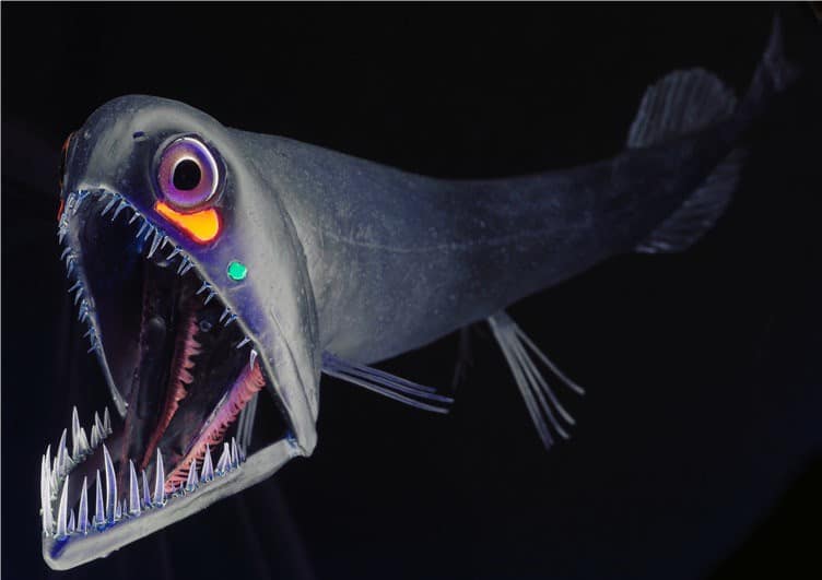
The area contains a variety of habitats ranging from warm tropical beaches to cold seafloor mountains and valleys that exist in total darkness.

Read on to learn about the rarest and unique wildlife to be found in the crashing waves and depths of the South Atlantic!

South Atlantic Animals Summary

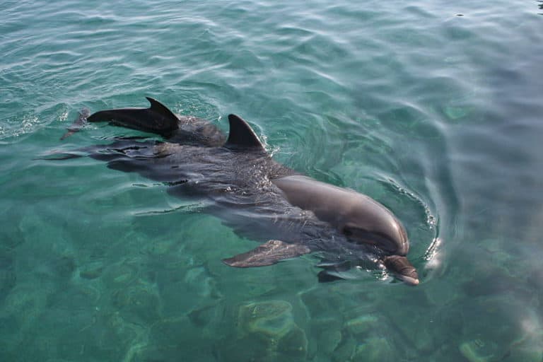
What familiar and unusual animal species live in the South Atlantic? As with all of the world’s oceans, this saltwater environment is home to microscopic plankton, many species of fish, marine mammals such as whales, dolphins, and seals, sea turtles, birds, crustaceans, jellyfish, marine invertebrates, and more.

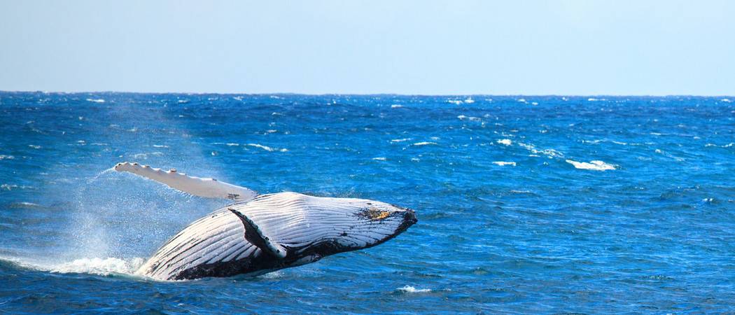
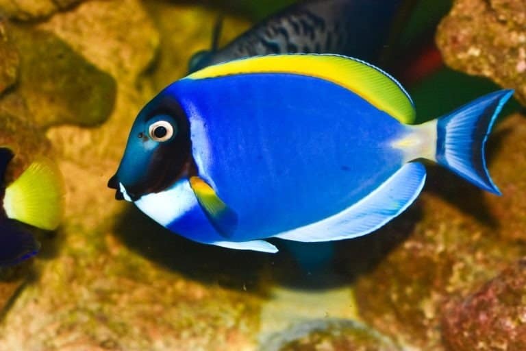
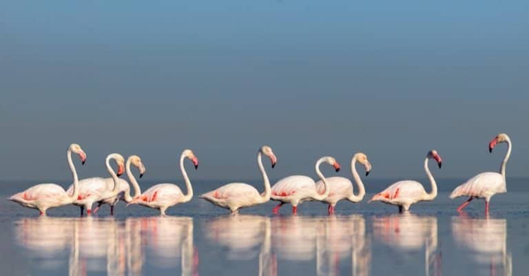
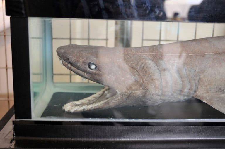
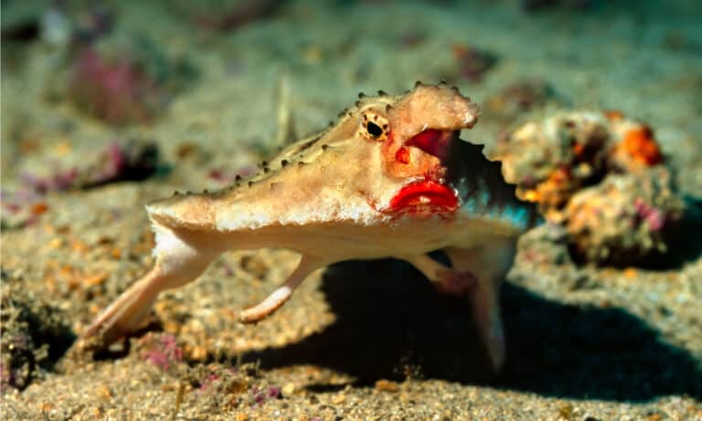
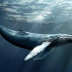
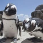
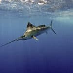
The variety does not end there, however. Colorful tropical fish and small sharks stalk coastal coral reefs. Huge whales, manta rays, and basking sharks open their mouths to feast on the smallest of creatures, plankton, and krill. Seagulls and their relatives fill the skies, while flightless penguins hunt from warm and cold shores.

The Official National Animal of the South Atlantic

The United Nations’ Law of the Sea Convention in 1982 limited “territorial waters” – those belonging to and controlled by a specific country – to twelve nautical miles from the coast. Therefore, the bulk of the South Atlantic does not belong to any country, so it does not have a national animal.

Where To Find The Top Wild Animals in the South Atlantic

On the seafloor, at the bottom of the South Atlantic, are shallow areas known as continental shelves. These areas are home to many types of fish. People even fish there. They catch varieties such as sardines, round and Brazillian sardinella, groupers, snappers, horse mackerel, hake, pilchard, anchovy, Argentine shortfin squid,

Near the coast, fishermen hunt other prey, including northern brown shrimp, perlemoen abalone, and American cupped oyster.

Ah, but perhaps you are not interested in deep-sea fishing but in wildlife watching. Perhaps the easiest way to view South Atlantic wildlife is to visit a beach along the coast of South America or Africa.

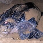
Sometimes, unusual and exotic animals even come ashore. For example, if you want to experience the magical moment when sea turtles drag themselves ashore to lay eggs or when the babies hatch en masse and make a run for the sea, head to the beaches of Brazil, Uruguay, Argentina, Guyana, French Guiana, or Suriname. You have to visit at just the right time to see green, leatherback, or olive ridley sea turtles.

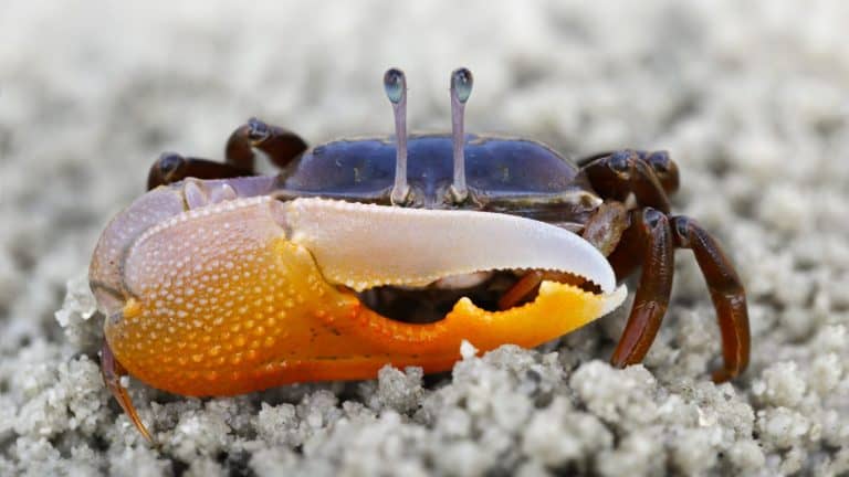
You can also simply put on a pair of goggles and a snorkel and go swimming. Colorful fish, crabs, and other animals will be visible anywhere that the water is clear.

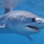
Are you interested in getting up-close and personal with the toothy grin of a great white shark? Travel to South Africa, where experienced guides will take you under the water in a protective shark cage.

The Most Dangerous Animals in the South Atlantic Today

When we talk about dangerous ocean animals, sharks often come readily to mind. Worldwide, the great white shark is responsible for the most shark attacks on people, and this is true of the South Atlantic as well. Brazil and South Africa are among the top ten countries for unprovoked shark attacks.

There are, however, other dangerous animals – ones that are very hard to see. For example, the Irukandji jellyfish, native to the waters of Australia, has been known to sting people swimming in the Atlantic Ocean. It is very small, its bell or “head” is less than an inch. Its stinging tentacles can be equally small or can be more than three feet in length. Their venom is very potent and deadly. According to one researcher, the sting is “100 times as potent as that of a cobra” bite.

Endangered Animals in the South Atlantic

The South Atlantic is home to a number of exotic and endangered species. The West Indian and West African manatees or sea cows are slow-moving herbivores that can be easily injured by speedboats. They are protected species and in danger of extinction.

There are also seal, sea lion, sea turtle, and whale species on the endangered species list. These, as well as dolphins and sea birds, may become entangled in fishing nets or strangled by human trash.

Animals Found in the South Atlantic Ocean

250 species documented in our encyclopedia

Thank you for reading! Have some feedback for us?