
Damselfish
Small fish, big reef attitude
Small fish, big reef attitude
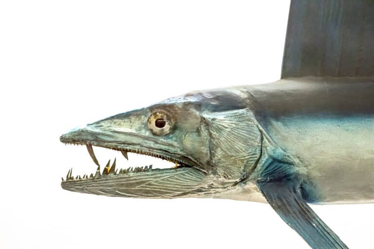
Sail-fin hunters of the midwater

Built for the backwash
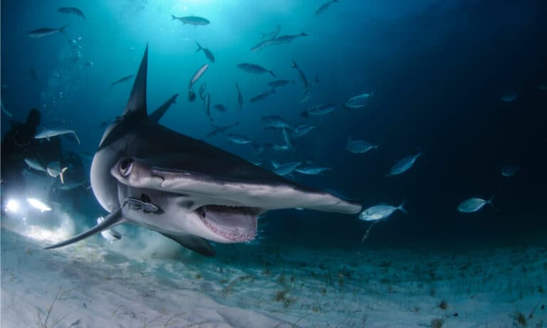
Biggest hammerhead, biggest comeback needed
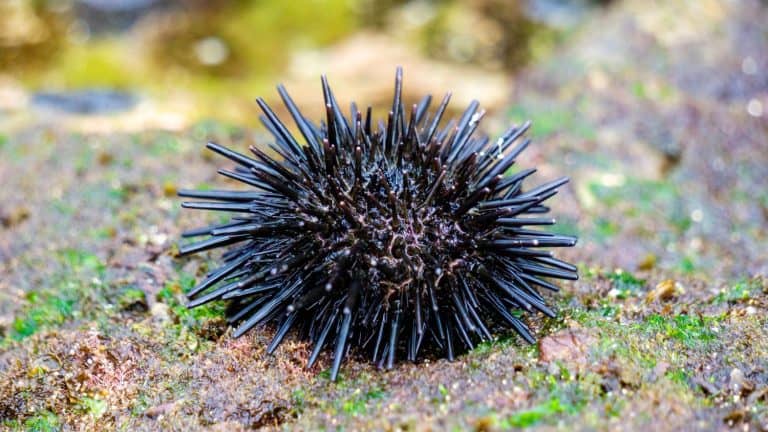
Spines, jaws, and ocean power
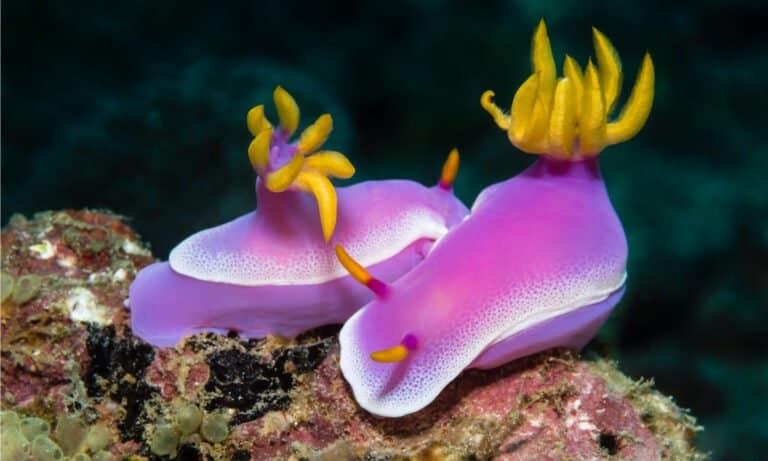
Nature's neon, toxin-borrowing sea slugs
Square head, deep dives, giant squid.
Small fish, huge impact.
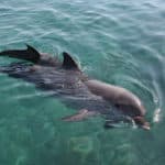
One fish, two worlds
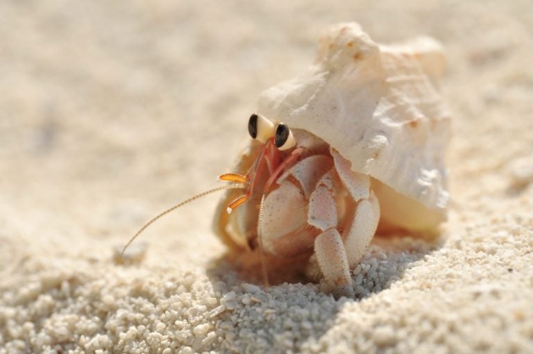
Borrowed shells, bold lives
The Mediterranean Sea is a semi-enclosed intercontinental sea of the Atlantic Ocean basin, connected to the open Atlantic through the Strait of Gibraltar and bordered by southern Europe, North Africa, and the Near East.
The Mediterranean Sea forms a vast marine crossroads between three continents, where narrow straits, complex coastlines, and numerous islands create a mosaic of habitats-from rocky reefs and seagrass meadows to deep basins and productive continental shelves. Although it is part of the Atlantic system, its restricted exchange with the ocean and strong evaporation give it distinctive physical and chemical conditions, including comparatively warm waters and elevated salinity.
Its circulation is shaped by the inflow of fresher Atlantic surface waters through Gibraltar, transformation within the basin, and the export of denser, saltier intermediate and deep waters back into the Atlantic. This "anti-estuarine" pattern, coupled with pronounced regional variability (e.g., western vs. eastern basins) and seasonal mixing, helps structure ecological productivity and biodiversity.
Biologically, the Mediterranean supports temperate-to-subtropical ecosystems with notable endemism and high species richness, including iconic seagrass (Neptune grass) meadows, coralligenous assemblages, and diverse pelagic and benthic communities. At the same time, intense coastal development, shipping, fishing pressure, and biological invasions (including via the Suez Canal) make it a globally important region for marine conservation and management.
Etymology: From a Latin term meaning 'in the middle of land', reflecting the sea's position enclosed by the surrounding continents.
Ancient maritime civilizations, high salinity and circulation, rich endemic biodiversity, tourism and fisheries
A semi-enclosed sea between southern Europe, North Africa, and the Near East, extending from the Strait of Gibraltar in the west to the Levantine coasts in the east and lying north of the Sahara and south of the European mainland.
Calypso Deep (Ionian Sea), within the Hellenic Trench system south-west of Greece (~5,267 m)
Mediterranean coast including the Alboran Sea approaches (plus proximity to the Strait of Gibraltar).
Extensive Mediterranean coast (Costa Brava to Andalusia) including the Balearic Sea area.
Mediterranean presence via the overseas territory of Gibraltar at the Strait of Gibraltar.
Mediterranean coast along the Gulf of Lion (including Corsica as a French island).
Small coastline on the French Riviera.
Major central-basin coastline including Sicily, Sardinia, and the Tyrrhenian/Adriatic/Ionian margins.
Island state in the central Mediterranean south of Sicily.
Short Adriatic coastline near the Gulf of Trieste.
Long, island-rich Adriatic coastline.
Very short Adriatic coastline near Neum.
Adriatic coastline including the Bay of Kotor area.
Coastline on the Adriatic and Ionian seas.
Extensive coastline and archipelagos across the Ionian and Aegean basins.
Coastline along the Aegean and Levantine margins, including the Sea of Marmara approaches.
Island in the eastern Mediterranean (Levantine Basin).
Eastern Mediterranean coastline on the Levant.
Eastern Mediterranean coastline on the Levant.
Eastern Mediterranean coastline along the Levantine Basin.
Mediterranean frontage via the Gaza Strip coastline.
Southern-eastern Mediterranean coast including the Nile Delta and Suez area.
Long North African coastline along the central and eastern basins.
North African coastline between the western and central Mediterranean (including Gulf of Gabès).
North African Mediterranean coastline along the western basin.
Bordered by the coasts of southern Europe (Iberian, French, Italian, Balkan and Greek peninsulas), North Africa (Morocco to Egypt), and the Near East (Turkey to the Levant). It connects to the Atlantic Ocean through the Strait of Gibraltar and to the Red Sea via the Suez Canal; it also exchanges water with the Black Sea through the Turkish Straits system (Dardanelles-Sea of Marmara-Bosphorus).
Surface avg: ~18-22°C (annual mean varies by sub-basin; western/northern lower, eastern/southern higher).
Deep avg: ~13°C (deep and intermediate layers are relatively warm compared with the open ocean at similar latitudes).
Net evaporation exceeds precipitation + river input, driving elevated salinity. Fresher Atlantic Water enters at the surface through Gibraltar (~36-37 PSU) and becomes saltier eastward; salty intermediate waters export back toward the Atlantic at depth.
Strong seasonality: winter surface cooling and deep convection in select regions (e.g., Gulf of Lion, Adriatic, Aegean); summer surface warming with a pronounced thermocline (typically ~10-50 m). Eastern basin generally warmer than western for much of the year.
Anti-estuarine exchange at Gibraltar: surface inflow of Atlantic Water (AW) into the Mediterranean and deeper outflow of Mediterranean Outflow Water (MOW) into the Atlantic. Basin-scale circulation includes cyclonic/anticyclonic gyres and boundary currents shaped by complex topography. Notable systems: Algerian Current and associated eddies (western basin), Liguro-Provençal Current, Tyrrhenian circulation, Adriatic inflow/outflow exchanges, Ionian circulation variability (including decadal reversals influencing the Eastern Mediterranean), and the Asia Minor Current / Levantine circulation with energetic eddies in the Levantine Basin.
Generally microtidal: typical tidal ranges ~0.1-0.5 m over much of the basin, with larger ranges in a few areas due to resonance and local geometry (can approach ~1 m or more locally, e.g., parts of the northern Adriatic). Tides are mixed (diurnal/semidiurnal) depending on location; sea-level variability is often dominated by winds and atmospheric pressure (storm surges, seiches) rather than astronomical tide.
Key water masses: (1) Atlantic Water (AW) enters at the surface and becomes progressively warmer/saltier eastward. (2) Levantine Intermediate Water (LIW) forms mainly in the Levantine (winter cooling + evaporation) at ~200-600 m, warm and salty (~14-16°C; ~38.5-39+ PSU), spreading westward and contributing strongly to MOW. (3) Western Mediterranean Deep Water (WMDW) forms via winter convection (notably Gulf of Lion) and fills deep western basins (~12.5-13°C; ~38.4-38.6 PSU). (4) Eastern Mediterranean Deep Water (EMDW) forms primarily in the Adriatic and Aegean (via dense-water formation) and ventilates eastern depths (~13-14°C; ~38.7-39.1 PSU). Overall characterized by relatively warm deep waters, high salinity, and efficient intermediate-depth ventilation compared with many open-ocean basins.
Typically strongly stratified in spring-summer: a warm, lower-salinity (relative) surface layer overlying saltier intermediate waters (LIW), then deep waters. Winter mixing partially erodes stratification; deep convection occurs episodically in key formation regions (Gulf of Lion, Adriatic, Aegean), renewing deep and intermediate layers. Eastern basin often shows stronger haline stratification due to higher salinity, while local freshwater inputs (e.g., Po, Nile outflow remnants, Black Sea influence via the Turkish Straits to the Aegean) can enhance near-surface buoyancy locally.
Upwelling is generally weaker and more localized than in major eastern boundary current systems, but occurs in: (1) wind-driven coastal upwelling zones along parts of the Iberian/Alboran region and North African coast (especially western/central Mediterranean), (2) localized upwelling and nutrient injection around prominent straits, sills, and shelf breaks (e.g., Strait of Gibraltar/Alboran gyres, Sicily Channel), and (3) mesoscale eddy-driven upwelling/downwelling features (e.g., Algerian eddies, Levantine eddies) that can intermittently elevate nutrients into the euphotic zone. Overall nutrient supply is strongly influenced by winter mixing and lateral inputs rather than persistent large-scale upwelling.
Anti-estuarine circulation (surface Atlantic inflow, deeper Mediterranean outflow) driven by net evaporation; exceptionally high salinity for a mid-latitude sea; relatively warm deep waters; strong mesoscale eddy activity (notably Alboran and Algerian eddies) shaping productivity and transport. Marked west-east gradient: the eastern Mediterranean is among the most oligotrophic marine regions globally (very low surface nutrients/chlorophyll). Episodic deep-water formation and interannual-decadal circulation shifts (e.g., Eastern Mediterranean Transient-like events) can rapidly alter ventilation, temperature/salinity structure, and biogeochemistry. Sea-level variability often dominated by atmospheric forcing and basin-scale seiches rather than tides.
The Mediterranean Sea has a predominantly temperate-to-subtropical marine climate shaped by its semi-enclosed geometry, strong evaporation, and limited exchange with the Atlantic through the Strait of Gibraltar. High evaporation relative to precipitation and river input drives elevated salinity, especially in the eastern basin, while regional winds and basin-scale circulation create strong gradients in temperature, salinity, and biological productivity (generally higher in the northwestern and some coastal/upwelling-influenced areas, lower in much of the eastern basin). Sea-surface temperatures range from cool in winter to very warm in late summer, with frequent seasonal stratification and episodic mixing events that influence nutrients and ecosystems.
Winter (roughly Dec-Mar): coolest sea-surface temperatures, increased wind-driven mixing and deeper mixed layers; more frequent frontal systems and rough seas, especially in the western and central basins. Spring (Apr-Jun): rapid warming and onset of stratification; productivity pulses often follow winter mixing, varying by sub-basin and proximity to nutrient sources. Summer (Jul-Sep): warmest waters, strong stratification, generally calmer sea state; heatwaves in the marine environment can raise SSTs well above seasonal norms, and localized upwelling may occur under persistent winds. Autumn (Oct-Nov): gradual cooling, weakening stratification, and an increase in rain and convective events; this transition can bring energetic weather and short-lived high-impact coastal storms.
The Mediterranean does not experience tropical hurricanes/typhoons in the same way as open-ocean tropical basins due to limited size, generally cooler waters, and strong wind shear. However, it does produce intense extratropical cyclones and mesoscale lows year-round, peaking in the cool season, which can generate gale-to-storm-force winds, high waves, and storm surges-particularly in the Gulf of Lion, Adriatic, Aegean, and Ionian regions depending on track and local wind regimes (e.g., Mistral, Bora, Etesians). In some cases, tropical-like cyclones ("medicanes") form mostly in autumn to early winter when the sea is still warm and upper-level cold air supports convection; these are relatively rare, typically smaller than tropical cyclones, but can bring damaging winds, heavy rainfall, and coastal flooding.
Sea ice is generally absent across the Mediterranean. Under rare, exceptional cold outbreaks, short-lived coastal or nearshore ice can occur in the northernmost enclosed/shallow areas (e.g., parts of the northern Adriatic and lagoons/estuaries), but it is uncommon, localized, and not a persistent seasonal feature.
The Mediterranean Sea is a semi-enclosed, evaporation-dominated basin with relatively high salinity, strong west-east gradients in temperature and nutrients, and complex circulation that creates a mosaic of temperate-to-subtropical habitats. Despite generally oligotrophic (nutrient-poor) waters-especially in the eastern basin-it supports high habitat diversity (from coastal lagoons and seagrass meadows to deep basins and submarine canyons) and a distinctive biota shaped by isolation, Atlantic inflow through Gibraltar, and long human use (fishing, coastal development, shipping).
High biodiversity for a temperate sea, with strong regional turnover (western vs. eastern basins), many habitat-specialists (e.g., coralligenous assemblages, seagrass-associated fauna), and notable endemism fostered by semi-enclosure and varied microclimates. Biodiversity is unevenly distributed: coastal and structured habitats (seagrass, rocky reefs, coralligenous) are especially species-rich, while offshore waters are comparatively less productive but still support diverse pelagic and deep-sea communities.
Species count: ≈17,000 described marine species; ~20-30% considered endemic to the Mediterranean
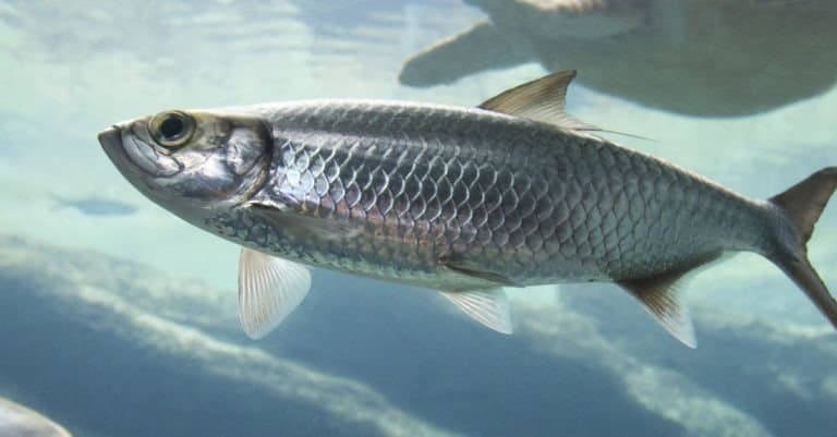
The Mediterranean neritic zone spans the sunlit coastal shelf and nearshore waters, shaped by steep continental margins, limited shelf area in many regions, and strong local variation from river-influenced gulfs to ultra-oligotrophic rocky coasts. High salinity and clear water favor extensive seagrass meadows (especially Posidonia oceanica and Cymodocea nodosa) and photophilic algal communities on hard substrates. Coastal habitats include lagoons, estuaries, and embayments that act as nurseries for fish and invertebrates, while rocky reefs and coralligenous outcrops support high endemism and complex habitat structure. Productivity is often localized and seasonal-enhanced by winter mixing, upwelling hotspots, river plumes (e.g., Po, Rhone, Ebro), and fronts-supporting fisheries for small pelagics (sardine, anchovy), demersal fishes, octopus, and bivalves in suitable areas. Coastal pressures (urbanization, pollution, trawling impacts on soft bottoms, invasive species via shipping and the Suez Canal) strongly influence community composition.
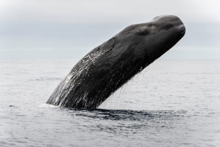
The Mediterranean pelagic zone is dominated by generally oligotrophic (nutrient-poor) open waters with high clarity and a pronounced east-west gradient, with the eastern basin typically more nutrient-limited than the western. Seasonal stratification is strong: winter cooling and wind-driven mixing deepen the mixed layer and replenish surface nutrients, while summer stratification limits nutrient resupply and favors smaller phytoplankton and microbial production. Mesoscale features-fronts, eddies, and boundary currents-create patchy productivity and aggregation zones for plankton, fish, and top predators. The pelagic community includes small pelagic fishes (sardine, anchovy, sprat locally), medium predators (mackerels, bonitos), large pelagics (bluefin tuna, swordfish), and abundant gelatinous zooplankton (jellyfish and salps) that can bloom under certain conditions. Deep pelagic layers include vertically migrating mesopelagic fishes and cephalopods that link surface production to deeper waters, while cetaceans (fin whale, sperm whale, dolphins) forage along productive corridors such as the Ligurian-Provençal region and major basin fronts.
The Mediterranean benthic zone ranges from dynamic shallow sands and rocky shores to deep basins with relatively warm, saline deep waters compared with the Atlantic at similar depths. Shallow benthos features seagrass-rooted sediments, maerl (rhodolith) beds in some areas, and rocky reefs with algae, sponges, and reef-building organisms; these habitats stabilize sediments, store carbon, and provide refuge and nursery grounds. A hallmark mid-depth habitat is the coralligenous assemblage-biogenic, carbonate-rich structures built largely by encrusting red algae and inhabited by sponges, gorgonians, bryozoans, and diverse invertebrates-forming biodiversity hotspots on dimly lit rocky bottoms. Deeper slopes and seamounts host cold-water corals and vulnerable sponge grounds in suitable currents, while soft-bottom communities include burrowing bivalves, polychaetes, echinoderms, and crustaceans that recycle organic matter. Because surface productivity is often low, much of the deep benthic ecosystem depends on episodic particle flux, marine snow, and lateral transport from margins and canyons; trawling on continental slopes and climate-driven oxygen/nutrient shifts can substantially alter these communities.
The demersal zone in the Mediterranean includes fishes and invertebrates living close to the seabed on shelves, slopes, and in submarine canyons, where they exploit benthic prey and detrital resources while also feeding into higher trophic levels. Soft-bottom shelves support demersal assemblages such as hake (Merluccius merluccius), red mullets, soles, and cuttlefish, while rocky and structured habitats (reefs, coralligenous) support groupers, sea breams, scorpionfishes, lobsters, and diverse crustaceans. On deeper slopes, species like deepwater rose shrimp, Norway lobster, and various grenadiers and cephalopods are common, often concentrated along canyon systems that funnel organic matter and provide complex terrain. Demersal predators connect the benthic and pelagic systems by consuming benthic invertebrates and small fishes while being prey for larger fishes, sharks and rays (where present), and marine mammals. This zone is particularly sensitive to bottom-contact fishing gears and habitat degradation, because many demersal species rely on specific substrates and slow-growing biogenic structures.
Notable migrations include (1) Atlantic bluefin tuna entering the Mediterranean primarily in spring to early summer (roughly April-July) to spawn in warmer, stratified waters (e.g., Balearic and Tyrrhenian regions, central Mediterranean), with dispersal later in summer and autumn; (2) swordfish showing seasonal movements with increased spawning-related presence in warmer months (late spring-summer) and broader dispersal in cooler seasons; (3) small pelagics (sardine, anchovy) shifting distribution seasonally with temperature, plankton availability, and spawning timing-often schooling near productive coastal fronts in cooler months and dispersing or moving deeper/offshore in summer; (4) cetaceans tracking prey and fronts-fin whales concentrating seasonally in productive areas such as the Ligurian Sea during spring-summer, while sperm whales and some dolphins use canyon-rich slopes year-round with seasonal foraging peaks; and (5) sea turtles (loggerhead, green) undertaking seasonal foraging and nesting movements, with nesting in late spring-summer and post-nesting dispersal into foraging grounds across basins. Movements are strongly influenced by regional circulation, temperature fronts, and localized productivity hotspots.
Key Mediterranean food webs are often driven by oligotrophic, microbe-leaning pathways with strong spatial and seasonal pulses. A dominant chain is: picophytoplankton and nanophytoplankton → microzooplankton (ciliates, heterotrophic flagellates) → mesozooplankton (copepods) → small pelagic fishes (anchovy, sardine) → larger pelagics (tuna, bonito, swordfish) and top predators (dolphins, sharks, seabirds). In spring and during mixing/upwelling events, larger phytoplankton can increase, strengthening a more classical pathway: diatoms → copepods/krill-like crustaceans → small pelagics → predators. Benthic-coupled webs are also central: seagrass and macroalgae production plus detritus → deposit feeders and grazers (sea urchins, gastropods, amphipods) → demersal fishes (wrasses, breams, mullets) and cephalopods → higher predators (groupers, large fishes, dolphins). Coralligenous and sponge-dominated reefs support suspension-feeding networks: phytoplankton/particulates → sponges, bryozoans, bivalves → reef-associated predators (scorpionfish, lobsters) → larger demersals. Deep-slope systems depend heavily on exported organic matter: marine snow and carrion → benthic invertebrates and scavengers (crustaceans, echinoderms) → deep demersal fishes and cephalopods → sperm whales and large predatory fishes. Across these webs, gelatinous zooplankton blooms can intermittently divert energy from fish-dominated pathways, affecting recruitment and predator-prey dynamics.
The Mediterranean Sea is a global biodiversity hotspot with high endemism but is among the most human-impacted marine regions due to its semi-enclosed nature, dense coastal populations, intense maritime traffic, and long history of resource use. Many coastal and benthic habitats (seagrass meadows, coralligenous reefs, coastal wetlands, and reefs/canyons) are degraded or fragmented. While marine protected areas and regional cooperation are expanding, ecosystem condition is generally stressed and many assessed fish stocks remain overexploited, with climate-driven warming and biological invasions accelerating change.
Stressed; high human pressure with localized improvements inside well-managed protected areas
High exploitation rates and illegal/unreported fishing continue to depress many assessed stocks; sensitive species (sharks, rays, large pelagics, groupers) are particularly affected, with bycatch impacts on turtles, seabirds, and cetaceans.
Chronic plastic and microplastic contamination, nutrient/organic loading near coasts, chemical pollutants (e.g., persistent organics, heavy metals), and episodic oil/ship-source pollution; wastewater overflows and inadequate treatment remain significant in some areas.
Rapid warming, more frequent and intense marine heatwaves, shifts in species distributions, mass mortality events (e.g., benthic invertebrates), increased stratification and deoxygenation risk, and ongoing acidification affecting calcifiers.
Lessepsian migration via the Suez Canal and shipping-mediated introductions (ballast water, hull fouling) are reshaping food webs; invasive herbivorous fish and predatory invertebrates can cause habitat and fisheries impacts.
Coastal development, dredging, anchoring damage, trawling on sensitive bottoms, and coastal squeeze reduce and fragment key habitats such as Posidonia seagrass meadows, coralligenous assemblages, and coastal wetlands/estuaries.
Intense shipping, boating, and tourism drive underwater noise, collision risk for cetaceans, disturbance at breeding/foraging sites, and localized habitat damage from anchoring and recreational use.
Ports, coastal defenses, seabed cables/pipelines, desalination outfalls, and offshore energy expansion can alter habitats, increase turbidity/noise, and fragment seascapes if poorly sited or managed.
River regulation and damming reduce sediment and nutrient delivery, contributing to delta/coastal wetland erosion; altered freshwater inflows affect estuarine and nearshore ecosystems.
Unsustainable extraction/pressure on vulnerable resources (e.g., certain invertebrates, corals, and forage fish) and cumulative impacts reduce ecosystem resilience.
Warming-associated disease outbreaks and mass mortality events in benthic organisms (e.g., gorgonians, sponges) and increased pathogen dynamics in stressed coastal zones.
High levels of marine litter (notably plastics) and microplastics; localized eutrophication and hypoxia near urban/industrial/agricultural outfalls; chemical contaminants in sediments and biota near industrial hotspots; ship-source pollution and oil spill risk along major routes.
Many assessed stocks remain overexploited or fully exploited; trawling pressure affects demersal habitats; bycatch remains a key issue for turtles, elasmobranchs, and seabirds; enforcement and data quality vary strongly among subregions.
Warming is rapid relative to many oceans, with frequent marine heatwaves causing coral-like community losses in coralligenous systems and shifts toward warm-water assemblages; acidification and deoxygenation risks increase stress on calcifiers and deeper/basin systems; phenology changes and altered productivity patterns are increasingly evident.
Strong invasion pressure via the Suez Canal and shipping; notable impacts from invasive herbivorous fish (e.g., rabbitfish) contributing to algal overgrazing and habitat change in parts of the eastern Mediterranean, plus invasive jellyfish and invertebrates affecting fisheries and tourism.
Narrow passage connecting the Atlantic Ocean to the Mediterranean Sea between Spain and Morocco.
Controls most water exchange with the Atlantic and strongly influences Mediterranean circulation, salinity, and ecology; also a globally significant maritime chokepoint.
Large embayment of the northwestern Mediterranean off southern France.
Major site of winter deep-water formation and strong northerly winds that shape regional oceanography and productivity.
Channel between Corsica (France) and Sardinia (Italy).
Notable for intense currents, complex navigation conditions, and protected waters within the International Marine Park of the Strait of Bonifacio.
International marine protected area spanning waters of France, Monaco, and Italy in the northwestern Mediterranean.
One of the Mediterranean's best-known large MPAs, recognized for high densities of cetaceans (fin whales, striped dolphins) and transboundary conservation.
Protected island group south of Mallorca (Balearic Islands, Spain) with clear waters and seagrass meadows.
Flagship protected area for well-preserved Posidonia oceanica seagrass, important for biodiversity, carbon storage, and fisheries nursery habitat.
Rugged headland and nearshore protected area on Spain's Catalan coast at the eastern end of the Pyrenees.
Biodiversity hotspot shaped by strong winds and currents; noted for underwater caves, rocky reefs, and rich benthic communities.
France's oldest marine national park in the Hyeres Islands, with protected coastal waters and islands.
Model Mediterranean MPA with long-term protection supporting healthy fish populations and recovering ecosystems.
Small protected archipelago off L'Estartit on Spain's Costa Brava.
Among the Mediterranean's most famous dive sites; long-standing protection has produced high fish biomass and iconic grouper sightings.
Granite islets south of Corsica within the Strait of Bonifacio reserve.
Renowned for clear water diving, seabird habitat, and sensitive seagrass and rocky-reef ecosystems under strong conservation measures.
Island group off northeastern Sardinia, Italy, with extensive shallow bays and channels.
A major national park area known for seagrass meadows, coastal biodiversity, and important habitat for marine fauna in the Tyrrhenian Sea.
Archipelago off western Sicily (Favignana, Levanzo, Marettimo).
Hosts one of the largest MPAs in Europe; notable for rich marine life, seagrass habitats, and historical tuna trap fisheries.
Volcanic island north of Palermo with a surrounding marine reserve.
One of Italy's best-known marine reserves and dive destinations, valued for clear waters, volcanic seascapes, and protected fish populations.
Diving areas around Malta and Gozo featuring caves, arches, and steep drop-offs.
Internationally famous Mediterranean diving region with exceptional underwater visibility and geological formations.
Protected coastal massif with deep inlets (calanques) and adjacent marine zones.
Iconic Mediterranean coastal-marine landscape; important for habitat protection, including reefs, caves, and seagrass meadows near a major city.
Volcanic island complex in the Aegean with a submerged caldera and steep underwater walls.
Notable for dramatic volcanic seascapes, unique geology, and popular dive sites tied to one of the Mediterranean's most famous eruptions.
Deep trench system south of Greece (Ionian to south of Crete) along the Hellenic subduction zone.
Among the Mediterranean's deepest and most tectonically active areas; important for seismic/tsunami research and deep-sea habitats.
The deepest known point of the Mediterranean, located in the Ionian Sea within the Hellenic Trench system.
Extreme-depth environment used in oceanographic studies of Mediterranean deep waters and geology.
Narrow strait between Sicily and mainland Italy with strong tidal currents.
Famed for complex hydrodynamics and upwelling that support diverse plankton and unusual deep-water species appearing near the surface.
Shallow bank and complex seabed between Sicily and Tunisia, including ridges and seamount-like highs.
Well-known hazard and historical shipwreck area; also ecologically important for fisheries and as a biodiversity-rich seabed feature.
Historic wreck dives around Malta from World War II, including patrol boats and aircraft.
Major draw for wreck diving in the Mediterranean, combining cultural heritage with artificial-reef habitat value.
Large roll-on/roll-off ferry that sank in 1980 near Cyprus, lying on its side at recreational diving depths.
Widely regarded as one of the world's top wreck dives; supports abundant marine life and is a flagship Mediterranean wreck site.
The Mediterranean Sea has been a core corridor for maritime trade, migration, and cultural exchange since antiquity, linking the Levant, North Africa, and southern Europe. It underpinned ancient civilizations including the Egyptians, Phoenicians (major seafaring traders), Greeks (colonization and exploration across the basin), Carthaginians, and Romans (who called it Mare Nostrum and built extensive port and shipping infrastructure). Key historical trade routes moved grain (notably from Egypt and North Africa to Rome), olive oil, wine, metals, timber, ceramics, textiles, and later spices and luxury goods via Levantine connections. The sea also hosted pivotal naval conflicts (e.g., Punic Wars, Battle of Actium, Lepanto), medieval crusader and Ottoman-Venetian rivalry, and early modern exploration that connected Mediterranean commerce to Atlantic routes after the Age of Discovery. Historic port cities-Alexandria, Carthage/Tunis region, Athens/Piraeus, Rhodes, Venice, Genoa, Marseille, Barcelona, and Valletta-served as long-lived nodes of maritime power, shipbuilding, and navigation innovation; Constantinople (modern Istanbul) was a major maritime hub on the Sea of Marmara connected to the Mediterranean via the Dardanelles.
The Mediterranean is one of the world's busiest semi-enclosed seas for container shipping, energy transport, ferries, and short-sea trade, concentrated along east-west trunk routes between the Strait of Gibraltar and the Suez Canal. Major lanes run: (1) Gibraltar-Alboran Sea-western Mediterranean to the Ligurian/Tyrrhenian hubs and onward to the Adriatic and Aegean; (2) central corridor via Sicily Channel (between Tunisia and Sicily) connecting western basins to the Ionian and eastern Mediterranean; (3) Levant/Egypt approaches feeding the Suez Canal; plus dense ferry and Ro-Ro networks in the Adriatic and Aegean. Strategic chokepoints include the Strait of Gibraltar (Atlantic access), the Suez Canal approaches (global Europe-Asia route), the Turkish Straits system (Dardanelles-Sea of Marmara-Bosphorus linking to the Black Sea), and the Strait of Sicily/Malta Channel (central basin constriction). Major ports (cargo/containers/energy and passenger depending on location) include: Algeciras and Valencia (Spain), Barcelona (Spain), Marseille-Fos (France), Genoa and Trieste (Italy), Gioia Tauro (Italy), Piraeus (Greece), Izmir and Mersin (Türkiye), Haifa and Ashdod (Israel), Port Said/Alexandria/Damietta (Egypt), Tangier Med (Morocco, at the Mediterranean-Atlantic interface), and major transshipment and bunkering nodes around Malta (Marsaxlokk/Freeport). Cruise routes heavily overlap with these shipping corridors, raising congestion and emissions concerns near coastal urban areas.
Commercial fisheries operate throughout the basin, often multi-gear and multi-species, with notable activity in the Adriatic, Aegean, Alboran Sea, Gulf of Lion, Tyrrhenian, and around Tunisia-Libya shelves. Industrial and semi-industrial fleets use trawls (including demersal trawling where permitted), purse seines for small pelagics, longlines for tuna and swordfish, and nets/traps for coastal species. Key pressures include overfishing in several subregions, bycatch (including protected species), habitat impacts from bottom-contact gears, and the need for coordinated management across many national EEZs and international waters pockets.
Artisanal and small-scale fishing is culturally and economically significant across Mediterranean coasts and islands (e.g., Greek islands, Italian and Spanish coasts, Maghreb, Levant). It commonly uses small vessels, set nets, hook-and-line, pots/traps, and seasonal targeting of local species; it supports local markets, gastronomy, and community identity. Traditional practices persist in places (e.g., tuna traps/tonnara heritage in parts of Italy/Spain, lagoon fisheries, and small-scale octopus and shellfish fisheries), though they face competition, rising costs, coastal development, and climate-driven shifts in species composition.
Diving conditions vary by sub-basin but commonly feature clear water (often excellent visibility), generally mild-to-moderate currents with localized strong flows near straits and headlands, and strong seasonality in temperature (cooler in winter/spring; warm in late summer). The Mediterranean's relatively low nutrient levels often support high visibility but can mean less dense fish biomass than some tropical systems; nonetheless, endemic biodiversity, seagrass meadows, caves, and historic wrecks are major draws. Hazards can include boat traffic in busy corridors, sudden winds (e.g., Mistral, Bora), and thermoclines at depth. Many sites are within or near MPAs with rules on access and anchoring.
Tourism is a dominant coastal industry, centered on beaches, sailing/yachting, island-hopping, cultural heritage, and cuisine. High-intensity destinations include the Balearics, Costa Brava and Costa del Sol (Spain, Mediterranean-facing segments), French Riviera (Côte d'Azur), Italian Riviera/Amalfi Coast/Sicily/Sardinia, Adriatic resorts (Croatia, Montenegro), Greek islands (Cyclades, Dodecanese, Crete, Ionian), Malta, Cyprus, the Turkish Riviera (Antalya region) and Aegean coast, and North African resorts (Tunisia, parts of Morocco's Mediterranean coast, and selected areas in Egypt's Mediterranean). Cruise tourism is concentrated around Western Mediterranean circuits (Barcelona-Marseille-Genoa/La Spezia-Rome/Civitavecchia-Naples-Palermo) and Eastern Mediterranean circuits (Piraeus, Turkish Aegean ports, Cyprus, Israel, Egypt). Nature-based activities include marine protected area visits, whale/dolphin watching in select areas (e.g., Ligurian Sea sanctuary), coastal trekking, kayaking, and gastronomy tourism tied to fisheries and local products. Environmental issues linked to tourism include seasonal water demand, wastewater and plastic pollution, anchoring impacts on seagrass meadows (Posidonia oceanica), and coastal habitat loss.
Oil and gas activities occur in several Mediterranean areas, with offshore gas development being especially notable in parts of the eastern Mediterranean (Levant Basin), alongside production and infrastructure off North Africa (notably Libya and Egypt's Mediterranean margin) and legacy/limited production in parts of the central and western Mediterranean. The basin hosts extensive subsea pipelines, LNG and gas export infrastructure in some regions, and significant tanker traffic carrying crude and refined products through main corridors. Exploration and development are shaped by environmental concerns, seismic survey impacts, complex maritime boundary claims in portions of the eastern Mediterranean, and proximity to densely populated coasts and sensitive habitats.
The Mediterranean is a major strategic theater due to its chokepoints (Gibraltar, Suez approaches, Turkish Straits), proximity to the Middle East and North Africa, and dense commercial shipping. Multiple navies maintain regular patrols and bases/forward operating presence, including NATO members and regional states; activities include sea-lane security, deterrence, intelligence and surveillance, submarine operations, and maritime interdiction. The sea is also central to migration and search-and-rescue operations, counterterrorism and sanctions enforcement, and crisis response. Key strategic nodes include areas around Crete and the Aegean, Sicily and the central basin, the Levantine basin, and approaches to major straits and canal routes.
The Mediterranean littoral spans a mosaic of coastal cultures and languages shaped by millennia of seaborne exchange. Northern shores include Iberian (Catalan/Valencian and broader Spanish coastal communities), Provençal and other French Mediterranean cultures, Italian coastal and island communities (Liguria, Campania, Sicily, Sardinia), Adriatic cultures (Venetian-influenced areas and diverse South Slavic coastal communities), Greek and Aegean island cultures, and Turkish coastal cultures. Southern and eastern shores include Amazigh (Berber) and Arab communities across Morocco-Algeria-Tunisia-Libya, Egyptian Mediterranean communities, Levantine Arab cultures (e.g., Palestinian, Lebanese, Syrian coastal communities where applicable), and Jewish/Israeli coastal communities. Distinct indigenous/coastal identities include Amazigh groups in North Africa, various islander communities (Balearic, Corsican, Sardinian, Sicilian, Maltese, Cypriot, Cretan), and historically significant seafaring traditions such as Phoenician heritage in the Levant, maritime republic legacies (Venice, Genoa), and Ottoman-era coastal networks. Foodways, boatbuilding, fishing methods, and port-city cosmopolitanism remain common cultural threads across the basin.
190 species documented in our encyclopedia
Thank you for reading! Have some feedback for us?
We appreciate your help in improving our content.
Our editorial team will review your suggestions and make any necessary updates.
There was an error submitting your feedback. Please try again.