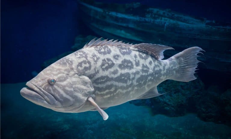
Grouper Fish
Big mouth. Bold strike. Reef ruler.
Big mouth. Bold strike. Reef ruler.
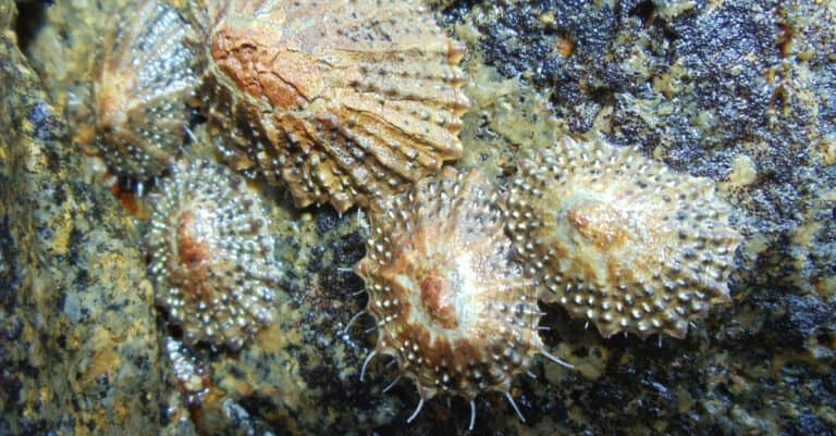
Cling hard, graze smart, ride the tide.
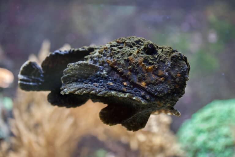
Looks like a rock. Hits like a needle.
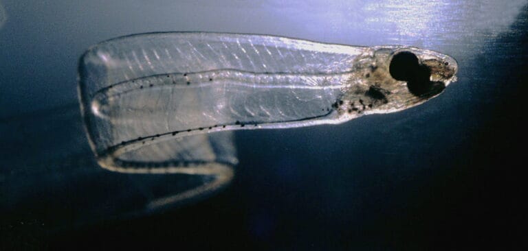
Leaf-larva today, eel tomorrow
Burrow fast. Filter the surf.
Reef gardeners with a hidden blade
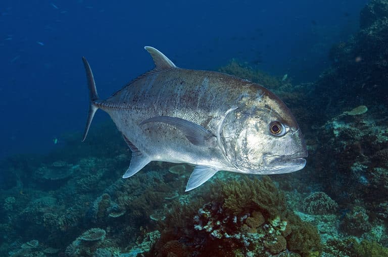
The Indo-Pacific's powerhouse jack

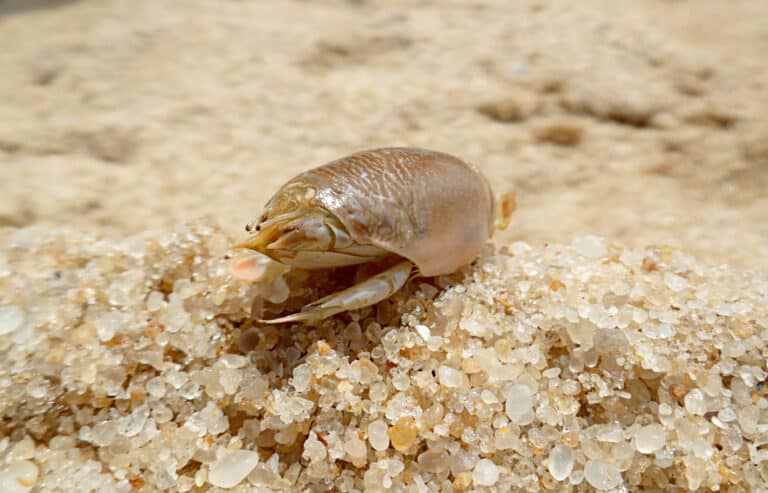
Six legs, endless lives.
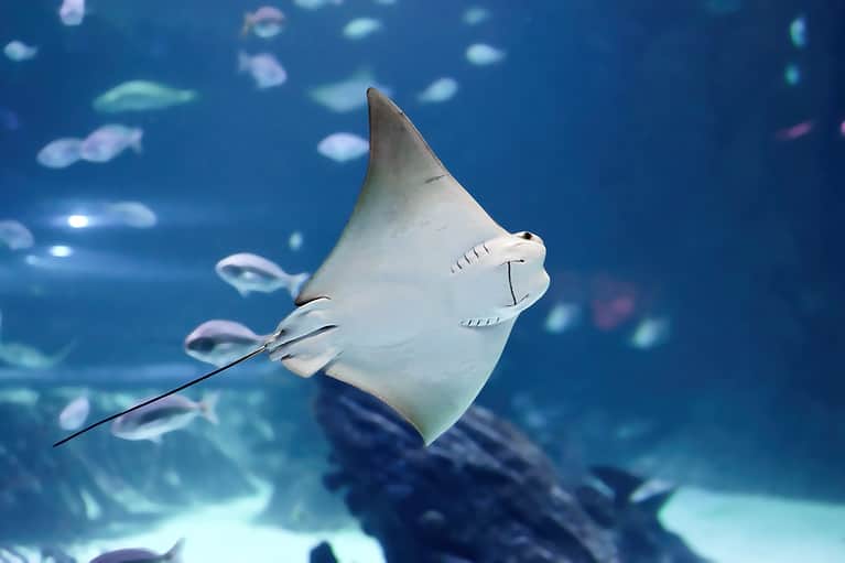
Stingrays: discs, senses, and surprises

Built to see, swoop, and soar
The Red Sea is a warm, high-salinity marginal sea of the Indian Ocean basin lying between northeast Africa and the Arabian Peninsula, connected to the open ocean through the Gulf of Aden via the Bab el-Mandeb Strait.
Bordered by desert coasts and fed by minimal river input, the Red Sea is an unusually clear, warm marine basin where evaporation greatly exceeds precipitation, driving salinities higher than most tropical seas. Its narrow, elongated shape and deep axial trough reflect active tectonics along the Red Sea Rift, and water exchange with the Indian Ocean is funneled through the Bab el-Mandeb, creating distinctive circulation and water-mass structure.
Ecologically, the Red Sea is celebrated for extensive fringing reefs, offshore reef platforms, and coral communities that persist under high temperatures and salinity. These conditions, combined with geographic isolation and strong environmental gradients from north to south, support high biodiversity and notable endemism, making the region a key natural laboratory for studying reef resilience in arid, warming climates.
Etymology: The name 'Red Sea' appears in classical Greek and Latin sources as terms meaning 'Red Sea' and may relate to ancient color-based naming traditions for directions or to occasional reddish discoloration from blooms of the cyanobacterium Trichodesmium. The modern Arabic name translates directly as 'the Red Sea'.
Warm, clear, high-salinity waters; extensive coral reefs and high biodiversity; major shipping route via the Suez Canal
The Red Sea is a long, narrow marginal sea in the northwestern Indian Ocean region, lying between northeast Africa (west) and the Arabian Peninsula (east). It extends from the Sinai Peninsula in the north to the Bab el-Mandeb Strait in the south, where it connects onward toward the Gulf of Aden and the Indian Ocean.
Central axial trough (deep rifted basin of the central Red Sea)
Northern and western Red Sea coast; includes Gulf of Suez coast and access toward the Suez Canal.
Tiny coastline at the head of the Gulf of Aqaba (northern arm of the Red Sea).
Small coastline at the head of the Gulf of Aqaba (around Aqaba).
Longest eastern shoreline; extensive fringing reefs and coastal shelves.
Southeastern and southern approaches; includes coast near Bab el-Mandeb.
Central-western coastline with broad reef tracts and shelf areas.
Southwestern coastline; includes the Dahlak Archipelago and complex reef/island systems.
Southwestern entrance region near Bab el-Mandeb (Red Sea-Gulf of Aden gateway).
West: coasts of Egypt, Sudan, Eritrea, and Djibouti (northeast Africa). East: coasts of Saudi Arabia and Yemen (Arabian Peninsula). North: the Sinai region with two northern arms-the Gulf of Suez (leading to the Suez Canal) and the Gulf of Aqaba. South: Bab el-Mandeb Strait opening into the Gulf of Aden (toward the Indian Ocean).
Surface avg: ~27-29 °C (basin-wide annual mean; warmer toward the south)
Deep avg: ~21-22 °C (relatively warm, weakly varying with depth compared with most oceans)
Elevated salinity driven by intense evaporation, arid climate, and minimal river input; only limited exchange with the Indian Ocean through the Bab el Mandeb. Fresher intrusions occur seasonally in the southern Red Sea from Gulf of Aden inflow.
Strong north-south and seasonal gradients: winter surface cooling is greatest in the northern Red Sea; summer warming peaks in the south/central basin. Typical winter SST ~21-26 °C (north cooler, south warmer); typical summer SST ~28-33 °C (north lower end, south/central higher end).
Exchange flow through Bab el Mandeb is strongly seasonal and monsoon-influenced. In winter, a two-layer pattern is common: surface inflow of relatively fresher Gulf of Aden/Indian Ocean water into the Red Sea and subsurface outflow of warm, salty Red Sea Water toward the Gulf of Aden. In summer, a three-layer pattern often develops: a thin surface outflow from the Red Sea, an intermediate inflow from the Gulf of Aden, and a deeper outflow of dense Red Sea water. Within the basin, along-axis currents and mesoscale eddies (including boundary-intensified flows along both coasts) redistribute heat and salinity.
Generally microtidal to low-mesotidal. Semi-diurnal tides are common, with spatial variability and amphidromic structure producing stronger tidal ranges and currents near constrictions (notably Bab el Mandeb) and some coastal embayments. Typical tidal ranges are often ~0.2-0.8 m, locally approaching ~1 m+ in certain gulfs/harbors; tidal currents can be significant in straits and reef channels.
Dominant basin water mass is warm, highly saline Red Sea Water (RSW), formed largely by winter cooling and evaporation in the northern/central Red Sea and modified by mixing. It is exported through Bab el Mandeb at intermediate to deep levels (depending on season). Surface layers in the southern Red Sea are seasonally influenced by Gulf of Aden Surface/Intermediate waters that are relatively cooler/fresher and can carry higher nutrient signals into the basin.
Strongest in the south and in summer when warm, fresher Gulf of Aden inflow caps denser saline water, producing a pronounced thermocline/halocline in the upper ~50-150 m. Stratification weakens in winter in the north due to surface cooling, deeper mixing, and episodic convection that helps ventilate intermediate/deeper layers. Deep waters remain relatively warm and saline with comparatively small vertical temperature gradients.
Most notable nutrient-enhancing upwelling/entrainment occurs in the southern Red Sea and around Bab el Mandeb (including along the Eritrea/Yemen coasts) during periods of strong monsoon-driven winds and exchange with the Gulf of Aden. Additional localized upwelling-like signals can occur along boundary regions where wind-driven divergence and eddy activity lift cooler, more nutrient-influenced subsurface waters onto shelves and reef slopes, but basin-wide productivity remains limited compared with major eastern boundary upwelling systems.
Exceptionally clear waters (low terrigenous input and limited river discharge) support extensive coral reef development. Persistent high temperatures and high salinity create extreme conditions that select for heat- and salt-tolerant biota. Oxygen minimum features can develop at intermediate depths in some regions due to restricted ventilation and strong stratification, while deep waters remain unusually warm for their depth. Dust deposition from surrounding deserts can episodically fertilize surface waters with micronutrients/trace metals. The narrow connection at Bab el Mandeb makes the basin sensitive to climate-driven changes in monsoon winds and exchange, influencing salinity, nutrient inputs, and ecosystem conditions.
The Red Sea has a hot, arid, desert-influenced marine climate with very warm sea-surface temperatures year-round, exceptionally high salinity, and generally clear waters due to minimal river runoff. Evaporation greatly exceeds precipitation, driving high surface salinity and strong vertical density structure; despite this, seasonal winds and occasional deep mixing (especially in the north) help ventilate deeper waters. Conditions are favorable for coral reefs and high biodiversity, but thermal stress can occur during the hottest months, particularly in the southern and central Red Sea.
Seasonality is driven mainly by air temperature and monsoon-linked wind shifts rather than large rainfall changes. - Winter (roughly Nov-Mar): Cooler air temperatures; the northern Red Sea can experience stronger cooling and more frequent mixing events, with generally lower sea-surface temperatures across the basin. - Spring (Apr-May): Rapid warming; increasing stratification; visibility often remains high. - Summer (Jun-Sep): Hottest period with very warm surface waters and strong stratification; evaporation peaks and salinity remains high. Winds can be persistent and can generate choppy seas and localized upwelling, especially in the south. - Autumn (Oct): Gradual cooling and transition in prevailing winds; stratification weakens compared with peak summer. A notable north-south gradient exists: the southern Red Sea is typically warmer and more influenced by exchanges with the Gulf of Aden, while the northern Red Sea experiences greater winter cooling.
Tropical cyclones do not typically form within the Red Sea itself due to unfavorable conditions and its geography, so hurricane/typhoon-style direct impacts are uncommon. However: - Cyclones in the nearby Arabian Sea/Gulf of Aden can indirectly affect the region by enhancing swell, strengthening winds, and increasing moisture transport that can trigger heavy rain and flash-flood events along surrounding coasts. - Local strong-wind events can produce rough seas and short-period waves, but these are generally not equivalent to tropical-cyclone conditions. Overall, the Red Sea is considered a low-frequency/low-direct-risk basin for tropical cyclones, with occasional indirect influences from storms in adjacent basins.
No sea ice occurs in the Red Sea; ice conditions are not relevant outside polar/subpolar regions.
The Red Sea is a warm, clear, oligotrophic (nutrient-poor) marginal sea characterized by high salinity, minimal river input, and strong north-south gradients in temperature and productivity. Its ecology is dominated by extensive fringing and barrier coral reef systems along both coasts, supporting diverse reef-fish assemblages and specialized communities adapted to arid coastal conditions, seasonal mixing, and localized upwelling/inflow dynamics near the southern entrance.
Marine biodiversity is high for its size and latitude, driven largely by coral-reef habitat complexity and long-term partial isolation that has promoted regional endemism (notably among reef fishes and some invertebrates). Diversity is highest in reef-associated taxa; offshore pelagic diversity is moderate but includes important migratory species. Stressors include warming marine heatwaves, coastal development, shipping, pollution, and localized overfishing, with notable spatial variability in reef condition.
Species count: ≈1,200-1,400 fish species (reef-associated majority); >300 reef-building (scleractinian) coral species; thousands of described mollusks/crustaceans and other invertebrates; reef-fish endemism commonly cited at ~10-20% (varies by group and definition of 'Red Sea region').
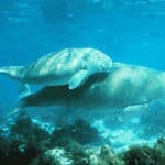
The Red Sea neritic zone is dominated by narrow continental shelves and extensive fringing reefs that run along much of both African and Arabian coastlines. Warm temperatures, exceptionally clear water, and high salinity-combined with very low river input-favor coral reef growth but limit nutrient supply, making many coastal waters oligotrophic except where local upwelling, reef passes, or human inputs elevate productivity. Habitats include reef crests, lagoons, patch reefs, seagrass meadows, and mangrove stands (notably in sheltered bays), supporting high endemism and diverse reef fish communities (surgeonfishes, parrotfishes, butterflyfishes, groupers, snappers) and invertebrates (giant clams, sea urchins, reef-building corals).
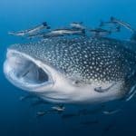
The Red Sea pelagic zone is a long, relatively enclosed basin with strong north-south gradients in temperature and salinity and generally low surface nutrients. Primary production is often modest in offshore waters, driven by picophytoplankton and small flagellates, with seasonal or localized boosts from mixing and exchanges near the Bab el Mandeb (southern gateway) and occasional mesoscale eddies. Pelagic communities include zooplankton (copepods, salps), micronekton (lanternfishes), and higher predators such as tunas, mackerels, billfishes, sharks, and occasionally whales; many species use the basin as a corridor between the Indian Ocean and northern reef systems. Water clarity and stratification favor visually hunting predators and tightly coupled microbial and planktonic food webs.
The benthic zone ranges from shallow reef flats and sandy lagoons to deep basins exceeding ~2,000 m, with substrates including coral framework, carbonate sands, rubble slopes, and deeper soft sediments. In shallow areas, reef-building corals and crustose coralline algae create complex three-dimensional habitat that supports sponges, tunicates, bryozoans, echinoderms, and abundant benthic microalgae. Seagrass beds and mangrove fringes trap sediments, cycle nutrients, and provide nursery habitat for juvenile fishes and invertebrates. In deeper settings, reduced light and low organic input favor detritus-based communities-polychaetes, bivalves, crustaceans, and deposit feeders-linked to the slow rain of particulate organic matter from surface waters, with localized enrichments near slope channels and reef drop-offs.
The demersal zone in the Red Sea is especially important along reef slopes, outer reef walls, and shelf edges where currents concentrate plankton and organic particles near the bottom. Demersal fishes include groupers, snappers, emperors, goatfishes, lizardfishes, jacks, and reef-associated sharks and rays, many of which hunt across the reef-sand interface or along drop-offs. Nocturnal demersal activity is prominent: some predators feed on emerging invertebrates and small fishes, while others intercept zooplankton advected along reef faces. These near-bottom communities are sensitive to habitat structure (live coral cover, rubble fields) and to oxygen and temperature patterns that influence the distribution of prey and refuges.
Notable movements are strongest in the southern Red Sea near Bab el Mandeb, where seasonal monsoon-driven circulation enhances biological activity and can attract wide-ranging pelagic species. Many reef fishes (e.g., some groupers, snappers, and rabbitfishes) form seasonal spawning aggregations tied to lunar cycles and water temperature, often peaking in warmer months and around predictable reef points and channels. Pelagic migrants such as tunas, mackerels, and billfishes may increase seasonally in response to prey availability and water exchange with the Gulf of Aden; occasional visits by whale sharks and other large planktivores are often seasonal and linked to localized plankton blooms or fish spawning events near productive reef areas.
Key food webs are anchored by (1) reef benthic primary producers (symbiotic zooxanthellate corals, turf algae, crustose coralline algae, and seagrasses) supporting herbivores (parrotfishes, surgeonfishes, rabbitfishes, sea urchins) and then mesopredators and apex predators (groupers, snappers, barracudas, reef sharks); (2) a pelagic plankton pathway where phytoplankton and microbes feed zooplankton (copepods, larvae), which feed small pelagic fishes and squids, in turn supporting tunas, jacks, billfishes, dolphins, and sharks; and (3) a detrital/microbial loop in nutrient-poor waters where dissolved organic matter is recycled by bacteria and microzooplankton, increasing efficiency of energy transfer and supplying particulate detritus to benthic deposit feeders. Cross-linkages are strong: reef fish and invertebrate larvae export to the pelagic, while pelagic plankton subsidies and fish spawning events import energy back to reefs, intensifying feeding along reef edges and passes.
The Red Sea supports globally significant coral reefs, seagrass beds, mangroves, and pelagic ecosystems with high endemism and communities adapted to warm, saline, low-nutrient conditions. While some northern/central reefs show relatively high heat tolerance compared with many other regions, the system is under increasing pressure from rapid coastal development, shipping and port expansion, pollution hotspots, and sustained fishing pressure in parts of the basin. Overall conservation status is mixed: pockets of strong ecological condition persist, but cumulative impacts are rising and uneven governance capacity across bordering states creates variable protection and enforcement.
Moderate but deteriorating in hotspots; localized high-condition reefs persist
Rising sea temperatures increase mass coral bleaching risk, reduce recovery windows after heatwaves, and can shift community composition; marine heatwaves and chronic warming also stress seagrass and mangroves. Ocean acidification threatens coral calcification, and deoxygenation risk is emerging in enclosed, stratified areas.
Oil contamination risk from dense tanker traffic and offshore facilities; chronic inputs from ports, ship discharges, antifouling compounds, desalination brine and chemicals, sewage/untreated wastewater, and localized industrial effluents. Plastic debris and ghost gear affect reefs and megafauna; episodic spills can cause acute reef and shoreline impacts.
Coastal reclamation, dredging, and shoreline hardening for tourism and urban expansion remove or fragment coral reefs, seagrass beds, and mangroves; sediment plumes from construction can smother corals and reduce water clarity.
Port development, shipping lanes, subsea cables/pipelines, and increased vessel traffic raise risks of anchoring damage, groundings on reefs, noise, light pollution, and collision impacts on turtles and marine mammals.
Fishing pressure on reef fishes and invertebrates (including groupers, snappers, sharks/rays in some areas) can reduce biomass and alter food webs; bycatch impacts turtles and dolphins; illegal and unreported fishing persists in parts of the basin.
Recreational diving/snorkeling pressure, anchor damage, wildlife harassment, and expanding coastal tourism can degrade popular reef sites; poorly managed visitation concentrates impacts on limited high-visibility reefs.
Biofouling and ballast-water introductions via intense shipping create ongoing invasion risk; non-native algae and invertebrates can establish near ports and disturbed habitats, potentially competing with native reef communities.
Altered circulation and water quality near large coastal engineering projects and desalination outfalls can modify local salinity/temperature regimes; mangrove hydrology is altered by coastal roads and fill.
Extraction and depletion of local reef resources (e.g., ornamental collection in some localities, invertebrate harvesting) and cumulative declines in key functional species can reduce resilience to climate stress.
Coastal and near-coastal quarrying/mineral extraction can increase sedimentation and habitat disruption; localized impacts may be significant where operations are adjacent to sensitive shorelines.
High vessel density creates chronic hydrocarbon and antifouling contamination risk, with major spill potential along shipping corridors. Key issues include untreated/partly treated sewage near rapidly growing cities, industrial/port effluents, marine litter (plastics, lost gear), and desalination brine/chemical discharges that can elevate local salinity and affect benthic habitats.
Status varies by subregion: some remote/offshore and well-managed areas retain higher reef fish biomass, while many accessible reefs near population centers show reduced top predators and signs of growth/recruitment overfishing. Bycatch and illegal/unreported fishing remain concerns, and shark/ray depletion is reported in parts of the region.
The Red Sea is already warm; additional warming increases bleaching frequency and reduces recovery time. Some northern reefs show comparatively higher thermal tolerance, but extreme heatwaves still pose high risk. Acidification is expected to reduce coral calcification over time; combined warming and potential low-oxygen events can compound stress, particularly in semi-enclosed bays.
Shipping-mediated introductions (ballast water, hull fouling) are the primary pathway, with highest vulnerability near ports and disturbed coastal developments. Establishment risk rises where native communities are weakened by pollution and habitat modification.
A protected marine and desert headland at the southern tip of the Sinai Peninsula, where fringing reefs meet strong currents at the junction of the Gulfs of Suez and Aqaba.
One of the Red Sea's flagship protected areas, famous for exceptionally clear water, vibrant coral walls, and dense fish life driven by nutrient-rich currents.
A set of narrow channels between the Sinai Peninsula and Tiran/Sanafir islands that control water exchange into the Gulf of Aqaba.
Current-swept reefs (e.g., Jackson, Woodhouse, Thomas, Gordon) make it one of the most iconic Red Sea diving regions, known for pelagics, drift dives, and dramatic reef drop-offs.
A WWII-era British cargo ship sunk in 1941, resting on the seabed with holds containing motorcycles, trucks, and military supplies.
Often cited as one of the world's top wreck dives; its accessible depth, historical cargo, and prolific marine growth make it a global dive attraction.
A long offshore reef plateau and wall system in the Egyptian Red Sea, exposed to open-sea conditions and strong currents.
Renowned for shark encounters (notably oceanic whitetip seasonally) and spectacular wall diving, illustrating the Red Sea's high-energy offshore reef ecology.
Two small, remote islands with steep reef walls and surrounding deep water, far offshore from the Egyptian coast.
A premier liveaboard destination famous for big pelagics, coral-covered walls, and notable wrecks (including the Numidia and Aida) close to the reefs.
An isolated offshore reef with a lighthouse, rising from deep water and encircled by steep drop-offs.
One of the Red Sea's most celebrated remote reefs for hammerhead sightings, strong currents, and pristine coral formations.
A large reef complex and lagoon systems in the southern Egyptian Red Sea with patch reefs, coral gardens, and sheltered bays.
Known for diverse habitats (walls, lagoons, pinnacles) and frequent dolphin encounters, showcasing southern Red Sea biodiversity.
A protected coastal-marine area south of Marsa Alam featuring islands, seagrass beds, mangroves, and coral reefs.
Important for habitat diversity and conservation (including seagrass-associated megafauna such as dugongs and turtles) in an arid, low-runoff sea.
A broad archipelago of hundreds of islands with extensive shallow reefs, lagoons, and seagrass areas along Eritrea's coast.
One of the Red Sea's largest island groups, valued for relatively less-developed reefs and important nursery habitats supporting regional biodiversity.
A protected archipelago off southwest Saudi Arabia with coral reefs, seagrass meadows, and mangrove-lined shores.
A key conservation area for Red Sea biodiversity and coastal habitats, supporting rich reef fish communities and migratory species.
A nearshore submarine sinkhole with a steep vertical profile adjacent to a reef wall, popular for snorkeling and diving.
One of the Red Sea's most famous dive sites due to its distinctive geomorphology and accessibility; also notable for the hazards of deep technical routes.
A deep axial basin within the Gulf of Aqaba, part of the Dead Sea Transform system, reaching great depths relative to surrounding shelves.
Highlights the tectonic origin and extreme depth gradients of the northern Red Sea region, influencing circulation, temperature structure, and localized marine habitats.
The Red Sea has been a core corridor linking the Mediterranean world to the Indian Ocean for millennia. Ancient Egyptian expeditions sailed from ports on the Red Sea (via Wadi Hammamat routes) to reach Punt for incense, gold, and exotic goods. In classical antiquity, Greco-Roman and Arab merchants used the Red Sea in the monsoon-driven trade network described in the Periplus of the Erythraean Sea, connecting ports in Egypt and Arabia to East Africa and India. Islamic-era trade and pilgrimage routes expanded maritime traffic, with Jeddah becoming a principal gateway to Mecca. In the 19th-20th centuries the opening of the Suez Canal transformed the Red Sea into a principal global chokepoint and intensified exploration, hydrographic surveying, and strategic competition among colonial and later regional powers.
One of the world's most important shipping corridors, the Red Sea carries traffic between Europe/the Mediterranean and the Indian Ocean/Asia via the Suez Canal (north) and Bab al-Mandab (south). Main north-south lanes follow the central deep basin, with routing constrained near chokepoints and around reef-fringed coasts. Key ports include (north to south): Suez/Port Said (via canal system, Egypt), Ain Sokhna and Safaga (Egypt), Aqaba (Jordan) and Eilat (Israel) via the Gulf of Aqaba, Jeddah and Yanbu (Saudi Arabia), Port Sudan (Sudan), Massawa and Assab (Eritrea), Djibouti (Djibouti, at the southern gateway), and Aden's regional role just beyond Bab al-Mandab. Cargo profiles include container shipping, general cargo, bulk commodities, refined products, and substantial oil and LNG-related traffic transiting between producing regions and global markets.
Commercial fishing occurs along multiple national coasts, typically focusing on reef-associated finfish, small pelagics in some areas, and offshore/high-value species where accessible. Industrial-scale operations are generally more limited than in some other regional seas due to extensive reef shelves, conservation areas, national regulations, and capacity constraints, but there is targeted commercial harvest of tuna-like species near the southern connection, shrimp in suitable habitats, and reef fish in regulated fisheries. Concerns include localized overfishing near population centers, bycatch in some gears, and habitat impacts where destructive practices occur.
Artisanal and small-scale fisheries are widespread and culturally significant along Egyptian, Sudanese, Eritrean, Yemeni, and Saudi coasts, often using small boats, handlines, traps, gillnets, and traditional methods near reefs and lagoons. These fisheries frequently supply local markets and livelihoods, with seasonal patterns tied to weather, currents, and spawning aggregations. Management challenges include monitoring dispersed landing sites, ensuring sustainable catch of slow-growing reef species, and balancing fishing access with expanding tourism and marine protected areas.
Diving conditions are generally characterized by warm water (often ~22-30°C seasonally), high salinity, and typically excellent visibility due to low river input and limited turbidity. Reefs are extensive and close to shore in many areas, with walls, pinnacles, and coral gardens. Seasonal winds can create surface chop and currents, especially near straits and exposed offshore sites; winter can bring cooler temperatures and occasional rougher seas. Marine life is diverse, with hard and soft corals, large reef fish, sharks in some offshore areas, and occasional pelagics near channels and drop-offs.
Tourism is a major coastal economic driver, especially where reef accessibility and infrastructure are well developed. Signature activities include beach tourism, snorkeling, scuba diving, liveaboard boating, wildlife watching (dolphins, reef fish), sailing/kitesurfing in windy areas, and coastal cultural tourism tied to historic ports and pilgrimage gateways. Prominent destinations include Egypt's Sinai and southern Red Sea resorts (e.g., Sharm el-Sheikh, Hurghada/El Gouna, Marsa Alam), Saudi Arabia's growing Red Sea tourism developments (including island and reef destinations), and Jordan's Aqaba as a compact hub for reef access and regional travel. Tourism pressure concentrates around popular reefs and nearshore lagoons, creating management needs for anchoring, waste, coastal construction, and visitor carrying capacity.
The Red Sea region supports oil and gas activities primarily through coastal terminals, shipping of crude and refined products, and some offshore exploration/production in select sectors. Saudi Arabia and Egypt have developed energy infrastructure along their Red Sea coasts (including export/import terminals and refineries), and there has been periodic exploration interest in Red Sea basins where geology is prospective. Compared with the Persian Gulf, offshore production is more limited, but energy transit risk is high because large volumes of hydrocarbons move through the sea and its chokepoints. Environmental sensitivities are significant due to coral reefs and limited natural flushing in some coastal areas.
The Red Sea has outsized strategic importance because it links the Suez Canal to Bab al-Mandab-two global maritime chokepoints affecting trade and energy flows. Regional navies and coast guards patrol for maritime security, smuggling, and piracy spillover risks from the Gulf of Aden, while multiple external powers maintain a security presence or access arrangements nearby (particularly around Djibouti and the southern approaches). Strategic concerns include protection of shipping lanes, port security, conflict spillover from adjacent regions, and the security of undersea cables and critical energy infrastructure. The concentration of traffic near narrow passages amplifies the geopolitical stakes of freedom of navigation and regional stability.
Coastal societies around the Red Sea include diverse Arab and African communities shaped by maritime trade, pilgrimage, and fishing. On the Arabian side, Hejazi coastal culture in western Saudi Arabia (notably around Jeddah and Yanbu) reflects centuries of trade and Hajj-linked exchange, while Yemeni Red Sea communities retain strong ties to fishing and regional commerce. On the African side, Egyptian Red Sea and Sinai communities combine Bedouin heritage with modern tourism economies; Sudanese and Eritrean coastal peoples (including Beja-related groups and other local communities) have long traditions in small-scale fishing, seafaring, and caravan-to-coast trade. Across the basin, the Red Sea historically facilitated movement of people, languages, and goods-creating shared culinary, architectural, and mercantile influences-while local identities remain distinct and often closely tied to specific ports, islands, and reef-lagoon fishing grounds.
172 species documented in our encyclopedia
Thank you for reading! Have some feedback for us?
We appreciate your help in improving our content.
Our editorial team will review your suggestions and make any necessary updates.
There was an error submitting your feedback. Please try again.