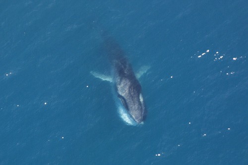
Fin Whale
The fast rorqual with a split-color jaw

The fast rorqual with a split-color jaw
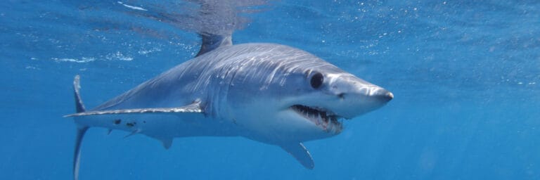
Warm-blooded speed in the open sea
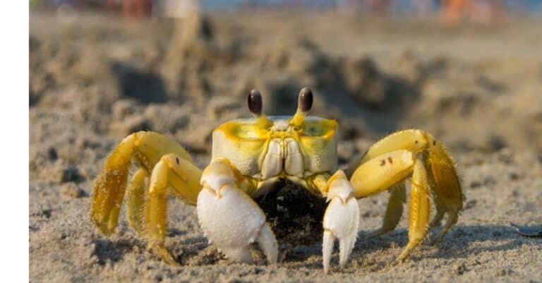
The night sprinters of the sand
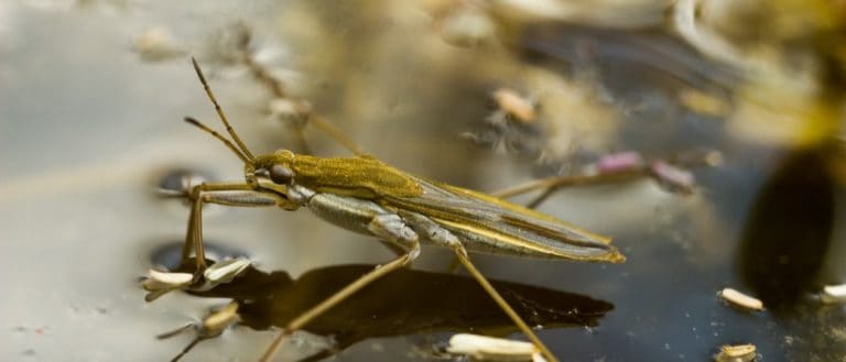
Skating predators of the surface film
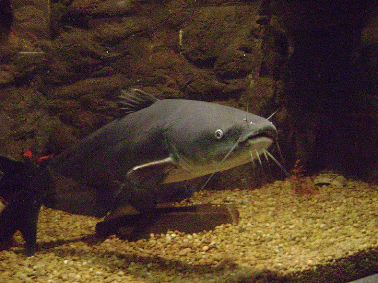
Whiskers, spines, and river smarts
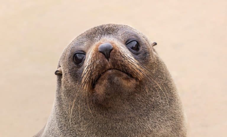
Ear flaps, fast flippers, wild rookeries
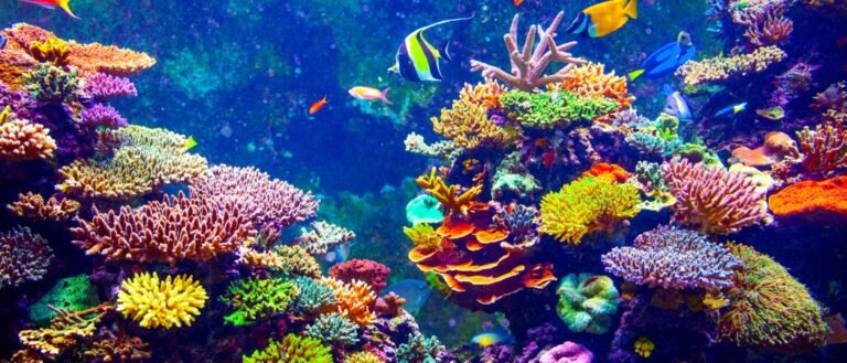
Tiny polyps, massive oceans
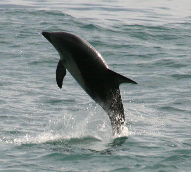
Cape-wearing acrobat of cool seas

Black tip. Bright reef. Loyal patrol.
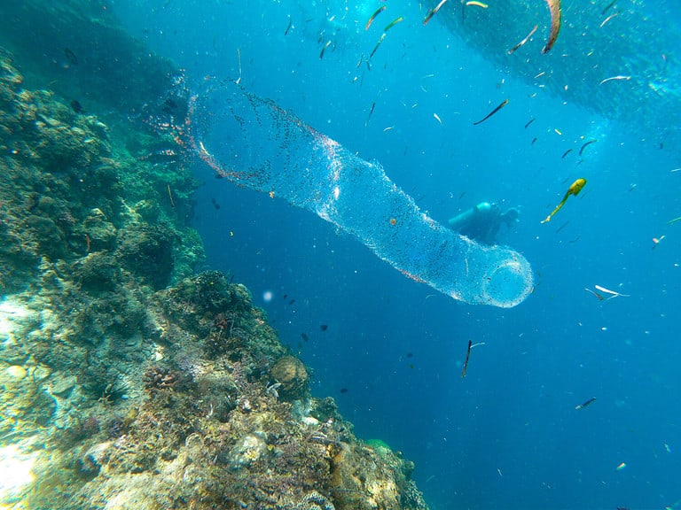
Glowing tubes that filter the sea
The Tasman Sea is a temperate marginal sea of the South Pacific Ocean lying between southeastern Australia and New Zealand, bounded by the Coral Sea to the north and the Southern Ocean influences to the south.
The Tasman Sea forms the broad oceanic corridor separating Australia and New Zealand, spanning deep basins, seamounts, and the edge of the Australian and Zealandia continental shelves. Its waters range from subtropical influences in the north to cool-temperate conditions in the south, creating strong gradients in temperature, nutrients, and productivity across relatively short distances.
A major driver of its ecology is the East Australian Current, which transports warm water southward along Australia and sheds eddies into the Tasman, shaping local circulation, nutrient delivery, and the distribution of plankton, fish, and higher predators. Along its margins, productive shelf seas and coastal habitats support kelp forests, reef and estuarine communities, and important breeding and foraging grounds for seabirds and marine mammals, while the open sea hosts migratory pelagic species that move through this dynamic, current- and eddy-rich environment.
Etymology: Named after Dutch explorer Abel Janszoon Tasman (1603-1659), who conducted voyages in the region in the 1640s; "Tasman Sea" literally means the sea associated with/near Tasman's explorations and legacy.
Rough trans-Tasman weather and seas, East Australian Current influence, and rich temperate marine biodiversity (pelagic fisheries, coastal reefs, marine mammals).
The Tasman Sea is a marginal sea of the South Pacific Ocean lying between southeastern Australia (including Tasmania) and New Zealand, spanning the mid-latitude temperate zone and influenced strongly by the East Australian Current and associated eddies.
Deepest soundings occur in the Tasman Basin, particularly near the central-southern Tasman Sea (abyssal basin areas adjacent to major ridges such as the Lord Howe Rise/South Tasman Rise).
Borders the Tasman Sea along New South Wales, Victoria (via Bass Strait), and Tasmania; includes Lord Howe and Norfolk Islands.
Borders the Tasman Sea along much of the western coastline of both the North Island and South Island.
West: Australia (New South Wales, Victoria, Tasmania). East: New Zealand (primarily the North and South Islands' western coasts). North: transitions toward the Coral Sea and the southwest Pacific near the latitude of southern Queensland/northern New South Wales. South: merges into the Southern Ocean south of Tasmania and the South Island of New Zealand.
Surface avg: ~14-20 °C (typical basin surface average; warmer in the north/west under EAC influence, cooler toward the south/east)
Deep avg: ~2-4 °C below ~1000 m (cold, relatively uniform deep waters)
Surface salinity is elevated where subtropical waters dominate (EAC and Tasman Front), and reduced in cooler southern/eastern areas and during high-precipitation/runoff events. Subsurface waters often show distinct salinity maxima/minima associated with subtropical mode/intermediate waters.
Strong seasonality: summer surface warming and a shallow seasonal thermocline; winter cooling with deeper mixed layers, especially in the south and during stormy periods. Northern Tasman influenced by warm East Australian Current (EAC) incursions; southern/western Tasman more frequently cooled by subantarctic influences.
Dominated by the East Australian Current flowing south along Australia, shedding warm-core eddies into the western/central Tasman. The Tasman Front carries subtropical water eastward toward northern New Zealand. In the south, the Subtropical Front/extension of the Antarctic Circumpolar Current influences cooler waters and mesoscale eddies; circulation is highly eddy-rich with frequent meanders and cross-basin exchange.
Mostly semidiurnal to mixed semidiurnal across the basin. Open-ocean tidal ranges are generally modest, while coastal ranges and currents intensify on shelves and in constricted passages (notably around New Zealand straits and embayments). Tidal currents can strongly modulate mixing on the continental shelves and around seamounts/ridges.
Mix of warm, salty subtropical waters (EAC/Tasman Front) overlying cooler, fresher subantarctic-influenced waters to the south/east. Subtropical Mode Water can form/advect within the region, with Antarctic Intermediate Water (cool, relatively fresh) underlying the thermocline in much of the basin. Deep waters are cold, oxygenated, and relatively stable, with properties tied to Southern Ocean sources.
Typically well-stratified in spring-summer with a seasonal thermocline (often ~20-100 m, locally deeper), strongest in the north/west under EAC warming. Winter storms and surface cooling deepen the mixed layer and erode stratification, especially in the southern Tasman and over shelves. Mesoscale eddies create strong local variability (fronts, doming/tilting isopycnals).
Intermittent coastal upwelling along parts of southeastern Australia (driven by wind events and EAC interactions, including upwelling-favorable southerlies), plus localized upwelling and enhanced productivity at shelf breaks, seamounts, and along major fronts (Tasman Front, Subtropical Front). Cyclonic (cold-core) eddies can elevate nutrients by lifting the nutricline in the central/western Tasman.
Highly eddy-dominated sea with frequent warm-core EAC eddy shedding, creating strong patchiness in temperature, nutrients, and biology. Sharp frontal zones (Tasman Front/Subtropical Front) act as ecological boundaries and migratory corridors. Marine heatwaves can occur during strong EAC penetration and persistent anticyclonic eddies, driving anomalously warm conditions and ecosystem shifts. Occasional extreme storm/wave events and strong air-sea fluxes in winter can rapidly deepen mixing and alter upper-ocean properties.
The Tasman Sea has a predominantly temperate, maritime climate with strong west-to-east weather variability driven by the mid-latitude westerlies and frequent passing fronts. Sea conditions and temperatures vary markedly from north (warmer, more subtropical influence via the East Australian Current) to south (cooler, more subantarctic influence). The East Australian Current transports warm water southward along Australia's coast, enhancing eddy activity and local productivity; around New Zealand, currents and complex bathymetry further shape regional variability. Overall, expect moderate to strong winds at times, changeable weather, and a mix of nutrient-poor warm-core eddies and cooler, more productive waters depending on location and season.
• Summer (Dec-Feb): Warmest sea-surface temperatures; generally more stable stratification and calmer spells, though fronts and gales still occur. Northern and western areas can feel more subtropical due to the East Australian Current. • Autumn (Mar-May): Gradual cooling; increased frontal passages compared with summer; continued eddy activity. • Winter (Jun-Aug): Coolest sea-surface temperatures; more frequent and stronger westerly winds, larger swell, and higher wave energy. Storm tracks and cold fronts are more active, especially in central and southern parts. • Spring (Sep-Nov): Transition back to warmer conditions; variable winds and frequent weather changes; productivity can increase in some areas as mixing eases and light increases. Latitudinal gradient: Northern Tasman is milder and warmer year-round; southern Tasman experiences cooler conditions and stronger influence from Southern Ocean weather.
Tropical cyclones are uncommon in the Tasman Sea itself, but remnants of tropical cyclones from the Coral Sea can transition into extratropical systems and track into or across the Tasman, mainly in late summer to early autumn. The dominant severe-weather pattern is extratropical cyclones and deep low-pressure systems embedded in the mid-latitude westerlies, occurring year-round but typically more frequent/intense in winter and spring. These systems can generate gale to storm-force winds, rapidly changing seas, and long-period swell. East Coast Lows (near southeastern Australia) can also affect the western Tasman, producing heavy rainfall onshore and hazardous coastal/marine conditions, most often in the cooler months but possible any time.
No regular sea ice. The Tasman Sea lies well north of the typical Antarctic sea-ice extent; sea-ice presence is essentially absent. Very rare, indirect impacts can include occasional drift of cold, subantarctic waters or swell conditions associated with Southern Ocean systems, but not sea-ice formation in the Tasman Sea.
The Tasman Sea is a temperate-to-subtropical marginal sea between southeastern Australia and New Zealand, shaped strongly by the southward-flowing East Australian Current (EAC), its eddies, and convergent ocean fronts (e.g., Tasman Front/Subtropical Front). This circulation creates strong gradients in temperature, nutrients, and productivity across the basin, supporting a mix of warm-water and cool-temperate communities. Ecologically it functions as both a productive pelagic system (fronts/eddies concentrating plankton and forage fish) and a diverse coastal-shelf system with kelp-dominated reefs, seagrass, and soft-sediment habitats, plus deep-sea seamount and canyon ecosystems that can host vulnerable, slow-growing benthic fauna.
Biodiversity is high overall but strongly varies by latitude and habitat. Warm-core eddies and boundary currents transport subtropical larvae southward, increasing species richness episodically along southeastern Australia and parts of northern New Zealand, while cooler southern and deeper environments favor distinct temperate and deep-sea assemblages. The region supports diverse pelagic predators (tunas, billfish, sharks), migratory marine mammals, and seabirds, with benthic diversity concentrated on complex rocky reefs, seamounts, and canyon walls.
Species count: Regionally, on the order of ~1,000+ marine fish species across connected Tasman/SE Australia/NZ waters; thousands of described invertebrates (with many more likely undescribed in deep habitats); ~30+ cetacean species recorded; and 60-100+ seabird species using the basin and its margins seasonally.
The Tasman Sea neritic zone spans the continental shelves off southeastern Australia (NSW-Victoria-Tasmania) and around New Zealand's coastal margins, including embayments, estuaries, and island shelves. It is strongly shaped by temperate conditions and the warm, poleward-flowing East Australian Current (EAC), which can deliver subtropical water, larvae, and episodic marine heatwaves. Habitats include kelp forests (notably giant kelp and other laminarian assemblages), rocky reefs, sandy beaches and dunes, seagrass meadows in sheltered bays, and productive upwelling/eddy edges that concentrate plankton and baitfish. This zone supports high biodiversity of reef fishes, invertebrates (abalone, lobster/crayfish), coastal sharks and rays, and seabirds, with productivity often peaking where currents meet shelf breaks, headlands, and tidal mixing zones.
The pelagic zone of the Tasman Sea is the open-water environment beyond the shelf, dominated by the interaction of the EAC, its separation into eddies, and cooler subantarctic-influenced waters arriving via the broader South Pacific circulation. Strong fronts and mesoscale eddies create patchy but sometimes intense productivity by concentrating nutrients, plankton, and micronekton; these features form "hotspots" for predators. The upper sunlit layer supports phytoplankton blooms and zooplankton (e.g., copepods, krill-like euphausiids), while deeper layers host diel-vertical-migrating squid and lanternfishes that link surface productivity to depth. Pelagic biodiversity includes tunas, billfish, sharks, pelagic rays, marine mammals (dolphins and migrating whales), and wide-ranging seabirds that forage along frontal boundaries and eddy margins.
The benthic zone includes the seafloor across continental shelves, slopes, canyons, and deep basins separating Australia and New Zealand. On shelves, sediments range from coarse sands to muds supporting benthic infauna (worms, bivalves), crustaceans, and demersal fish nurseries; rocky bottoms host reef-building algae, sponges, ascidians, and corals adapted to temperate waters. Down the slope and in deeper areas, cold-water communities-sponges, gorgonians, soft corals, and other suspension feeders-occur where currents deliver particulate food, including on seamounts and canyon walls. Organic matter "marine snow" and carcass falls provide energy to deep benthos, while disturbance (storms on shelves; trawling impacts in some areas) can strongly influence habitat structure and recovery rates.
The demersal zone consists of organisms living and feeding just above the seabed on shelves and slopes, closely tied to bottom type, currents, and temperature gradients. Demersal fish and invertebrates exploit boundary-layer flows that bring oxygen and food while offering shelter and ambush opportunities along reefs, kelp edges, and seabed features (ridges, troughs, canyon heads). Typical demersal roles include benthic predators and scavengers (feeding on crustaceans, molluscs, and small fish), and mid-level consumers that couple benthic production to higher predators. This zone is ecologically important for energy transfer: pelagic-derived carbon (plankton and fish falls) subsidizes demersal communities, while demersal prey supports seals, larger fish, and sharks, especially around productive shelf-break fronts.
Seasonal migrations are most notable from austral autumn through spring (roughly May-November), when large baleen whales (especially humpbacks, and also southern right whales in some coastal areas) move along Australia's and New Zealand's margins between feeding grounds at higher latitudes and breeding/calving areas in warmer waters. Many seabirds (e.g., albatrosses and shearwaters) range widely across the Tasman Sea year-round but concentrate along fronts and eddies during productive periods, often peaking in cooler months. Pelagic fish migrations are linked to temperature and current shifts: tunas, billfish, and some sharks track warm-core EAC waters and eddy fields, generally expanding southward in warmer seasons and contracting northward as waters cool.
Primary production begins with phytoplankton in the euphotic zone, stimulated by nutrient inputs from mixing, shelf-break processes, and eddy dynamics; coastal macroalgae/kelp and seagrass also contribute substantial local production. Phytoplankton is grazed by zooplankton (copepods, euphausiids) and filter feeders (bivalves, some benthic invertebrates), while kelp detritus and dissolved organic matter fuel detrital pathways on reefs and soft sediments. Small pelagic fishes (sardines, anchovies), juvenile stages of many species, and squid convert plankton and micronekton into prey for larger predators (tunas, billfish, sharks, dolphins). Demersal pathways link benthic invertebrates (crabs, prawns, molluscs, echinoderms) to bottom-associated fishes and then to higher predators including seals and large sharks. Seabirds and marine mammals often forage at trophic "pinch points" where currents and fronts aggregate baitfish and squid; baleen whales can short-circuit the web by feeding directly on zooplankton (krill-like euphausiids) in cooler, productive waters and along frontal zones.
The Tasman Sea supports productive temperate pelagic and shelf ecosystems shaped by the East Australian Current and Subtropical Front, sustaining migratory tunas, sharks, seabirds, marine mammals, and coastal habitats (kelp forests, reefs, canyons). Overall conservation condition is mixed: offshore waters remain relatively intact compared with many global seas, but the region is experiencing rapid ocean warming and marine heatwaves (notably off eastern/southern Australia), shifting species distributions, localized habitat degradation near coasts/ports, and ongoing fishing and shipping pressures. Protection exists through Australian Commonwealth/state marine parks and New Zealand marine mammal sanctuaries, but coverage and enforcement vary and climate-driven impacts are increasing faster than management responses.
Moderate ecological health with increasing pressure (climate-driven change and cumulative human impacts).
Rapid ocean warming and more frequent/intense marine heatwaves (including strengthening/southward extension of the East Australian Current) drive species redistribution, kelp/reef stress, altered productivity, and compound impacts with fishing and pollution; ocean acidification adds chronic stress for calcifiers.
Commercial and recreational fishing pressure on tunas, sharks/rays, demersal fish and invertebrates in shelf/slope systems; risks include localized depletion, trophic effects, and bycatch of seabirds, turtles, and marine mammals in some gear types.
Marine debris and microplastics, lost fishing gear, urban/industrial runoff (nutrients, sediments, heavy metals) near coasts/estuaries, and chronic shipping-related contamination (oil/chemicals, antifoulants) affect water quality and biota.
Biofouling/ballast-mediated introductions and climate-enabled range expansions (e.g., long-spined sea urchin impacts on kelp reefs; invasive seaweeds such as Undaria in ports/coasts) alter habitats and food webs.
Coastal development and modification of estuaries/nearshore reefs (dredging, shoreline armoring, marina/port expansion) reduce habitat complexity and nursery areas, especially near major population centers and ports.
High vessel traffic and operational noise (shipping, fishing, tourism) disrupt marine mammals and seabirds; wildlife interactions (entanglement/strikes) and disturbance at breeding/foraging sites occur in some hotspots.
Ports, shipping lanes, submarine cables and potential offshore energy developments increase seabed disturbance, collision risk, and cumulative noise/light impacts if not carefully sited and managed.
Key issues include plastic debris and microplastics across surface waters; ghost gear from fisheries; localized nutrient/sediment runoff and contaminants near urbanized coasts and ports; and episodic spill risk from dense trans-Tasman shipping.
Fisheries are managed by Australia and New Zealand with additional high-seas/regional frameworks, but pressures persist: some stocks are stable under quotas while others face uncertainty from climate-driven shifts, bycatch (seabirds, sharks, marine mammals) and localized depletion near productive shelf edges and seamount/slope features.
Warming and marine heatwaves are intensifying, particularly along Australia's east and around Tasmania, driving range shifts (more subtropical species), loss/decline of kelp forests in places, altered plankton productivity and food-web timing; ongoing acidification threatens shell-formers (mollusks, pteropods) and can affect early life stages of fish and invertebrates.
Notable problems include port-associated invasive seaweeds (e.g., Undaria) and climate-enabled expansions such as the long-spined sea urchin affecting kelp-dominated reefs; ongoing risk remains from ballast water and hull biofouling across major shipping routes.
Remote volcanic island and surrounding islets roughly 600 km east of mainland Australia, fringed by coral communities in otherwise temperate waters.
World Heritage-listed for its mix of tropical/temperate marine life driven by the East Australian Current; southernmost true coral reef system on the planet.
Network of NSW and Commonwealth marine protected areas around Lord Howe Island and nearby reefs/seamount habitats.
Protects high endemism, reef fish, seabird foraging areas, and deep-sea habitats; a flagship temperate-subtropical conservation area in the Tasman Sea.
Large isolated reef/lagoon system north of Lord Howe Island, often awash with a small sand cay forming in calm conditions.
Among the world's most southerly coral reefs; important habitat for reef fish, turtles, and migratory seabirds in open-ocean Tasman waters.
Remote coral reef complex near Middleton Reef with shallow reef flats and lagoon areas exposed at low tide.
Key stepping-stone habitat across the Tasman Sea and part of a rare high-latitude coral reef pair, shaped by warm-current influence.
Submerged ridge system running through parts of the Tasman region, with numerous seamounts and steep flanks rising from deep water.
Creates productive upwelling and aggregations of pelagic species; notable for deep-sea biodiversity and fisheries/oceanography research.
Chain of submerged volcanic seamounts and guyots extending through the Tasman Sea region toward Lord Howe Rise.
Enhances local productivity and provides habitat for deep-sea corals and pelagic predators; important for understanding hotspot volcanism and marine connectivity.
Shallow strait separating mainland Australia (Victoria) and Tasmania, linking the Tasman Sea with the Great Australian Bight/Southern Ocean margins.
Major shipping corridor with complex currents and strong tides; ecologically important for seals, seabirds, and migratory species.
Narrow, high-energy channel between New Zealand's North and South Islands connecting the Tasman Sea with the Pacific Ocean.
Renowned for powerful tidal flows and mixing; biologically rich corridor used by marine mammals and seabirds and central to New Zealand maritime history.
Broad bay at the northern end of New Zealand's South Island opening to the Tasman Sea, bordered by Abel Tasman and surrounding coastal habitats.
Important nursery and feeding grounds influenced by coastal currents; well-known for recreational boating/diving and productive temperate ecosystems.
Marine park off the NSW mid-north coast protecting islands, reefs, kelp forests, and subtropical reef communities.
One of Australia's best-known transition zones where tropical and temperate species overlap due to the East Australian Current.
Steamship wreck off Sydney (late 19th century), lying in deep water and often visited by advanced divers when conditions allow.
A historically significant wreck site and a well-known technical dive in the Tasman Sea off Australia's busiest port approaches.
Bulk carrier wrecked in 1974 near Newcastle, with exposed superstructure and scattered debris fields in surf-zone conditions.
Iconic modern wreck on Australia's Tasman coastline; notable for storm-driven wrecking event and ongoing coastal dynamics/erosion studies.
Rocky islets just offshore from Byron Bay with reefs, swim-throughs, and current-swept walls.
Famous dive site where warm-current influence can bring manta rays, turtles, and seasonal sharks alongside temperate species-an emblematic Tasman Sea biodiversity mix.
Prominent headland/rock and sea cave system with gutters, sponge gardens, and strong currents.
One of eastern Australia's most celebrated temperate dive sites; known for grey nurse sharks and rich invertebrate communities supported by Tasman Sea currents.
The Tasman Sea has been a major corridor for exploration and migration in the southwest Pacific. Polynesian voyagers crossed it (or its southern fringes) as part of wider Pacific navigation traditions, and Maori settlement in New Zealand (from wider Polynesian routes) shaped enduring maritime cultures on the eastern side. For Europeans, Abel Tasman's 1642 voyage gave the sea its name and initiated sustained European charting; later British and French expeditions refined navigation and coastal knowledge. From the 19th century onward it became a key trans-Tasman trade and passenger route linking Australian colonies/states with New Zealand, carrying wool, timber, agricultural products, minerals, mail, and migrants. In the 20th-21st centuries, the sea remained central to aviation and maritime connections between two closely linked economies, with undersea telecommunications cables and regular ferry/cruise movements reinforcing its role as a connective "highway" between Australia and New Zealand.
Major shipping activity concentrates on trans-Tasman lanes connecting Australia's east/southeast coast ports with New Zealand's main ports, and along-coast routes that run through the wider Tasman approaches. Key Australian ports linked into Tasman Sea trade include Port Botany (Sydney), Newcastle, Port of Brisbane, Port Kembla (near Wollongong), Melbourne (Port Phillip), and Hobart (via Bass Strait/Tasman approaches). On the New Zealand side, principal ports include Auckland, Tauranga, Wellington, Lyttelton (Christchurch), and Port Chalmers (Dunedin). Cargoes include containerized goods, bulk commodities, petroleum products, and refrigerated exports; cruise shipping commonly transits between Sydney/Brisbane and Auckland/Wellington and to ports in Tasmania and New Zealand's South Island. Weather (westerlies, frontal systems, and occasional severe storms) influences routing, and the East Australian Current can affect passage planning along the Australian margin.
Commercial fisheries operate along the Tasman margin and adjacent shelves/slopes of both Australia and New Zealand, including pelagic longline, trawl, purse seine (where permitted/appropriate), and pot/trap operations in coastal areas. New Zealand's Quota Management System and Australia's Commonwealth/state-managed fisheries shape effort distribution, with some fleets targeting offshore pelagics and others focusing on shelf species and deepwater grounds near seamounts and canyon systems. Bycatch management (seabirds, marine mammals) and spatial protections (marine parks/closures) are important operational constraints in parts of the region.
Small-scale and recreational/charter fisheries are culturally and economically significant on both sides of the Tasman. In Australia, coastal communities in New South Wales, Victoria, and Tasmania support line fishing and potting for nearshore species and rock lobster in southern waters. In New Zealand, Maori tribes and local communities maintain customary harvest practices (subject to temporary customary closures and local regulations) and support shore-based and small-boat fishing for inshore finfish and shellfish. Surf beaches, estuaries, and sheltered bays around Tasmania and New Zealand's North and South Islands are common artisanal fishing areas.
Diving conditions are generally temperate, with visibility and sea state strongly influenced by local swell exposure, fronts, and currents. Along eastern Australia, the East Australian Current can bring warmer water intrusions and variable visibility; southern areas and New Zealand waters are cooler with stronger seasonal changes and frequent surge on exposed sites. Typical considerations include kelp forests, surge and swell on open coasts, and rapidly changing weather; drysuits are common in cooler seasons/latitudes, while wetsuits may suffice in warmer northern Tasman-influenced waters.
Tourism is driven by trans-Tasman cruising, coastal nature experiences, and wildlife encounters. Popular activities include whale watching (seasonal migration corridors), dolphin and seabird tours, sport fishing charters, sea kayaking, surfing (notably on exposed coasts), and scenic coastal drives. Major destinations tied to the Tasman Sea include Australia's east coast (Sydney and surrounding beaches, the NSW North Coast), Tasmania (Hobart, Bruny Island, Tasman Peninsula, and the rugged west/east coasts), and New Zealand's coastal hubs (Auckland/Hauraki Gulf approaches, Wellington/Cook Strait gateway, Abel Tasman National Park, Kaikoura on the broader region's eastern approaches, and the Marlborough Sounds). The sea's temperate ecosystems and dramatic coastal geomorphology support eco-tourism focused on marine parks, islands, and headlands.
Direct offshore oil and gas extraction is limited compared with other basins in Australasia, but the broader Tasman region includes long-running offshore hydrocarbon activity in southeastern Australia (notably the Gippsland Basin off Victoria, connected to Tasman approaches) and exploration interest has periodically occurred in frontier areas. New Zealand has had offshore gas production west of the North Island (outside the Tasman Sea proper in many definitions), while exploration policy and environmental constraints have shaped the pace and location of new projects. Overall, the Tasman Sea is better known for shipping, fisheries, and conservation values than for major new hydrocarbon developments.
The Tasman Sea is strategically important as the maritime space between two close security partners, Australia and New Zealand, supporting freedom of navigation, joint exercises, and maritime surveillance. It functions as a key transit and training area for the Royal Australian Navy and Royal New Zealand Navy, with air and maritime patrol operations monitoring fisheries compliance, search and rescue, and maritime domain awareness. Its position on approaches to major population centers (Sydney, Brisbane, Auckland, Wellington) and as a corridor for undersea cables and trade routes gives it ongoing strategic relevance; occasional multinational exercises and visiting naval transits also occur.
Indigenous and coastal cultures around the Tasman Sea include Aboriginal peoples of Australia's east and southeast coasts (with diverse sea country connections and long-standing coastal resource use) and the Maori of New Zealand, whose identity and traditions are deeply maritime (canoe voyaging heritage, customary fisheries, and coastal settlement patterns). Tasmania's Aboriginal communities maintain renewed and continuing cultural relationships with coastal waters and islands. Contemporary coastal cultures in both countries feature strong boating, surfing, fishing, and maritime working traditions (ports, shipbuilding/repair, marine services), with trans-Tasman family, sporting, and economic ties reinforcing a shared "Tasman" social space.
210 species documented in our encyclopedia
Thank you for reading! Have some feedback for us?
We appreciate your help in improving our content.
Our editorial team will review your suggestions and make any necessary updates.
There was an error submitting your feedback. Please try again.