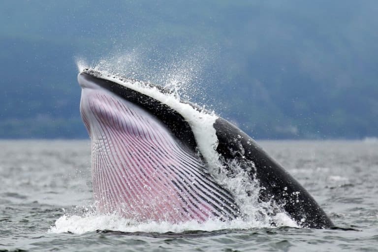
Minke Whale
Small rorqual, big ocean presence

Small rorqual, big ocean presence
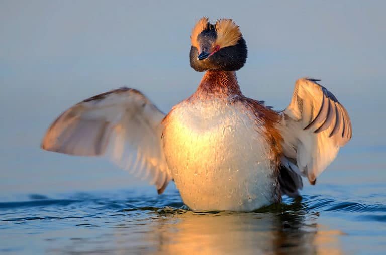
Golden horns, master of the dive
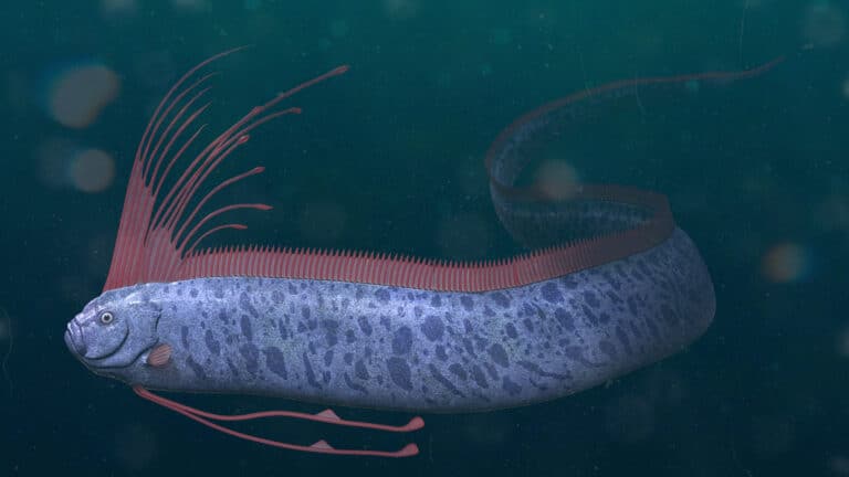
Ribbon giants of the twilight sea
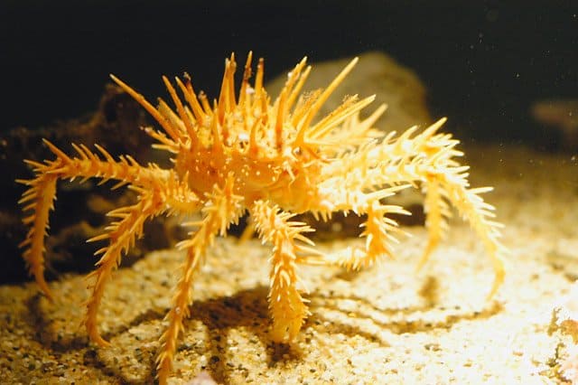
Cold-water royalty of the seafloor
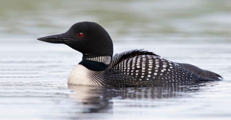
Haunting voice of northern lakes
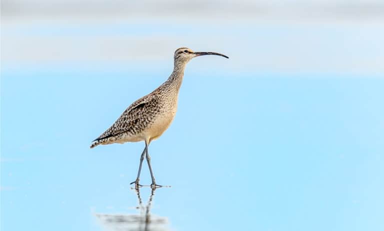
Curved bill, epic journeys
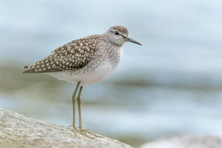
Built for mudflats and megamigrations
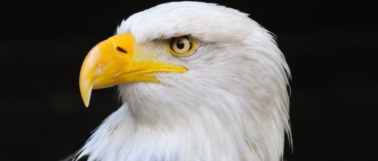
Built to soar, born to strike

Pods, clicks, and ocean smarts.
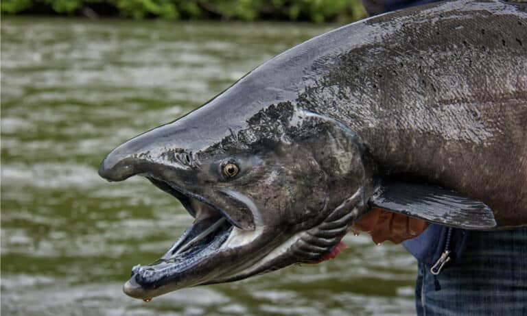
King of the Pacific salmon runs
The Bering Sea is a high-latitude marginal sea of the North Pacific Ocean situated between Alaska and eastern Russia, linked to the Arctic Ocean through the Bering Strait and characterized by broad continental shelves, strong seasonal sea-ice dynamics, and high biological productivity.
The Bering Sea forms a pivotal marine crossroads between the Pacific and the Arctic, where cold polar influences meet subarctic waters along an expansive continental shelf. Its geography is dominated by wide, shallow shelf seas (notably over the eastern Bering shelf) contrasted with deeper basins to the west and south, creating sharp gradients in temperature, salinity, and nutrient availability that shape distinctive habitats.
Seasonal sea ice is a defining driver of the Bering Sea's ecology. In winter and spring, ice growth and retreat influence water-column stratification and timing of phytoplankton blooms, while wind, tides, and currents promote mixing and transport across the shelf. These physical processes-along with nutrient replenishment from upwelling, shelf-break exchanges, and inflow from the North Pacific-fuel exceptionally productive food webs.
As a result, the Bering Sea supports some of the world's most important commercial fisheries and sustains abundant marine life, including large populations of seabirds and marine mammals. Its ecosystems are tightly coupled to climate variability: changes in sea-ice extent, ocean temperature, and circulation can shift productivity patterns, alter species distributions, and reshape the balance between pelagic (open-water) and benthic (seafloor-based) food webs.
Etymology: The sea is named after Vitus Bering, a Danish-born navigator in Russian service who explored the region in the 18th century during expeditions that helped map the North Pacific and the waters between Asia and North America; "Bering Sea" thus denotes the sea associated with Bering's explorations.
One of the world's most productive fishing grounds (Alaska pollock, crab), seasonal sea ice, and rich marine mammal & seabird ecosystems
The Bering Sea is a high-latitude marginal sea in the North Pacific, lying between western Alaska (USA) to the east and eastern Russia (Chukotka and Kamchatka) to the west, and extending northward to the Bering Strait where it connects to the Arctic Ocean.
Bowers Basin (southern Bering Sea, near the Aleutian arc)
Borders the eastern Bering Sea via Alaska, including extensive continental shelves that host major fishing grounds.
Borders western and southwestern Bering Sea along Chukotka and Kamchatka Peninsula, including gulfs and shelves affected by seasonal sea ice.
East: Alaska (including the Seward Peninsula and Yukon-Kuskokwim delta region). West: Russian Far East (primarily Chukotka and the Kamchatka Peninsula). South: the Aleutian Islands island arc forming a partial boundary with the open North Pacific. North: the Bering Strait (between Alaska and Russia) leading to the Chukchi Sea/Arctic Ocean.
Surface avg: ~4-7 °C annual mean at the surface (strong spatial/seasonal variability; colder north/near ice, warmer south/shelf in late summer)
Deep avg: ~1-3 °C typical below the seasonal thermocline and in deeper basin waters (locally colder near the bottom on the northern shelf; generally a few degrees above freezing)
Typical salinity ranges ~31-33.5 PSU across much of the shelf and basin. Freshening occurs in spring/summer from sea-ice melt and river inputs (notably the Yukon and other Alaskan rivers), producing a low-salinity surface layer on the eastern shelf and in the north. Saltier Pacific-origin waters (~33-34+ PSU) enter through Aleutian passes and dominate deeper/basin waters and portions of the outer shelf.
Winter: extensive sea ice over much of the shelf; surface water near freezing (-1.8 to 0 °C). Spring: rapid freshening/stratification from ice melt; surface warms to ~0-4 °C. Summer: surface warms broadly (~4-12 °C; typically ~6-10 °C on the shelf, lower offshore). Autumn: cooling and storm-driven mixing erodes stratification; surface drops back to ~0-4 °C before freeze-up.
Major systems include: (1) Aleutian passes inflow of North Pacific water (notably through Unimak and other passes) feeding the southeastern Bering; (2) the Bering Slope Current (northward along the continental slope, transporting slope/basin water and eddies); (3) shelf circulation with the Anadyr Current (cold, nutrient-rich northward flow on the western shelf) and the Alaska Coastal Current (northward along Alaska, relatively fresh and warmer in summer); (4) exchange through the Bering Strait-net northward transport into the Chukchi/Arctic with strong seasonal and wind-driven variability; (5) mesoscale eddies along the slope enhancing cross-shelf exchange and nutrient supply.
Mixed, largely semidiurnal tides with strong spatial variability. Large tidal ranges and vigorous tidal currents occur around the Aleutian passes and some shelf regions, driving strong mixing fronts. The broad eastern shelf often exhibits pronounced tidal mixing that helps set up stratification boundaries (tidal fronts) between well-mixed coastal/shelf waters and more stratified mid-shelf waters. Seasonal sea ice can damp surface expressions and alter friction/mixing locally.
A subarctic marginal-sea system combining Pacific inflow, shelf-modified waters, and seasonal ice processes. Key characteristics include: (1) Pacific-origin waters entering via Aleutian passes, relatively saltier and nutrient rich compared with coastal waters; (2) a seasonally freshened surface layer from ice melt and river runoff; (3) cold bottom/shelf waters maintained by winter cooling/ice formation and subsequent isolation beneath summer stratification ("cold pool" on the eastern shelf); (4) northward export of modified Pacific water through the Bering Strait into the Arctic, often relatively freshened and cooled compared with source waters.
Strongly seasonal. Winter: weak stratification and deep mixing on much of the shelf due to cooling, wind, and brine rejection during sea-ice formation (locally increasing salinity in subsurface/bottom waters). Spring: rapid stratification from ice melt and warming creates a shallow halocline/thermocline. Summer: pronounced two-layer structure-warm, fresher surface layer over colder, saltier bottom water; the eastern shelf often maintains a persistent near-bottom cold pool separated from the surface by a strong pycnocline. Autumn storms progressively erode stratification and deepen the mixed layer.
Key nutrient supply zones include: (1) slope and shelf-break upwelling along the continental margin (wind-driven and eddy-assisted), bringing nutrient-rich deeper water onto the outer shelf; (2) Anadyr region/western shelf where nutrient-rich Pacific waters and tidal mixing enhance productivity; (3) Aleutian passes and nearby shelf areas where intense tidal mixing and topographic interactions pump nutrients upward; (4) localized coastal and canyon-associated upwelling hotspots (episodic), especially during favorable wind events and in association with the Bering Slope Current and mesoscale eddies.
Seasonal sea ice strongly modulates light, stratification, and timing of phytoplankton blooms (including under-ice and ice-edge blooms). Formation of the eastern-shelf "cold pool" creates a persistent summer bottom-water habitat near 0-2 °C that can act as a thermal barrier influencing fish distributions. High storminess and strong winds drive rapid shifts between stratified and mixed states, affecting nutrient delivery and bloom dynamics. Significant cross-shelf exchange via eddies and fronts concentrates productivity and can create sharp ecological boundaries. Interannual variability is large, tied to sea-ice extent/timing, Pacific inflow, and atmospheric modes, producing notable regime shifts in temperature, ice cover, and ecosystem structure.
The Bering Sea has a cold, subarctic to polar marine climate shaped by high latitude, strong wintertime heat loss, frequent low-pressure systems, and pronounced shelf-slope oceanography. Conditions range from ice-covered, frigid winters over much of the shelf to cool, fog-prone summers with strong stratification and high biological productivity driven by mixing and nutrient supply (including shelf break processes and episodic upwelling). Air-sea temperature contrasts, strong winds, and currents (including exchanges through the Aleutian passes and the Bering Strait) strongly modulate regional weather and ecosystem dynamics.
Winter (Nov-Mar): Very cold air outbreaks are common; strong northerly winds can advect sea ice southward across the shelf. Air temperatures often well below 0°C over the sea, with frequent snow and blowing snow; ocean surface near the freezing point (~−1.8°C) where ice forms. Spring (Apr-Jun): Rapid transitions as daylight increases; sea ice retreats (timing varies greatly by year). Stratification increases with meltwater, influencing the spring bloom; weather remains changeable with lingering gales. Summer (Jul-Sep): Cool maritime conditions (often ~5-12°C air over open water), frequent low cloud and fog, and generally reduced sea ice (mostly absent except far north in many years). Surface waters warm modestly on the shelf; fronts and eddies remain important for nutrient delivery. Autumn (Oct-early Nov): Strong cooling, increasing storms, and breakdown of summer stratification; sea ice begins forming in the north and expands southward as temperatures drop.
Tropical cyclones do not typically occur in the Bering Sea. Instead, storminess is dominated by mid-latitude/extratropical cyclones, especially from late autumn through spring. Powerful Aleutian Low systems can bring gale to storm-force winds, high seas, heavy precipitation, and rapid pressure falls; these storms drive major mixing, coastal surges, and ice motion. Occasionally, the remnants of western North Pacific typhoons transition to extratropical systems and can enhance wind and wave events over the southern Bering Sea and Aleutians in late summer-autumn.
Seasonal sea ice is a defining feature, especially over the broad eastern and northern shelves. Ice typically forms in the north in autumn/early winter and expands southward through winter, with extent and duration varying strongly year to year (warm years can have much reduced southern/central ice). Maximum extent is usually late winter to early spring, followed by retreat in spring and early summer. Ice types include first-year pack ice, drifting floes, and leads/polynyas driven by winds and currents; meltwater promotes strong spring stratification and influences productivity. The southern deep basin is often ice-free, while the northern shelf and areas nearer the Bering Strait are more persistently ice-affected.
The Bering Sea is a cold, high-latitude marginal sea with exceptionally high primary and secondary production driven by seasonal sea-ice dynamics, nutrient-rich shelf waters, strong tidal mixing, and slope/shelf-break upwelling. Its broad continental shelf, recurring ice-edge blooms, and productive fronts support large biomasses of zooplankton, forage fish, groundfish, seabirds, and marine mammals, making it one of the world's most important high-latitude fishing and wildlife regions. Ecological structure shifts strongly with season (ice-covered to open-water) and across major water masses (coastal, middle-shelf, outer-shelf, and slope domains).
Biodiversity is high for a polar/subpolar system, with particularly high biomass and strong food-web coupling from ice algae and spring phytoplankton blooms to zooplankton, fish, seabirds, and marine mammals. Species richness is generally lower than temperate/tropical seas, but habitat diversity (ice-edge, shelf, canyons, nearshore kelp/eelgrass, and deep slope) and the overlap of Arctic and North Pacific faunas elevate overall diversity. Community composition and functional diversity vary markedly with sea-ice extent, temperature regimes, and shelf-slope exchange.
Species count: Approx. 300-450 fish species reported across the broader Bering Sea region; 20+ marine mammal species; dozens of regularly occurring seabird species (with 30-40+ key breeding/foraging species); and thousands of benthic invertebrate taxa (crabs, clams, echinoderms, sponges, corals, etc.).
The Bering Sea neritic zone spans the broad continental shelf-especially over the eastern Bering Sea shelf-where shallow, cold waters, strong tidal mixing, and seasonal sea-ice formation create one of the world's most productive coastal marine regions. Spring and early-summer phytoplankton blooms are often triggered by ice-edge melt and increasing light, while shelf fronts (notably the "cold pool" boundary) organize nutrients and prey into bands that concentrate fish, seabirds, and marine mammals. Extensive shoals, embayments, and river-influenced coastal areas around Alaska and Russia support nursery habitat for juvenile pollock, crab, and flatfish, and provide feeding grounds for walrus and gray whales where benthic prey is abundant. Productivity and habitat structure vary strongly with ice extent, wind-driven mixing, and inflow of nutrient-rich waters from the Aleutian passes.
The pelagic zone of the Bering Sea includes deeper basin waters and the open-water surface layer beyond the shelf break, where wind forcing, mesoscale eddies, and exchange with the North Pacific and Arctic govern nutrient delivery and plankton dynamics. Primary production peaks in spring-summer as light returns and stratification develops, with episodic nutrient replenishment from shelf-break upwelling, eddy transport, and winter mixing. Zooplankton communities (copepods and euphausiids/krill) can be exceptionally dense, supporting pelagic forage fish and squid, and in turn higher predators such as salmon, seabirds, and toothed whales. Seasonal sea ice modifies pelagic timing and composition: ice-associated algae can seed early production, while cold, fresh meltwater layers influence stratification and the match/mismatch between larval fish and zooplankton prey.
The benthic zone is dominated by the vast soft-sediment seafloor of the continental shelf and slope, with localized rocky substrates near islands and the shelf break. Cold bottom temperatures, high organic matter deposition from surface blooms, and strong benthic-pelagic coupling support rich communities of clams, polychaete worms, amphipods, brittle stars, and other invertebrates. In many shelf areas, large fractions of primary production are exported to the seabed, fueling a "benthic-rich" system that is especially important in colder, ice-influenced years. Habitat and community structure vary with sediment grain size, currents, and disturbance (ice gouging in shallow areas, storm reworking), creating mosaics of prey fields that underpin walrus feeding grounds and shape the distribution of bottom-feeding fish and crabs.
The demersal zone-waters just above the seabed-hosts key commercial and ecological species that forage on or near bottom habitats and move along depth and temperature gradients. Walleye pollock often aggregate near the bottom over the outer shelf and slope during parts of their life cycle, while Pacific cod, sablefish (deeper), and flatfishes (e.g., yellowfin sole, Greenland halibut) exploit benthic and near-bottom prey. The demersal environment is strongly structured by the shelf's thermal features, including the seasonal "cold pool," which can act as a barrier or refuge influencing fish distribution, predator-prey overlap, and fishing patterns. Near-bottom currents and resuspension events redistribute nutrients and detritus, supporting benthic invertebrates and providing feeding opportunities for demersal fish, skates, and crabs.
Notable migrations are strongly seasonal and track ice retreat, prey pulses, and spawning cycles. In spring and early summer, many seabirds move north and into the shelf region to breed and exploit bloom-driven forage fish and zooplankton concentrations; large feeding aggregations occur near fronts and the shelf break. Anadromous salmon (notably sockeye, chum, pink, and coho) migrate through and feed in the Bering Sea during ocean phases, with timing varying by stock and year. Gray whales migrate from breeding areas to summer feeding grounds in the northern Bering and Chukchi seas, often focusing on benthic prey hotspots; bowhead whales and some beluga populations move with the ice edge and into the Arctic via the Bering Strait. Pacific walrus migrate with sea ice, using it as a resting platform while foraging on shelf benthos, and many fish (e.g., pollock, cod) undertake seasonal movements between feeding areas and spawning grounds, including along the shelf break and Aleutian passes.
Bering Sea food webs are built on high primary production and strong benthic-pelagic coupling, with pathways that shift with ice conditions. (1) Ice-edge/pelagic chain: ice algae and spring phytoplankton blooms → copepods and krill → forage fish (capelin, herring) and juvenile pollock → seabirds, salmon, seals, and toothed whales. (2) Pollock-centered mid-trophic web: phytoplankton → zooplankton → walleye pollock (a major energy conduit) → predators such as Steller sea lions, fur seals, larger fish, and some seabirds. (3) Benthic-dominated chain (especially on the shelf): phytoplankton export/detritus → benthic invertebrates (clams, amphipods, polychaetes) → Pacific walrus, gray whales, eiders, and bottom-feeding fishes/crabs. (4) Shelf-break/slope pathway: upwelling-enhanced production and krill/squid along the slope → salmon, seabirds, and larger predators. Climatic variability (sea-ice extent, temperature, stratification) alters the balance between pelagic retention versus export to the benthos, reshaping prey availability and cascading to fisheries and top predators.
The Bering Sea remains one of the world's most productive high-latitude marine ecosystems, driven by strong shelf processes, seasonal sea ice, and nutrient upwelling that support globally significant fisheries and abundant seabird and marine mammal populations. However, rapid Arctic-influenced warming, sea-ice loss, and shifting ocean conditions are altering food webs and species distributions, while heavy fishing pressure, ship traffic, and localized pollution add cumulative stress. Management capacity is relatively strong in parts of the U.S. EEZ (science-based quotas, bycatch rules, protected habitat measures), but climate-driven ecosystem change and transboundary pressures increase uncertainty and risk across the wider region, including Russian waters and high-seas areas.
Moderate but increasingly stressed; high productivity persists, yet climate-driven ecosystem shifts and cumulative human pressures elevate vulnerability.
Rapid warming, reduced and shorter-duration sea ice, marine heatwaves, altered timing/strength of spring bloom and zooplankton production, northward shifts of fish distributions, and increasing ocean acidification-affecting prey availability for seabirds, pinnipeds, and cetaceans.
Large industrial fisheries (e.g., pollock and other groundfish) can intensify food-web competition and bycatch risks; climate variability increases the chance of quota-setting mismatches with changing stock productivity and distribution, including cross-boundary management challenges.
Localized contamination from ports and coastal communities, legacy military/industrial sites in some areas, vessel-related discharges, and potential chronic inputs of plastics and microplastics; spill risk persists along shipping routes and near fuel storage/handling sites.
Growing vessel traffic through the Bering Strait region and across the shelf increases underwater noise, disturbance to marine mammals, and risk of ship strikes, especially during migrations and near coastal haul-outs.
Trophic reorganization and reduced availability of key forage species (e.g., changes in crab and small fish abundance in some periods) can deplete prey bases for predators, compounding climate effects.
Expansion/optimization of ports, shipping lanes, and coastal facilities increases disturbance, pollution risk, and habitat pressures in sensitive nearshore and island settings.
Loss of seasonal sea-ice habitat reduces resting/foraging platforms for ice-associated seals and alters ice-edge productivity hotspots; coastal erosion and permafrost-driven change affect nearshore habitat and sediment loads.
Warmer waters and changing species ranges can increase exposure to novel pathogens, harmful algal blooms, and parasite dynamics, with episodic mass mortality events possible in seabirds and marine mammals.
Ecosystem-level regime shifts (e.g., changes in benthic-pelagic coupling, reduced cold pool extent) modify habitat suitability and community structure across the shelf.
Marine debris and microplastics occur across the basin; localized contamination near settlements/ports and some legacy sites; ongoing risk from vessel discharges and accidental fuel/oil releases, especially along increasing shipping corridors and near island communities.
Many major U.S.-managed stocks have historically been managed with conservative harvest control rules and bycatch measures, but climate-driven shifts have increased uncertainty and led to heightened concern for some groups (notably periods of poor recruitment and reduced availability/abundance for certain crab and forage-dependent predators). Transboundary coordination and adaptive management are increasingly important.
Warming is reducing sea-ice extent and duration, weakening the cold-pool barrier on the shelf, shifting plankton timing and composition, and moving species distributions northward. Ocean acidification is a growing risk for calcifying organisms and early life stages, with cascading food-web effects.
No single basin-wide invasive species dominates, but risk is increasing via ballast water, hull fouling, and poleward range expansions. Monitoring focuses on early detection in ports and nearshore zones and on tracking novel species appearing with warmer conditions.
Narrow passage between Alaska (U.S.) and Chukotka (Russia) linking the Bering Sea to the Chukchi Sea (Arctic Ocean).
Key gateway for water, nutrient, and species exchange between the Pacific and Arctic; strategically important and a focal area for marine mammal migrations and sea-ice dynamics.
Large island in the northern Bering Sea, roughly between Alaska and Russia, bordered by broad continental shelf waters.
Important habitat and subsistence area for seabirds and marine mammals; sits near productive fronts and polynyas that concentrate prey and wildlife.
Volcanic island group on the southeastern Bering Sea shelf.
World-renowned breeding and haul-out area for northern fur seals and Steller sea lions; surrounded by highly productive fishing grounds.
Large island off the Yukon-Kuskokwim Delta in the eastern Bering Sea.
Influences local currents and productivity on the shelf; supports rich birdlife and marine mammal use in nearby waters and polynyas.
Broad embayment on the eastern Bering Sea off southwest Alaska.
One of the world's most productive salmon regions and an ecosystem cornerstone for major commercial and subsistence fisheries; extensive shallow-shelf processes drive high biological productivity.
Large bay along the southwestern Alaska coast opening into the eastern Bering Sea shelf.
Major migratory corridor and feeding area for marine birds and mammals; supports important regional fisheries and subsistence harvests.
Shallow inlet of the eastern Bering Sea along western Alaska near the Yukon River delta.
Seasonal sea-ice formation and river inputs shape productivity; important for local fisheries and as habitat for marine mammals and seabirds.
Large gulf on the Russian side (Chukotka), forming the northwestern reach of the Bering Sea.
Known for strong currents and high nutrient supply that support dense plankton and forage fish; an important feeding region for whales and seabirds.
Passage between the Chukotka Peninsula and St. Lawrence Island, linking the Gulf of Anadyr with the northern Bering Sea.
One of the most productive corridors in the region due to mixing and upwelling; concentrates marine mammals, seabirds, and commercial fish species.
Russian island arc at the western edge of the Bering Sea, including Bering Island and Medny Island.
Noted for rugged coasts and rich marine life; associated with unique populations of marine mammals and seabird colonies and forms a key biogeographic transition zone.
Volcanic island chain forming the southern boundary of the Bering Sea, punctuated by numerous deep passes to the North Pacific.
Passes funnel nutrient-rich waters and drive mixing that supports major fisheries (pollock, cod, crab) and abundant seabirds and marine mammals.
A major submarine canyon incised into the Bering Sea continental shelf and slope; it is recognized as one of the largest submarine canyons by volume.
Promotes upwelling and concentrates nutrients and prey, supporting high productivity and serving as an important feeding area for fish, seabirds, and marine mammals.
Large submarine canyon cutting into the western Bering Sea shelf break near the Navarin Basin region.
A major conduit for shelf-slope exchange and nutrient delivery; supports high productivity and attracts commercially important fish and upper-trophic predators.
Submarine canyon system along the eastern Bering Sea slope, often discussed as part of the Bering Sea shelf-break canyon complex.
The canyon system can enhance localized productivity and create feeding "hotspots" that aggregate fish, seabirds, and marine mammals along the shelf break.
The Bering Sea has long been a corridor linking Northeast Asia and North America, with Indigenous peoples using seasonal sea-ice and open-water routes for hunting, trade, and cultural exchange across what is now the Bering Strait region. It sits within the broader context of Beringia, the glacial-era land bridge and subsequent maritime crossroads that shaped human dispersal and long-distance contacts in the Arctic/subarctic. From the 18th century onward it became a focus of Russian imperial expansion and European scientific exploration-most notably Vitus Bering's expeditions (1730s-1740s), which helped map the strait and adjacent coasts and catalyzed the Russian fur trade. In the 19th-20th centuries the sea's commercial importance grew through industrial whaling and sealing (often destructive and contested), then large-scale fisheries development under evolving U.S.-Russia maritime boundaries and post-Cold War management regimes.
Shipping in the Bering Sea is strongly seasonal and weather/ice constrained, but it is strategically important as the Pacific gateway to the Arctic via the Bering Strait. Major routes include: (1) North Pacific approaches into the Bering Sea that funnel toward the Bering Strait for Arctic transits (including traffic linking the North Pacific to Russia's Northern Sea Route during navigable seasons); (2) regional supply and freight routes serving western Alaska communities; and (3) fishing fleet logistics routes between fishing grounds and processing hubs. Key ports and maritime nodes include Dutch Harbor/Unalaska (one of the largest U.S. fishing ports and a major logistics hub), Nome (important for regional resupply and increasingly discussed as an Arctic-facing port), and smaller Alaskan ports/harbors such as St. Paul and St. George (Pribilofs) for local support. On the Russian side, maritime support is tied to the Chukotka and Kamchatka coasts (with larger Kamchatka ports often serving as gateways for fleets operating farther afield). Shipping risks and constraints include sea ice, fog, storms, limited aids to navigation, and sparse search-and-rescue coverage compared to lower latitudes.
The Bering Sea supports some of the world's most valuable high-latitude fisheries, dominated by industrial-scale trawl and longline fleets and extensive shoreside and at-sea processing. Management is highly structured (notably on the U.S. side) with quotas, observer coverage, bycatch controls, and seasonal/area closures, including measures related to protected species interactions. Commercial activity concentrates on the broad continental shelf and slope where productivity is high due to mixing, nutrient supply, and shelf-break processes; seasonal sea-ice dynamics strongly influence timing and distribution.
Coastal Indigenous and local communities in Alaska and Chukotka rely on small-boat and nearshore harvests for subsistence and local markets, with strong cultural ties and seasonal patterns. Artisanal/small-scale activities commonly include nearshore salmon fishing, set nets and small gillnet operations where permitted, small longline/handline fisheries, and harvesting of marine mammals and invertebrates under applicable regulations and customary practices. Community-based processing, sharing networks, and mixed cash-subsistence economies are central features.
Diving is challenging and best suited to experienced cold-water divers: near-freezing temperatures much of the year, strong currents and tidal exchanges in passes, frequent low visibility from plankton blooms and sediment resuspension, and rapid weather changes (fog, swell, storms). Seasonal sea ice and limited emergency infrastructure increase risk and planning requirements; drysuits, redundant gas, and conservative profiles are typical.
Tourism is niche but notable, shaped by remoteness, wildlife abundance, and cultural interest. Key activities include wildlife viewing (seabird colonies, whales, seals/sea lions), eco-cruises and expedition cruising (often linking the Aleutians, Pribilofs, and sometimes onward toward the Arctic), sport fishing in accessible coastal areas and river-connected systems, and cultural tourism centered on Yupik, Inupiat, Aleut, and Chukchi heritage (museums, festivals, community visits where appropriate). Common destination nodes include Dutch Harbor/Unalaska as a logistics gateway, the Pribilof Islands for seabirds and marine mammals, and coastal western Alaska communities as access points for guided nature and cultural experiences (season and weather dependent).
Hydrocarbon potential has been explored historically, but the Bering Sea's oil and gas development is constrained by harsh operating conditions, ecological sensitivity, and regulatory and social scrutiny. Some areas have seen past leasing interest and exploratory activity, while other zones have faced moratoria or heightened restrictions at various times. Offshore development-where proposed-must contend with sea ice, extreme storms, limited spill response capacity, and the high ecological and subsistence importance of marine resources; as a result, large-scale production has been more limited compared with other basins.
The Bering Sea is strategically significant as a frontier between the United States and Russia and as the maritime gateway between the Pacific and Arctic Oceans. During the Cold War it was a key region for surveillance, air and maritime patrols, and early warning considerations; strategic relevance continues due to Arctic access, submarine and air routes, and increasing seasonal shipping. Presence includes coast guard and naval operations focused on sovereignty, domain awareness, search and rescue, and enforcement (particularly fisheries enforcement and maritime safety). The proximity of Alaska and Russia's Far East makes the region sensitive to geopolitical shifts and heightened monitoring.
Bordering cultures are predominantly Indigenous and coastal communities with deep maritime lifeways. On the Alaska side, this includes Yupik (especially along the Yukon-Kuskokwim Delta and Bristol Bay region), Inupiat communities closer to the Bering Strait, and Aleut communities across the Aleutian and Pribilof regions. On the Russian side, Chukchi and Yupik (Siberian Yupik) communities are prominent in Chukotka, alongside other Far Eastern coastal populations. Shared cultural elements include sea-ice knowledge, marine mammal and fish-based subsistence, boatbuilding and navigation traditions, seasonal camps, and cross-strait kinship ties historically present in the Bering Strait region (subject to modern border controls).
134 species documented in our encyclopedia
Thank you for reading! Have some feedback for us?
We appreciate your help in improving our content.
Our editorial team will review your suggestions and make any necessary updates.
There was an error submitting your feedback. Please try again.