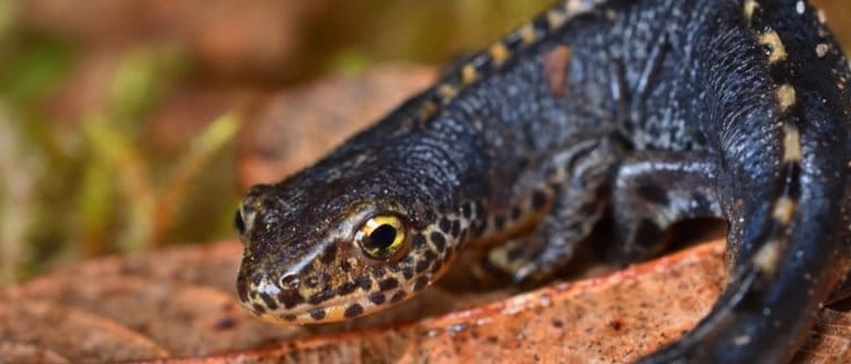
Newt
Crests, ponds, and potent defenses

Crests, ponds, and potent defenses
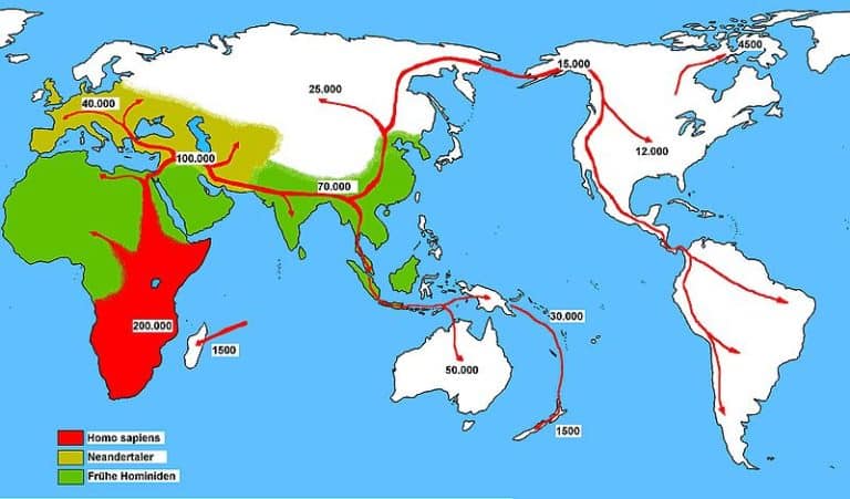
The culture-building biped

Bold stripes, bigger attitude.

Spines out, trouble out

Brains, beaks, and big voices
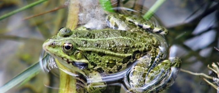
Tailless jumpers, masters of change

Glow at night, strike with precision
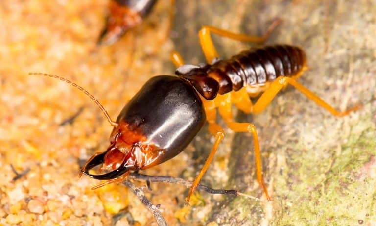
Nature's master recyclers (and builders)

Night pilots of the mammal world

More than night flyers
Karst is a landscape formed primarily by the chemical dissolution of soluble bedrock-most commonly limestone or dolomite-by slightly acidic water. This process creates distinctive surface and subsurface drainage patterns and landforms such as sinkholes, caves, and underground channels.
Karst terrain develops where rain and groundwater, acidified by dissolved carbon dioxide, percolate through fractures and bedding planes in soluble rock and gradually enlarge them. Over time, this dissolution reorganizes drainage from surface streams to subsurface conduits, producing features like swallow holes, disappearing (losing) streams, springs, and extensive cave systems. The resulting topography can range from gently rolling sinkhole plains to rugged tower or pinnacle karst, depending on rock purity, structure, climate, and uplift/erosion history.
Hydrologically, karst systems are characterized by rapid infiltration and highly variable flow paths, often moving water quickly through conduits with limited natural filtration compared to granular aquifers. This leads to patchy or absent surface water, sudden flooding in caves or springs after storms, and strong seasonal contrasts in water availability. Soils are often thin and discontinuous because bedrock dissolution and subsurface drainage limit soil formation and retention, which can affect agriculture, vegetation patterns, and construction stability.
Karst areas pose specific environmental and engineering considerations: groundwater is especially vulnerable to contamination due to fast transport and limited filtering, and the ground surface may be prone to subsidence or collapse where cavities form near the surface. Despite these challenges, karst landscapes are significant for freshwater resources (via major springs and aquifers), unique habitats, and speleological and geotourism value.
Highly variable; occurs from near sea level coastal plains to high plateaus and mountain massifs. Commonly expressed as low-relief karst plains and large closed depressions (flat-floored basins) and rolling karst plateaus, but also as rugged karst hills and tower karst.
From below sea level in coastal/anchialine karst and drowned karst systems to high-elevation alpine karst (>2,000-4,000 m) on carbonate ranges; local relief can range from a few meters on karst flats to hundreds of meters in tower karst, canyoned karst, and steep-sided sinkholes and large closed basins.
Strongly heterogeneous at short scales: gentle to moderate slopes on karst plateaus and plains punctuated by abrupt breaks in slope at sinkhole margins, collapse scarps, and limestone pavements. In mature tropical or uplifted karst, slopes can be steep to near-vertical on towers, cones, and canyon walls. Surface micro-relief (solution grooves, pits, and flutes) creates uneven footing even on overall gentle slopes.
Develops in regions underlain by soluble bedrock (most commonly limestone, dolomite, or gypsum) where slightly acidic water (carbonic acid from CO₂ in rain/soil) dissolves the rock along fractures, joints, and bedding planes. Progressive dissolution enlarges conduits, creating underground drainage networks; roof collapse and surface subsidence form sinkholes and depressions. Surface streams may be captured into swallow holes, leaving dry valleys and intermittent surface flow; long-term evolution produces towers, cones, and expanded cave systems.
Moderately to highly dynamic hydrologically but geomorphically variable. Bedrock surfaces can be long-lived, yet subsurface void growth can trigger sudden collapse, subsidence, and sinkhole formation (often episodic, sometimes accelerated by groundwater pumping or altered drainage). Flashy infiltration and conduit flow make water availability and flood behavior locally unpredictable; soil cover is often thin and easily eroded where disturbed.
Variable and often challenging. Wildlife movement is generally easier on soil-mantled poljes and gentle karst plains, but limestone pavement, grikes, sharp karren, cliffs, and sinkhole margins create frequent obstacles and injury risk. Sparse and seasonal surface water can constrain routes, while caves and fissures provide shelter/roosting sites for specialized species; overall permeability favors hidden water sources (springs/resurgences) as key travel and habitat nodes.
Large cave-roosting colonies and highly maneuverable flight to exploit insect pulses around cave entrances and sinkholes.
Fully aquatic cave salamander with reduced eyes and heightened non-visual senses to navigate and hunt in dark underground karst waters.
Loss of functional eyes and enhanced lateral-line and chemosensory systems for orientation and feeding in lightless caves.
Clicking-based echolocation to navigate and nest in dark caves, allowing flight where vision is limited.
Adhesive toe pads and strong grip for climbing smooth limestone faces and cave walls and ceilings.
Specialized hooves with hard edges and grippy pads for secure footing on steep, broken karst cliffs and ledges.
Karst landscapes can look "dry" at the surface even in rainy climates because water rapidly drains underground through cracks, sinkholes, and caves--so streams may vanish mid-channel.
Karst can produce both water scarcity and sudden flooding in the same area: water disappears into sinkholes quickly, but underground conduits can back up and cause rapid spring floods.
In karst, "rivers" often run underground; surface valleys may exist without a surface stream because the drainage has been pirated below ground.
Karst groundwater can travel much faster than in typical sand-and-gravel aquifers because flow may occur through cave-like conduits--meaning pollutants can spread quickly and unpredictably.
Sinkholes are not always slow-forming: some develop abruptly when a cavity roof collapses, even where the ground looked stable beforehand.
Thin, patchy soils in karst are not just from erosion--soil can be lost downward into fissures ("soil piping"), effectively draining the land of its own topsoil.
A spring in karst can switch on and off or change discharge dramatically with rainfall because the subsurface plumbing behaves like a complex overflow system with multiple hidden routes.
Karst areas can have plenty of rock yet little surface water storage: instead of lakes and rivers, the landscape stores water in fractures, conduits, and caves.
Caves in karst can act like natural archives: mineral deposits (speleothems) can record past rainfall and climate changes in their layered chemistry.
What looks like solid limestone can be honeycombed: small dissolution features can connect into networks that greatly increase permeability without obvious surface clues.
The world's longest known cave system is in karst: Mammoth Cave (Kentucky, USA) has mapped passages totaling hundreds of kilometers and continues to grow as new segments are discovered.
One of the deepest explored caves on Earth is in karst: Veryovkina Cave (Abkhazia/Georgia region) reaches well over 2,000 meters in depth.
One of the largest cave chambers ever discovered formed in karst: Son Doong Cave (Vietnam) contains enormous passages and cavern volumes that rank among the biggest known.
Some of the most extensive carbonate-karst regions on Earth span tens to hundreds of thousands of square kilometers (e.g., large karst belts in southern China and the Dinaric Karst of the Balkans), creating continent-scale underground drainage.
Karst aquifers are among the most productive groundwater sources on Earth, supplying drinking water for large populations-yet they can also be among the fastest to transmit contaminants due to their conduit networks.

Built to dig. Born to endure.
Night pilots of the mammal world

Built to soar, born to strike

Bony rays, endless ways.
Tailless jumpers, masters of change

Sun-powered lizards of the Americas

Six legs, endless lives.

Power of the Americas' apex cat

From geckos to dragons-lizard power

Small gnawers, huge impact.

Hands, minds, and social lives
More than night flyers

Not cavemen-Ice Age people
Crests, ponds, and potent defenses

Hear the rattle, give it space.
Glow at night, strike with precision
Bold stripes, bigger attitude.
Nature's master recyclers (and builders)

Built for land, made for time

The wolf's cousin, humanity's partner
Brains, beaks, and big voices
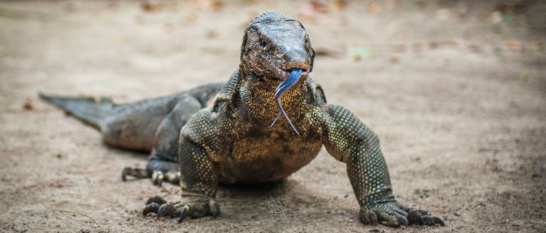
Big brains, bigger tongues.

Lemurs: Madagascar's primate marvels

Ancient shells, modern survivors
Thank you for reading! Have some feedback for us?
We appreciate your help in improving our content.
Our editorial team will review your suggestions and make any necessary updates.
There was an error submitting your feedback. Please try again.