Animal Habitats

River/Stream

Flowing freshwater systems from headwaters to deltas with diverse aquatic life
1,516 Animals
1/64 Page
Overview

Understanding This Category

A river is a flowing freshwater habitat in which water moves downslope through a defined channel, from headwaters to larger downstream reaches and often to lakes, wetlands, or the sea. Its ecology is shaped by current-driven processes (erosion, transport, deposition) and by connectivity with tributaries, floodplains, and groundwater.

Rivers are long, changing ecosystems that move water, sediment, nutrients, and life through a drainage basin. Habitats change from steep headwaters to lowland channels—flow, temperature, width, light, and substrate shape which species live there. Riffles, runs, pools, and floods link floodplains and riparian zones. Dams, land use, and pollution harm rivers; healthy ones support diverse fish, invertebrates, amphibians, and plants.

Key Characteristics

Flowing (lotic) freshwater with downstream current as the dominant physical driver
Longitudinal gradient from headwaters to mouth, with predictable shifts in temperature, channel form, and energy sources
Habitat heterogeneity (riffles/runs/pools, side channels, backwaters) shaped by variable flow and substrate
Sediment transport and deposition create and maintain bars, banks, and floodplains; periodic disturbance from floods
Strong connectivity to the surrounding catchment via tributaries, groundwater exchange, and riparian zones
Floodplain interaction and seasonal flow regimes (e.g., snowmelt, monsoon, rain-dominated) structure communities
High biological connectivity enabling migration, dispersal, and nutrient/organic matter movement
Water quality and thermal regime strongly influence species composition (oxygen, nutrients, turbidity, temperature)
Environment

Environmental Conditions

Climate

Temperature Range
0°°C to 30°°C
Precipitation
Moderate to high (typically ~500-2000+ mm/year in the catchment; seasonal peaks common from snowmelt or monsoonal rains). Sustained runoff/groundwater inputs needed to maintain baseflow.

Conditions

Highly variable: often high in open channels; frequently reduced by riparian canopy shading, turbidity/suspended sediments, and depth. Strong seasonal changes where leaf-out or snowmelt affects clarity and cover.

Flowing freshwater with longitudinal gradients (headwaters to lowland channels). Depth varies by channel size and morphology; currents range from riffles/rapids to slow pools; salinity typically ~0-0.5 ppt (freshwater), with occasional slight increases in arid basins or near estuarine influence.

Ecology

Ecological Community

Biodiversity Level

High - rivers contain diverse microhabitats (riffles, pools, runs, backwaters, gravel bars, undercut banks, woody debris) and strong longitudinal and seasonal gradients in flow, temperature, and substrate. This heterogeneity supports many specialized insects and fish, and connectivity to tributaries and floodplains further increases species richness; local diversity can drop where flow is highly altered, polluted, or fragmented by dams.

Flora

  • Submerged aquatic macrophytes
  • Emergent aquatic plants (reeds/sedges/rushes)
  • Riparian trees and shrubs
  • Algae (phytoplankton and periphyton/biofilms)
  • Mosses and liverworts in fast, cool reaches

Fauna

Ecosystem Services

  • Water purification via nutrient uptake, sediment trapping, and microbial processing of pollutants
  • Flood regulation and energy dissipation, especially where connected to floodplains and riparian wetlands
  • Groundwater recharge and maintenance of baseflow in connected aquifers
  • Habitat corridors that support migration and dispersal of fish, insects, birds, and mammals
  • Support of fisheries and food resources (fish, mussels) and recreation (angling, boating, wildlife viewing)
  • Bank stabilization and erosion control by riparian vegetation
  • Carbon cycling and storage in riparian soils, floodplain sediments, and woody debris
  • Cultural, educational, and aesthetic value; provision of water for people and agriculture (when sustainably managed)
Conservation

Conservation Status

Globally threatened and widely degraded: many river systems have altered flow regimes, fragmented connectivity, simplified habitats, and reduced water quality. Ecological integrity is highest in relatively intact, free-flowing basins, but these are increasingly rare and unevenly distributed.

Estimated ~50% of global river habitat condition has been lost or severely altered historically (via flow regulation, fragmentation, floodplain disconnection, and water-quality degradation). Lost
Declining Current Trend

Primary Threats

  • Dams, weirs, levees, channelization, and bank reinforcement fragment rivers, alter sediment transport and temperature, disconnect floodplains, and change seasonal flow cues needed for fish and invertebrates.
  • Nutrient runoff, sewage, industrial effluents, pesticides, plastics, and emerging contaminants drive eutrophication, toxicity, oxygen depletion, and food-web disruption.
  • Riparian clearing, floodplain conversion, water withdrawals, and encroachment reduce habitat complexity, shade, wood inputs, and groundwater/surface-water exchange.
  • Over-abstraction for irrigation, industry, and cities reduces baseflows, dries headwaters, concentrates pollutants, and increases temperature stress.
  • Acid mine drainage, heavy metals, and sediment pulses degrade water quality; placer and sand/gravel extraction destabilize channels and smother substrates.
  • Warming, altered precipitation, reduced snowpack/glacier melt, more droughts/floods, and marine heat effects in estuaries shift flow timing, temperature, and disturbance regimes.
  • Non-native fish, invertebrates, and plants alter predation/competition, increase turbidity or vegetation clogging, and can homogenize communities.
  • Overharvest and bycatch reduce native fish biomass, especially migratory species already stressed by barriers and habitat change.
  • Recreation pressure, boating, shoreline trampling, and noise/light near urban rivers can disturb wildlife and increase erosion.

Protection Efforts

  • Designation of protected river corridors and riparian buffers; limits on development in floodplains
  • Environmental flow standards and adaptive dam operations; minimum flow requirements
  • Barrier mitigation: dam removal, fish passage, bypass channels, and culvert replacement for connectivity
  • Pollution controls: wastewater treatment upgrades, nutrient management, industrial discharge regulation, and stormwater green infrastructure
  • Catchment-scale land management: erosion control, reforestation, sustainable agriculture, and sediment management
  • Invasive species prevention/rapid response and biosecurity (e.g., ballast/watercraft cleaning)
  • Sustainable fisheries rules (seasonal closures, gear restrictions) and enforcement against illegal harvest
  • Monitoring and basin governance: integrated water resources management (IWRM), transboundary agreements, and ecological indicators

Notable Protected Areas

Yellowstone National Park (USA) - headwater river systems Grand Canyon National Park (USA) - Colorado River corridor Danube Delta Biosphere Reserve (Romania/Ukraine) - lower-river and delta complex Kakadu National Park (Australia) - major tropical river-floodplain systems (e.g., Alligator Rivers) Okavango region protected areas (Botswana; Okavango Delta and upstream systems) - largely intact flow-driven wetland-river mosaic Madidi National Park (Bolivia) - Andean-to-Amazon river corridors Kruger National Park (South Africa) - protected reaches of major rivers (e.g., Sabie, Olifants)

Restoration Potential

Moderate to high where stressors can be reduced: rivers often respond quickly to improved water quality and restored flows, but full recovery can be limited by persistent barriers, altered sediment regimes, legacy contaminants, and floodplain development. Connectivity restoration (barrier removal/retrofits) and riparian/floodplain reconnection can yield large biodiversity gains.

Climate Vulnerability

High: river ecosystems are tightly coupled to temperature and flow timing/volume. Increased drought frequency, extreme floods, reduced snowpack/glacier inputs, and warming-driven oxygen stress can cause rapid regime shifts, especially in arid basins, regulated rivers, and systems with limited cold-water refugia.

Human Impact

Human Interaction

Human Uses

  • Drinking-water supply (surface water intakes) and groundwater recharge via connected aquifers
  • Irrigation for agriculture and livestock watering
  • Industrial process water (cooling, washing, manufacturing inputs)
  • Hydropower generation (run-of-river and reservoir-based)
  • Transportation and navigation (shipping corridors, ferry crossings)
  • Fisheries and aquaculture (subsistence, commercial, and ornamental species)
  • Wastewater dilution and conveyance (often historically, and still in some regions)
  • Sand and gravel extraction for construction materials
  • Riparian land use (cropping, grazing, forestry) leveraging fertile floodplain soils
  • Source of water for fire suppression and emergency response
  • Scientific research, monitoring, and education (field sites, reference reaches)

Impacts

  • Flow alteration from dams, diversions, and groundwater pumping (reduced baseflows, altered seasonal pulses, hydropeaking)
  • Habitat fragmentation and blocked migration routes for fish and other aquatic species
  • Pollution from point sources (wastewater effluent, industrial discharges) and nonpoint sources (fertilizers, pesticides, urban runoff)
  • Sedimentation and turbidity from land clearing, agriculture, logging, mining, and road construction
  • Channelization, bank armoring, dredging, and gravel mining that simplify habitat and increase erosion
  • Loss and degradation of riparian vegetation and floodplains due to levees, farming, and development
  • Thermal pollution and warming (loss of shade, heated discharges, climate change) impacting cold-water species
  • Invasive species introduction via boating, aquaculture, and altered conditions
  • Overfishing and bycatch; disturbance to spawning and nursery habitats
  • Reduced water quality and oxygen levels leading to algal blooms and fish kills
  • Cumulative climate-related stressors: altered precipitation, more extreme floods/droughts, wildfire runoff pulses

Sustainable Practices

  • Environmental flow management (maintain seasonal variability, baseflows, and flood pulses; reduce hydropeaking)
  • Protect and restore riparian buffers (native vegetation, shade, bank stabilization through bioengineering)
  • Reconnect rivers to floodplains where feasible (setback levees, restore side channels and wetlands)
  • Improve water quality via advanced wastewater treatment, nutrient removal, and industrial pretreatment
  • Agricultural best practices: precision fertilization, cover crops, erosion control, livestock exclusion/fencing, off-stream watering
  • Stormwater management in watersheds (green infrastructure, retention/detention, permeable surfaces)
  • Fish passage solutions (dam removal, fish ladders, bypass channels) and barrier prioritization
  • Sustainable sediment management (limit instream mining, manage reservoir sediment, restore gravel recruitment)
  • Integrated watershed management and source-water protection (land acquisition/easements, headwater protection)
  • Monitoring and adaptive management (biological indices, temperature, turbidity, contaminants; community science)
  • Invasive species prevention (clean-drain-dry for boats/gear; screening of intakes; rapid response)
  • Demand management and water conservation (leak reduction, efficient irrigation, reuse where appropriate)
Fun Facts

Did You Know?

Rivers are not just water-they're conveyors of rock: most of what you see as "muddy water" is the landscape in transit from mountains to deltas.

Many rivers have "hidden highways" underground: water exchanges constantly with the riverbed (the hyporheic zone), where microbes break down pollutants and recycle nutrients.

A river can run "uphill" locally-water surfaces slope downhill overall, but turbulence and waves can move water and floating objects upstream for short distances.

Some rivers can reverse direction temporarily due to tides or storm surges (e.g., parts of the Amazon and the St. Johns River), creating two-way flow.

Floods are often an ecological feature, not just a disaster: periodic flooding can replenish floodplain soils, trigger fish spawning, and sustain wetlands.

Cold, fast headwater streams can hold more dissolved oxygen than warm, slow rivers-so "bigger" doesn't always mean "better" for oxygen-loving species.

Rivers can be surprisingly loud: gravel and boulders clacking along the bed during high flows can generate underwater noise that fish and invertebrates detect.

Not all rivers end in the sea-some terminate in deserts or inland basins (endorheic systems), where water is lost to evaporation and infiltration (e.g., parts of the Okavango system).

Think of a river like a moving conveyor belt: it erodes material upstream, transports it midstream, and "drops off packages" (deposits sediment) where the flow slows.

A river network is like a tree: tiny headwater "twigs" feed larger branches, and what happens in the small tributaries strongly affects the trunk downstream.

The riverbed is like a living filter: water pumping in and out of the sediments works like a natural treatment system, powered by current.

Meanders behave like a slow-motion racetrack: the fastest water hugs the outside bend (erosion), while the inside bend is the "pit lane" where sand settles (deposition).

Floodplains are a river's "breathing room": when flows rise, the river spreads out, slows down, and drops nutrient-rich sediments-similar to a pressure-release valve.

Deltas are like a river's 'hand' opening into the sea: channels split into distributaries, spreading sediment like fingers to build new land.

The Nile is often cited as the world's longest river (~6,650 km), though the Amazon is close-exact rankings depend on how tributaries and sources are measured.

The Amazon is the world's largest river by discharge, releasing more freshwater into the ocean than the next several largest rivers combined.

The Congo is the deepest known river, with measured depths exceeding ~200 meters in places-deeper than many ocean coastal shelves.

Angel Falls (Venezuela) is the world's tallest waterfall (979 m), showing how rivers can create extreme vertical "drops" in the landscape.

The Brahmaputra-Jamuna is among the most sediment-laden large rivers, moving enormous amounts of sand and silt that constantly reshape channels and islands.

Some of the planet's most dynamic "wandering" channels occur on rivers like the Kosi (India/Nepal), nicknamed the "Sorrow of Bihar" for dramatic channel shifts and flooding.
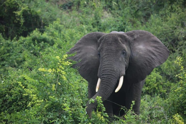
River/Stream Animals

Showing 1-24 of 1,516

All Animals A-Z

A

B

C

S